Showing posts with label roadwalking. Show all posts

2023-07-20: Old Road

5.59 mi, 453' gain, 1h32m RT. Windham NY roads 25/46 mi.

Excited following a very successful and enjoyable walk the previous day, I headed up to Windham after work to walk a mid-sized loop east of the center of town. This loop included part of Route 23, the most major thoroughfare in the town, which I wasn't really looking forward too, but getting it over with and covering the rural and, in some places, downright pastoral Old Road. I parked at the parking area for the Escarpment Trail off of Cross Road and headed off on a somewhat less enjoyable walk.

Roads walked: NY-23, Cross Road, Old Road

The limb of Elm Ridge towers over Route 23 in this view from the parking lot.

Mount Zoar seen to the east over Route 23.

Bright green grasses grow out of the side of a small stream fed by Silver Lake.

Cave Mountain dominates the view from this part of Route 23.

Signage where the highway crosses the Blue Line delineating the border of the Catskill Park.

Windham High Peak over Route 23 in this view from the hamlet of Brooksburg.

Mount Zoar seen over a scenic swamp to the north of the highway.

Van Loan Hill is one of two twin domes along the border of Windham and Jewett. This view is seen from near the Windham Path, a popular walking spot in Brooksburg.

Hunter Mountain rises ten miles to the south over one of many long private drives off of Old Road.

Hunter Mountain isn't visible from many places in Windham but it graces the skyline from Old Road. Zooming on the picture reveals the fire tower on its summit.

Windham High Peak over Old Road. While Windham is heavily forested, Old Road is the first place I've walked in the down that's dominated by open fields and meadows.

The Stavros Cemetery is home to graves dating to the early 19th century.


2023-07-17: Siam Road

 6.29 mi, 410' gain, 1h42m RT. Windham NY roads 18/46 mi.

I've been struggling to find the motivation to do much roadwalking this summer. I did a lot of work earlier in the year on the Catskill Hundred Highest and finished the Greene County Town Highpoints, but roads have failed to inspire me. By mid-July, I had only been roadwalking twice. I worried that perhaps working on the road for ten hours a day made me enjoy walking less.

In any case, Windham's roads are closed to public parking during the winter, so I really needed to step up my game for the month or so I had left in the summer before going back to school. I looked back to my original roadwalking, when I started in Durham back in 2018, for a sort of return to form. Many of my walks then were straight lines, where I'd walk two to three miles down a road, then turn around and walk back. My loops were always short, five miles at most.

I realized that my lack of passion for roadwalking was due largely to excessively high expectations. Every route I planned out was a 6-8 mile loop. Doing that after a ten-hour work shift in the middle of July isn't really all that appealing, and doing it once was exhausting enough to put me out of the habit for another month. Shorter walks meant less time and less energy, which meant I would walk more often, which, I hoped, would paradoxically mean I get the town done faster.

I ignored warnings on poor air quality due to smoke from Canadian wildfires and headed up to Route 21 this Monday to walk what I thought was a 4-5 mile section of road (I had miscalculated). I had hiked the East Jewett Range at around 80 AQI, and I was curious how well my asthmatic lungs would hold up to the 120 AQI we had on Monday, plus the smoke made the landscapes look kind of interesting. The walk was longer and more exhausting than expected but still well worth it and put me back into the mood for roadwalking.

Roads Walked: CR-21/Mitchell Hollow Road, Siam Road

Looking west towards West Cave Mountain from the southern terminus of CR-21 where it meets NY-23.

The Windham Highway Department is located along Route 21, near the Transfer Station and some other government infrastructure.

Orange haze darkens the sky in this view from the southeast end of Siam Road.

Looking northeast towards Mount Hayden over the Kirk Reservoir.

Some distance off of Siam Road I found this plaque christening the Gerald Kirk Dam. Located on the Batavia Kill, this earthen dam rises easily forty feet above the top of the reservoir and was completed in 1970.

Bump Mountain over the steep slopes of the dam.

Abandoned fencing runs through this overgrown field, making for a deeply pastoral scene.

The orange sky is more visible in this view to the west of Route 21, looking again towards Bump Mountain.

Cave Mountain, hardly visible from three miles away, backdrops a large horse farm to the south.

Looking straight down the gates at the farm on an overgrown path to nowhere.

The abandoned building where I parked, located near an electrical substation.


2023-05-17: Mitchell Hollow Road

 Windham NY Roads: 9/46 mi

My natural next step in roadwalking is to conquer the town of Windham. I began targeted roadwalking, trying to walk every thru public road in a town, back in mid-2018 with my hometown of Durham. After finishing in May 2019, I began targeting the neighboring towns, starting to the east and moving clockwise around the Durham borders. I finished Greenville in June 2021 and Cairo this past January, and the next town in that order is Windham.

Located to Durham's southwest, Windham is a small town by all metrics, with an area of only 45.2 mi2 and a population of 1708 at the last census. Nestled high in the Catskill Mountains, the center of settlement is over 1500' in elevation, although the town itself rises to 3984' at Black Dome Mountain in the south. Despite its remote location and small size, Windham is fairly built up, home to the very popular Windham Mountain Ski Resort, which consumes the entire north face of Cave Mountain. A large number of high-income seasonal homes make the town appear much larger than it really is.

I began my foray into the mountain town - and my first roadwalk of the summer - on Sutton Road, parking at the Mount Hayden trailhead just inside the Durham town line. I walked down Mitchell Hollow Road as far as the first intersection with Elm Street, a rather short in-and-out walk through rural terrain, alternating between forested mountains and view-giving fields.

Distance: 4.13 mi

Time: 01h 04m

Roads Walked: CR-10, CR-21/Mitchell Hollow Road, Cunningham Road, Sutton Road

Hills of the Richmond Range rise above fencing at a farm on Cunningham Road.

Mount Nebo towers over the landscape, appearing as much more of a peak than it truly is from this angle.

Signage at the town line along Route 10, surrounded by spring brush.

A lilac bush (Syringa vulgaris) blooms along the side of the road.

Looking down Mitchell Hollow Road from near its highest point, towards the mountains in the center of town.

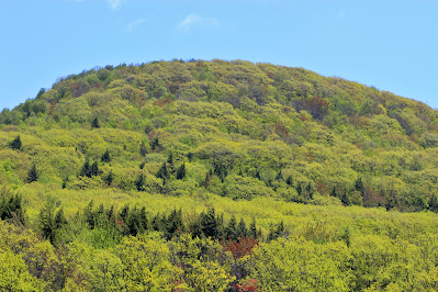
Beautiful yellow-green spring colors, sprinkled with bits of red and dark green of the evergreens, covered the mountains with a lovely rejuvenating appearance.

Important (if dubiously attributed) advice from a signpost found on a partially-collapsed barn.

Bump Mountain rises above mixed field/forest at the edge of a seasonal property.

A view of Richmond Mountain above a construction site, one of many along the route taking advantage of the good spring weather.

Mossy rock outcrops along Route 10, at the lower slopes of Mount Pisgah.

Looking east down Cunningham Road, the hills of Durham and more distant peaks in the Taconics are visible through the trees.


2023-01-04: Polly's Rock Road

Cairo NY Roads: 114/114 mi

In summer 2021, I began roadwalking the town of Cairo NY in earnest. I had previously walked all public thru roads in the neighboring towns of Durham and Greenville, both with far fewer roads than Cairo. Even being at college in Florida for most of the year, I made good progress in Cairo, working to get through as many miles of road as I could whenever the weather allowed. Today, I finished that goal.

Polly's Rock Road is, I think, an appropriate final walk in the town. A short backroad in the resort areas south of Round Top, much of the road is closed to vehicle traffic in the winter. It's narrow, quiet, wooded, and far away from the populated areas that dominate much of the town. With all this in mind, I headed up on a cloudy Wednesday afternoon to complete a years-long goal.

Low clouds obscure the Catskill Escarpment seen along a bend in the road.

The Kiskatom Brook, flowing fast with meltwater, runs under the road.

A view of the very narrow bridge over the brook.

Signage at the turnaround where I parked, where the road becomes seasonal.

The area around Polly's Rock Road was once home to extensive hiking trails. The land has since been bought by a local hunting club, and signs along the way warn curious visitors to stay out.

Looking down the lovely country road towards Cairo's southern border with Catskill.

Massive rock outcrops such as these comprise the southern side of the road, perfect for climbing or exploring around.

The road's namesake, Polly's Rock, was once a popular tourist attraction. The rock has excellent views of nearby Round Top and the more rural forests of southern Cairo, and is painted in all sorts of bright colors. Due to land changes, Polly's Rock, and the trails that lead to it, are no longer accessible to the public. The road is lined with a multitude of posted signs, and if I had violated such warnings, it would be foolish for me to post about it here.

Houses along Hearts Content Road, near where I parked to walk it two weeks earlier.

Potic Mountain rises in the hazy distance above the flat, forests plains. For a rather populated town, this is a rare view of Cairo showing total wilderness.

A wide view, looking towards Round Top, hidden in the clouds at left.

Bright graffiti marks Polly's Rock, at this point beyond vandalism and into the realm of novelty.

And that ends my long campaign to roadwalk Cairo. Over 114 miles of public thru roads (and one dead-end highway), come to a close on perhaps the most rural and quiet road in the town. This brings a total of three towns (Durham, Greenville, Cairo) where I've walked every mile of road. My next goal is Windham, a small town nestled high in the mountains to the northwest, although that may not get started until summer.

2022-12-26: Rudolph Weir Jr Road

Cairo NY Roads: 110/114 mi

The weather remained cold over the Christmas season, but it was no deterrent to finishing my final few walks in Cairo. I headed out on a chilly Boxing Day afternoon to walk a somewhat lengthy route in the western portion of town, north of the hamlet of South Cairo. This covered much of Indian Ridge road, which climbs the back of the eponymous rise, and Rudolph Weir Jr Road, the last of Cairo's many 'name roads'. My camera's battery was on the verge of death through most of this walk, so I used it sparingly, and made decent time on the hilly, rural terrain.

Roads Walked: Beers Road, Indian Ridge Road, Middlefield Road, Rudolph Weir Jr Road

Remnants of an old stone foundation near my parking spot on Rudolph Weir Jr Road.

A glacial erratic stands out among a hickory grove.

Standing perfectly still in the cold, this horse stood out on the rise of a hill.

Looking southeast towards the southern half of Potic Mountain.

An abandoned trailer along a private dirt road off of Rudolph Weir.

Strangely, one house on Middlefield Road was flying a Jolly Roger on their only flagpost.

Looking west into Cairo, the same power lines that run over High Hill cut through the forests of Indian Ridge.

Looking northwest towards Coxsackie, endless trees are interrupted only by another, more distant power line.

My walks in west Cairo have been sadly bereft of mountain views. This shot of Windham High Peak is the first I've taken all winter.

A stream running under Indian Ridge Road cuts a miniature canyon into the rock, with the river all frozen at its edges.

A young deer, all fattened for the winter, kept on grazing as I walked past.

Beers Road is a rural enough road that its signage is homemade, although the pole is provided by the highway department.

A single juniper tree stands out in the middle of a field along the very top of a hill.

This great big empty field on Beers Road has some interesting-looking structures at the end of it. Gates and surveillance cameras around the field suggest an equally interesting use.

Ice invades the edges of this tiny waterfall along a seasonal stream at the south end of Indian Ridge.