Straddling the border between Durham and Windham, Mount Zoar is the easternmost point of the Hayden Range at the northern end of the Catskills. The mountain has two summits, and I climbed the higher, western summit back in 2020. However, recent surveys have confirmed that the lower, eastern summit, at 2731', is officially titled Mount Zoar, and the peak I had climbed before is a distinct mountain known as "Peak 2760".With the real Mount Zoar remaining as the last peak in Durham I hadn't climbed, I set out late on a Wednesday afternoon to remedy this. Mount Zoar had captured my attention way back in 2018, mostly due to its proximity and its biblical name. Mount Zoar is privately owned and has no trails, public or otherwise, leading to the summit. The shortest approach, used by Jean Andre Lavendure in the only other recorded ascent, is to scramble up the rock walls on its steep eastern face, ascending 800' from Route 23 in Windham in under a mile.
The spot where I parked along Route 23 was right at the col between Zoar and Kate Hill to the east, but cliffs on the Zoar side of the highway prevented ascending from there. I walked south a bit to a point where I could climb up and dodged evening traffic to pull myself into the woods. The lower slopes were fairly steadily inclined, with a number of frozen swampy areas and some rock faces. I followed a stream much of the way up. The snow here was softer than the snow down the mountain, and my boots sunk right in; snowshoes would have been a better choice, but on a peak like this, nobody would care about my postholing except for me.
 |
| Looking up towards Windham High Peak from the base of Mount Zoar. |
 |
| Slick ice, colored by sediments and minerals, formed a frosty cap over exposed rocks and ledges. |
 |
| Heading up the steeper slopes on the lower half of the mountain's west face. |
After awhile, I crossed what looked like a very old unused road, then arrived at the truly steep part. The upper few hundred feet of the mountain's west face rises at a roughly 40° angle, broken every few yards by icy rock walls. Under these conditions, I found the best method of ascent was to kick steps into the snow with my feet and pull myself up with my poles, or with passing trees. This method is often used in high-altitude mountaineering, and it felt odd to try it out on such a minor mountain. In some ways, it was actually easier than summer scrambling.
 |
| Clouded evening sunlight colors more frozen icicles farther uphill. |
 |
| Dim traces of sunlight reflecting off the soft snow. |
 |
| Climbing past a large frozen waterfall. The snow in many areas obscured dangerous ice features such as this. |
Above these steps was the start of Zoar's extensive summit plateau. The terrain levelled out, and gaps in the trees to the east provided limited views of Kate Hill and Windham High Peak. There was a knob-like section of the mountain a few hundred feet south of here, and I was really hoping that this was the true summit, as my feet were starting to get wet, and all the trudging through shin-high snow was slow going on level ground.
 |
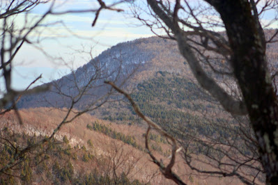
| Windham's northwest slope, seen from the gap in the trees. |
 |
| More icy rock outcrops on the way up the knob. |
 |
| Sunlight reflecting off snow through a rare break in the clouds. |
To my dismay, this turned out to be a false summit, with the true high point located in a flat area of more open forest farther to the west. I hiked past some interesting rock formations above the little knob. The true highest ground was hard to find, as the whole summit plateau is more or less the same height, and the thick layer of snow made it hard to tell if the rises and rills were made by ground, rock, or fallen trees. After some tromping around I figured I had covered the top at some point and headed back down.
 |
| Mount Zoar, 2731'. Note the flatness of the summit area. |
 |
| A glimpse of a view of Zoar's north side, towards Durham. |
 |
| A view of Windham High Peak from the edge of the summit plateau, looking slightly closer than from the bottom. |
Descending Zoar was a lot of fun. The steep slopes I had exhaustedly climbed on ascent became great big leaps on the way down. With the little footholds punched into the steep mountainside, I didn't have to worry as much about slipping. The snow made my tracks easy to follow, so I wouldn't get lost on the way out, and the descent was far faster and easier than it would have been in the summer. Each step down covered three to four steps up, and sometimes little chunks of snow would careen down the mountain behind me, the sort of action that could initiate an avalanche on a larger, snowier peak.
 |
| Kate Hill seen through the trees on descent. |
I hopped out of the woods and back onto Route 23 just around sunset, walking past rush hour traffic to return to my car. Mount Zoar, the last unclimbed peak in Durham, was now mine.
 |
| Cave Mountain stands out in the sunset on my walk back to the car. |


No comments:
Post a Comment