Macomb, South Dix, Grace, Hough, Dix Mountains: Adirondack High Peaks 14-18/46
Since last spring I had been planning more ambitious hikes in the Adirondacks, seeking longer, more strenuous climbs that bag more summits in one trip, partially for personal growth and partially due to higher gas prices. The five high peaks of the Dix Range are all connected by a series of trails, although most are technically herdpaths; a trail from Route 73 in Keene NY officially stops at Dix's summit, while unmaintained trails reach the four shorter summits.
After a great deal of planning, I decided to ascend largely via herdpaths from the south instead, following a popular unofficial trail up Macomb Mountain, then running north to South Dix and Grace, then backtracking and following the ridgeline to Hough and Dix. This plan seemed an even compromise of length and navigability; it has much less distance and elevation gain than following the official trail, but is more well-worn than the Boquet Forks herdpath that also ascends from the north.
Initial plans to do this hike as an overnight were thwarted by the late arrival of my bear canister, a requirement to camp in the High Peaks region and a good idea in any location. Overall the hike covered 17.5 miles and 5313' of gross elevation gain in one day. Both these numbers fall short of my personal records, but summiting five High Peaks in one day was something I had never done before, so it was still somewhat of an accomplishment.
1. Macomb Mountain
I left the house early, around 4:45 AM, to try and make up for the fact that I wasn't able to camp on the trail. I knew with the length and elevation gain, this hike was likely to take up a significant portion of the day hours, and I didn't want to wait daylight on the road. On the way out I observed the very early rays of a beautiful sunrise - one that I would soon drive into - along with the moon and some planets that were out before morning.
 |
| Orange and dark pink light lined the horizon from the driveway before dawn. |
 |
| The crescent moon, with some craters visible under magnification. |
The drive to the mountains was a little hectic; I realized that I had left too early to grab breakfast south of Albany, and by the time stores started opening, I was far enough north that there weren't too many options. Eventually I stopped at a gas station in Warrensburg for supplies for the hike, and something to eat for now, satiating my hanger and finishing my preparation for the hike.
I parked at the Elk Lake trailhead, a DEC-run trailhead located miles down a private dirt road. The Hunter's Pass Trail, the first leg of my journey, runs through land owned by the private Elk Lake Lodge, and the road there is lined with No Trespassing signs. The parking lot evidently fills up pretty quickly, and I got the last spot, although there was a group on their way out from a multi-day camping trip. There are a lot of lean-tos and campsites along the Hunter's Pass trail, which makes it a popular overnight destination.
My mostly-herdpath trip actually began with over two miles of hiking along the blazed and maintained Hunter's Pass trail, which covers the distance between the trailhead and the nearest state-owned land. My destination was the Slide Brook herdpath, which climbs the west side of Macomb Mountain. The turnoff point is just after cross the Slide Brook, one of many small streams that crosses the trail, marked by a small cairn near a lean-to. Continuing on from here will eventually take you to the Lillian Brook path, a herdpath that ascends Hough Peak, or all the way up to Dix on DEC trail. There were some campers sleeping in at the Slide Brook campsite, so I hurried past and onto the narrow path. Now the real adventure began.
The Slide Brook herdpath was very easy to follow, more well-worn than most Catskills herdpaths I've hiked. It's worth mentioning that this is the first herdpath hike I've done in the Adirondacks, and I was a little concerned about getting lost, but aside from the lack of junction markers it felt little different than using official trails. The path begins to steepen dramatically after leaving the main trail, and I started tiring out awfully quickly. Today's high at low elevations was supposed to be in the mid-90s, and I was already doused in sweat; perhaps the judgy hikers on Basin Mountain last month were right about wearing jeans for serious hikes. Occasional glimpses of Macomb Mountain through the treetops reminded me of just how far I had left to go.
Soon I reached the first major challenge of the day: the Macomb Slide. The long, bare rockslides common to the Adirondack peaks are generally seen as dangerous, if fascinating, features. However, intrepid trailblazers have routed the Slide Brook herdpath up a slide on the side of Macomb Mountain. Unlike most of the Adirondack slides, this consists of mostly loose rocks and dirt, rather than hard, unbroken granite. Still, the long, exposed scramble up ankle-turning terrain promised good views and an exciting few minutes.
I ran into a group at the foot of the slide who seemed to be questioning their decision to take this route up the mountain. They were staring up at the imposing, barren stretch of rocks with some level of despair. "I hear the right side is the best way up," one of them said to me. I agreed and, after pausing just a moment to appreciate the view and do a bit of preliminary pathfinding, headed off up the slide. I stumbled a bit at first over loose rocks before making my way to the slide's right end, paralleling the edge of the forest where there was more dirt, making for a vaguely safer ascent.
 |
| Looking down at Elk Lake, where I started the day's hike, from the base of the slide. |
 |
| The view up from partway up the slide. As much fun as the loose pink rocks looked, the risk of injury kept me mostly by the treeline. |
 |
| Looking northwest towards Gothics (L) over the limb of Nippletop (R). |
I played it safe most of the way up, but realized just below the top of the slide that I had missed what looked like some fun scrambles towards the center of the slide. It was remarkably dry for the Adirondacks, with very few streaks of water along the slide, and for the final stretch I walked more towards the center for the scrambles and the expansive views. I passed a hiker who was, to my disbelief, descending via the slide. The steep slopes and loose rocks were dangerous on ascent, but descending on this route seemed practically suicidal. I also noticed that the group at the base had started ascending slowly, following the route I had taken. I made sure to be cautious, not letting any rocks fall or slide below me.
The Macomb Slide has a vertical height of around 500', and spit me out just below the peak's summit around the 4000' elevation contour. The forest here was dramatically shorter than the one I had left at the bottom of the slide, dominated by firs and birches topping out at maybe 25 feet tall. There were a series of challenging scrambles - or, more accurately, unbroken exposed bedrock - that I had to find my way around, and the herdpath often split into a number of different options for circumnavigating these obstacles, but always (as far as I could tell) reunited with the main path.
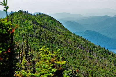 |
| Mountains disappear into the morning haze beyond the sharp south ridge of Macomb Mountain. |
 |
| A mass die-off of evergreens has painted this swamp at Elk Lake's West Inlet a deathly orange-red color. |
 |
| Clear Pond, owned by the Elk Lake Lodge, over Macomb's nearer limb. |
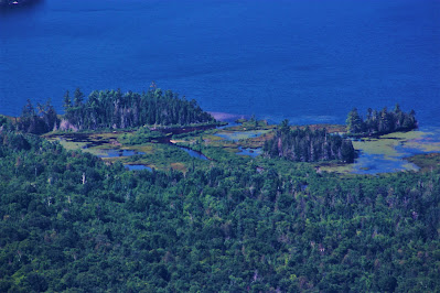 |
| Swampy land on the near shore of Elk Lake. |
 |
| Another view of Gothics, with Sawteeth at right. In experimenting with different processing methods, I ended up with this red-hued picture, and the original was unfortunately lost. |
Before I knew it, I was at Macomb's summit, marked by both a USGS marker and a wooden board bearing the peak's name. The summit boasts a nice west-facing view, and there was actually a bit of a breeze up here, a nice reprieve from the humidity and already-hot July morning. I hung out here for a few minutes, eating some food and drinking some water and analyzing the rest of the day. Although I had planned for the full-length, five highpoint hike, I also knew of the Lillian Brook herdpath, and considered it my 'bailout' trail if I became tired or ran out of supplies. Its nearest access point was between here and South Dix, but I had plenty of energy and daylight left, so prepared to head on to the next high peak.
 |
| Curiously, Macomb hosts an official summit label, which is uncommon among regular peaks and almost unheard of for untrailed summits. |
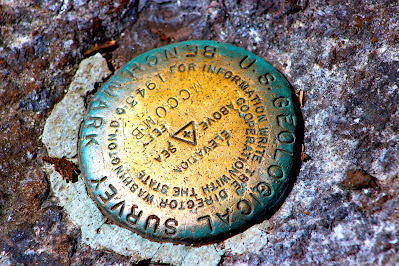 |
| While also rare, USGS survey markers aren't too unusual among the High Peaks. |
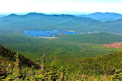 |
| A wide view looking west over Elk Lake and Boreas Mountain. |
 |
| Looking northwest towards the High Peaks. Mount Marcy, the state's highest point, towers over the other mountains right of center. |
 |
Macomb Mountain, 4384'. Adirondack High Peak 14/46.
This was the first of two takes, catching my reaction as the camera went off unexpectedly.
|
2. South Dix
The next of the day's five high peaks was South Dix, a peak I would top twice, as my route involved backtracking over its summit. South Dix is currently in the process of being renamed, with the proposed name of Carson Peak referencing an early founder of the Adirondack 46ers. For now, however, its name remains South Dix, and reaching it involved five hundred feet of vertical loss descending the north side of Macomb Mountain. This descent went by fairly quickly, going through mostly dense forest with few views and no obstacles more complex than simple scrambles and a little mud.
Soon I reached the col between the two peaks, denoted by the unmarked Lillian Brook cutoff herdpath. While this was only a quarter mile from South Dix's summit, it was slow going from here, mostly because the route was so distracting. A series of exposed rock sections, with interesting scrambles and cairns marking the path, also provided for wide open views to the east on the way up South Dix. It seemed I stopped every few minutes to try and take a picture, or simply to take in the view. Open, low-elevation areas are relatively rare in the Adirondacks, so I made sure to enjoy this brief ascent.
 |
| Foothills stretch out towards the east in the highlands between the Schroon River and Lake Champlain. |
 |
| A cairn marks the way atop a large boulder in one of the open areas. |
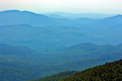 |
| A handful of tiny buildings are all that mar the wilderness landscape of North Hudson. |
 |
| I could have probably found an easier way around these outcrops, but it was more fun to just climb them directly. |
 |
| Some of the day's objectives: Dix Mountain (L) and Hough Peak (R). |
Just below South Dix's summit, I ran into a couple who seemed lost at the junction between three herdpaths. One led east, to South Dix and Grace, one led north, to Hough and Dix, and the one I was hiking led south to Macomb. They asked me for directions and I informed them which trails led where, then continued on my way. Evidently, this junction is only a few dozen feet from South Dix's summit, and before I knew it, I was on top of the mountain. There's a small overlook facing east from the top, but it was just more of the views I had seen on ascent, so I didn't linger too long here.
 |
| Hills to the southeast, north of Schroon Lake, top out around two thousand feet below the Dix Range's elevation. |
 |
| These yellow discs, marked with black marker, seem to be the closest to 'official' markers for untrailed peaks. |
 |
| Camel Mountain pops out above the nearer limbs of Macomb. In the background, Paradox Lake, a mere twelve miles away, seems distant in the humidity. |
 |
| Looking up to Macomb Mountain, its summit over three hundred feet above South Dix. |
While at the summit of Dix Mountain, several other hikers passed by, on their way back from Grace Peak, which was my next goal. One man came by with a dog that greeted me gladly, only to lick the poison ivy sores on my arms; another seemed confused as to why he was on South Dix again. After another quick stop at the overlook, I left the evidently high-traffic summit and headed over to Grace.
 |
South Dix, 4077'. Adirondack High Peak 15/46.
The yellow summit marker, mostly obscured, is visible at upper left. |
 |
| Looking down and north to a slide-riddled knob of Grace Peak. |
3. Grace Peak
Formerly known as East Dix, Grace Peak is the most recently named Adirondack High Peak, assigned its current name in 2014. Named after one of the founding 46ers, it's only the second high peak to be named after a woman, after Esther Mountain. At 4020' elevation, it's just barely over the 4000' cutoff to be considered a high peak, and forms the easternmost peak of the Dix Range. The trail between it and South Dix is pretty straightforward, with a long descent from South Dix, a shorter ascent up Grace, and a mostly constant grade.
Near the col, I ran into a few notable obstacles, the first being an area of significant blowdown. Since herdpaths are unofficial and unmaintained, trees that fall across them aren't cut, and in one short area, a number of large trees had fallen and blocked the trail, and a labyrinth of other trails circumvented some of them. These all spit out to a boggy area at the true col. I'm used to Adirondack mud, and to protect the high-altitude environment, the best option is usually to walk straight through it. I soon found that in this particular scenario, however, that was a mistake, as the mud here went well beyond my knees. After removing my right leg from the bog with considerable difficulty, I bushwhacked around the whole area and picked up the trail again on the other side.
 |
| Dix Mountain looms ever closer from atop Grace Peak. |
 |
| A look back at the hike so far includes the massive Macomb Mountain at left and the much less impressive South Dix at right. |
 |
| Hoffman Mountain (right of center) dominates the view directly south from Grace. Schroon Lake is visible at left. |
Approaching an apparent high point, the trail split off in two directions, one heading towards a very large section of exposed rock, one going around the rock and continuing downhill.
"Is this it? Is this the top?" I pondered aloud.
"Yep, this is it," a voice unexpectedly replied.
I spent the next twenty minutes or so talking with Jay, a man in his fifties who was trying to contact his wife from the small speck of cell service available atop Grace. Jay was in the process of completing a 'grid': Hiking all 46 high peaks at least once in every month of the year (that's 552 summits). This was his fourteenth time on Grace Peak, and he was doing all five mountains of the Dix Range from Route 73, following the less-well-worn Boquet Forks herdpath. He told me that he was gridding with a hiking partner, whom he was currently racing; she was doing the same hike as he was, but from the other direction.
I told Jay about the hike I was doing, and he described it as "a serious climb", which I took as a huge compliment from a peakbagger so much more experienced than I. Eventually the text to his wife went through, and he left, telling me to say hello to his hiking partner if I ran into her along the way. I stayed at Grace Peak for awhile longer; I tried to eat lunch, but somehow, I didn't have much of an appetite yet. I didn't stay long, however, wanting to stay out of the direct sunlight as much as possible.
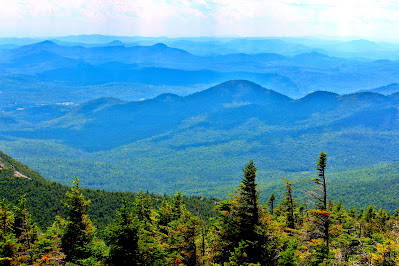 |
| The Northway (I-87) is visible as a slight gap in the trees at left in this mountainous landscape. |
 |
| Hills to the northeast are notably less rugged, but beyond lie Lake Champlain and Vermont's Green Mountains, looking more white in the haze. |
 |
Grace Peak, 4020'. Adirondack High Peak 16/46.
The lack of nearby trees means this big rock at the summit bears no labeled summit marker. |
After staying much longer than I had expected, I left Grace Peak and headed back towards South Dix. Knowing what to expect this time, I had no trouble navigating the blowdown and swampy areas near the col. I ran into the top outlet of the Boquet Forks trail, which seemed pretty easy to follow up here, but I had read trip reports about extensive blowdown and poorly-maintained areas farther down the mountain. Soon, I arrived at South Dix, and this time headed down the north trail at the junction, which spit me out at an overlook after a few hundred feet. After a brief pause here, I pushed on towards the next goal.
 |
| A nice view of Beckhorn, the sharp south side of Dix's summit, in front of passing clouds. |
4: Hough Peak
Hough (pronounced 'huff') Peak is one of several small peaks along the ridge between Dix and South Dix. Nearby Pough ('puff') Peak, closer to South Dix, has too little prominence to qualify as a High Point, and is also home to the main exit of the Lillian Brook herdpath - my last opportunity to bail on the final two mountains. However, it was still early afternoon, and I was still feeling fairly energetic and in good spirits, so I resolved to push on. I had bailed on too many lengthy Adirondacks hikes this summer, so I quickly pushed past Pough and its several lookouts and passed by the herdpath without giving it much of a thought.
 |
| Lightning Hill rises to the west of Elk Lake (lower left), mostly obscured by the limb of Macomb Mountain. |
 |
| Looking northwest from Pough, Mount Marcy bathes in sunlight, setting it apart from the surrounding lesser High Peaks. |
 |
| Looking backwards, the diminutive Grace Peak seems entirely unimportant compared to the higher mountains of the ridge. |
 |
| A close shot of forests and wetlands in the undeveloped Branch Valley to the southwest. |
Oddly enough, climbing Hough didn't seem like too much effort, despite the fact that it involved over five hundred feet of very steep, non-stop, scramble-infested elevation gain. I think at this point I was in 'grind mode'; I hadn't eaten very much, and I was just sort of hiking on autopilot without much thinking involved. The ridge near Hough's summit is very narrow, and the stunted high-altitude forest allowed for glimpses off either side. There are a number of clearings and limited overlooks along Hough, but I was too tired to stop at anything that wasn't the summit at this point.
 |
| Looking southeast from Hough Peak towards Clear Pond and the Hoffman Mountains. |
 |
| Dead birches, with their pale white bark, stand out against other trees in this shot of the valley floor. |
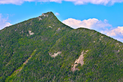 |
| Looking up towards Dix's Beckhorn Peak. The trail up follows the ridge at right; the descent involves getting down the rocky ledge at left. |
 |
| Another shot of Boreas Mountain over Elk Lake, my starting point now appearing hazy in the distance. |
 |
| Looking down the rocky ridge of Hough Peak. |
Hough Peak was the first summit of the day where I stopped for a long while (intentionally). I was beginning to become exhausted, and Dix Mountain was seeming less and less like a goal and more and more like one final obstacle - a true mountain in the metaphorical sense. From the top of Hough, the ridge up to Dix looked not dangerous or intimidating, but very tiring. After resting until my sweat cooled, finishing lunch, and breaking into my last drink, I was ready to continue on. There was no backing out now.
 |
| A view of Marcy's summit, some eight miles away. Zooming in reveals few, if any, hikers at the top. |
 |
| The hand-written marker at the summit of Hough Peak. |
 |
| Looking north towards Marcy (R) and some of the southeastern High Peaks. |
 |
| A view north towards Dix Peak's characteristically sharp summit. Nippletop is the mountain in the background, at left. |
 |
Hough Peak, 4420'. Adirondack High Peak 17/46.
Giant Mountain is visible through the trees in the background. |
5: Dix Mountain
This next part of the hike would prove to be the most difficult (in terms of getting my body to move) of all. It would involve 800 feet of elevation gain in under a mile, which normally would be no big deal, but after climbing four high peaks already, it would undoubtedly be a bit exhausting. The forests were thick, the trees small, the ridgeline very narrow, and the trail relentless, and I was so focused on reaching the summit I could hardly appreciate the beautiful alpine environment.
Still, this section of trail wouldn't be entirely uneventful. I passed a couple on descent - the ones I had directed way back at the junction before South Dix - who informed me of a woman above, who was, in their words, 'totally insane'. "She's hiking a grid, she's going to do all the High Peaks twelve times. I can't imagine it," they told me. I knew this must be Jay's hiking buddy, and soon enough, she and her dog passed me by on a particularly steep section.
"Jay says hello from the top of Grace Peak!" I greeted as she passed.
"Ah, that's good. What time was he there?" she responded.
"He left a little after noon, said he was headed over to Macomb next but he's probably well on his way to Hough by now," I responded.
She thought for a moment, trying to calculate their respective routes and times, then agreed and continued on her way. This was the last hiker I would see at altitude; beyond this, I would have Dix Mountain to myself. It was a little late in the afternoon to still be ascending, so this wasn't totally unexpected, but I was still a little surprised that I didn't pass anyone else descending. As I became more tired, my stops became more frequent, but thankfully a number of lookouts allowed for entertaining breaks.
 |
| From closer to the summit, the final approach to Dix doesn't look quite as terribly steep. |
 |
| Limited slides on the slope of Hough Peak. The rockslides common to the Adirondacks are oddly not quite as common in the Dix Range. |
 |
| Looking northwest to the wide summit ridge of Gothics in the Great Range. |
 |
| Another view out to Giant Mountain, notably closer than before. |
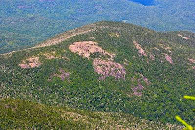 |
| An unnamed rocky knoll northeast of Dix stands out clear in the afternoon sunlight. |
The final stretch of forest up Beckhorn was very steep, and I made a number of lengthy stops as the elevation gain was actually exhausting my legs - something that's incredibly rare for me. I stopped for a power drink and noticed that at some point, something had fallen in my bottle. Under normal circumstances, I would have considered the contaminated fluids undrinkable, but here in the middle of this hike, it was the nectar of the gods.
Just below Beckhorn's summit there was a very large rock outcrop that seemed pretty much impossible to climb, certainly with my legs in their current state. A path led around the east side of the peak to an equally impossible rock outcrop (both were probably Class 4 or higher). I found a very poorly-worn herdpath around the first ledge and found myself atop Beckhorn. Although this was the side of Dix I had been seeing all day, I couldn't celebrate just yet; the true summit was still a quarter mile away, through dwarf alpine forests and rocks.
 |
| A small (~1") marker at Dix's summit. These are installed on unsurveyed High Peaks to denote the true summit for peakbaggers, but are too small to get a decent picture of. |
 |
| Looking northwest to Basin Mountain and more peaks of the Great Range. |
 |
| Fields in Addison County VT, on the other side of the lake, were just barely visible through the thick haze. |
 |
| A view of Dix Pond, a water body that reverts to a boggy flowage at during periods of low rain like this. |
Soon enough I was on top of Dix, and here I stopped for a long time. The mountain, the highest in the Dix Range and in the town of North Hudson, boasts impressive views in every direction, as the summit rock rises above the eye-level trees. I ate the last of my food and watched the clouds and the mountains through the haze, resting and turning every so often to keep from getting sunburned. It was a lovely spot, and even lovelier to have it all to myself for the half-hour or so I spent up there.
 |
| Looking northeast towards Giant Mountain and Rocky Peak Ridge. The photo isn't crooked, it simply shows the drop in elevation going east towards Lake Champlain. |
 |
| The start of my journey, on the far side of Elk Lake, disappears into the afternoon haze on such a humid day. |
 |
| A view of Dix's rather long, narrow summit ridge from its high point, with the Great Range at left. |
 |
Dix Mountain, 4840'. Adirondack High Point 18/46.
For some reason this came out extremely under-exposed. |
The afternoon soon began to grow late, and by 3:30, I decided that I needed to leave Dix's summit if I wanted to make it back to the car before dark. I was tired, and even moving downhill, I knew I would be slower than normal. The trek back to the trailhead involved over six more miles of hiking and, much to my dismay, several hundred feet of additional (unnecessary) elevation gain. The first difficulty was getting down Beckhorn, which required a bit of exposed scrambling, but thankfully nothing too difficult; I wasn't in a position to handle anything beyond low Class 3.
 |
| Climbing back up to Beckhorn. The dirt on Dix Mountain is unusually red for this area. |
 |
| Views down towards Dix Pond on the rocky descent via the Beckhorn Trail. |
I was now back on official, DEC-maintained trails for the first time since in over six hours, and even though the herdpaths weren't at all difficult to follow, there was a bit more sense of security being on a 'real' trail. The rest of the descent was a slog at best. I was tired, probably a bit dehydrated due to the high temperatures and humidity, and after reaching the valley, the trail kept inexplicably climbing upwards, taking odd turns up the mountain for a few hundred feet just to climb back down again. By late evening, the mayflies were out in full force, making the last mile or so out miserable. Still, for a five-high-point, seventeen-mile expedition, a few bugs and some exhaustion are a decent price to pay.
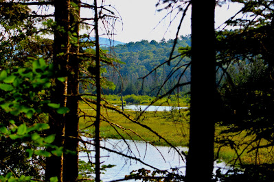 |
| A view of Dix Pond through the trees, seeming far more like a swamp than a pond in late July. |
 |
| A small waterfall on the Lillian Brook, seen from an unexpectedly sturdy wooden footbridge. Other creeks along the path, such at the Slide Brook, were all dry. |


No comments:
Post a Comment