
After a lengthy journey in to the wilderness of the Eastern Adirondacks, I parked along Route 73 southeast of Saint Huberts. I took the most direct trail up Giant Mountain, following the Ridge Trail from east of Chapel Pond. This approach is somewhat less popular than the Roaring Brook Trail to the west, but I have found that shorter, steeper trails make for shorter climbs than longer, more level trails. Along a ridge not far from the trailhead, the first lookout gave a view to the south and east.
 |
| The Ridge Overlook looks southeast towards the hills in Hammond Pond Wild Forest. |
 |
| The overlook afforded excellent views of Chapel Pond about a half-mile south. |
 |
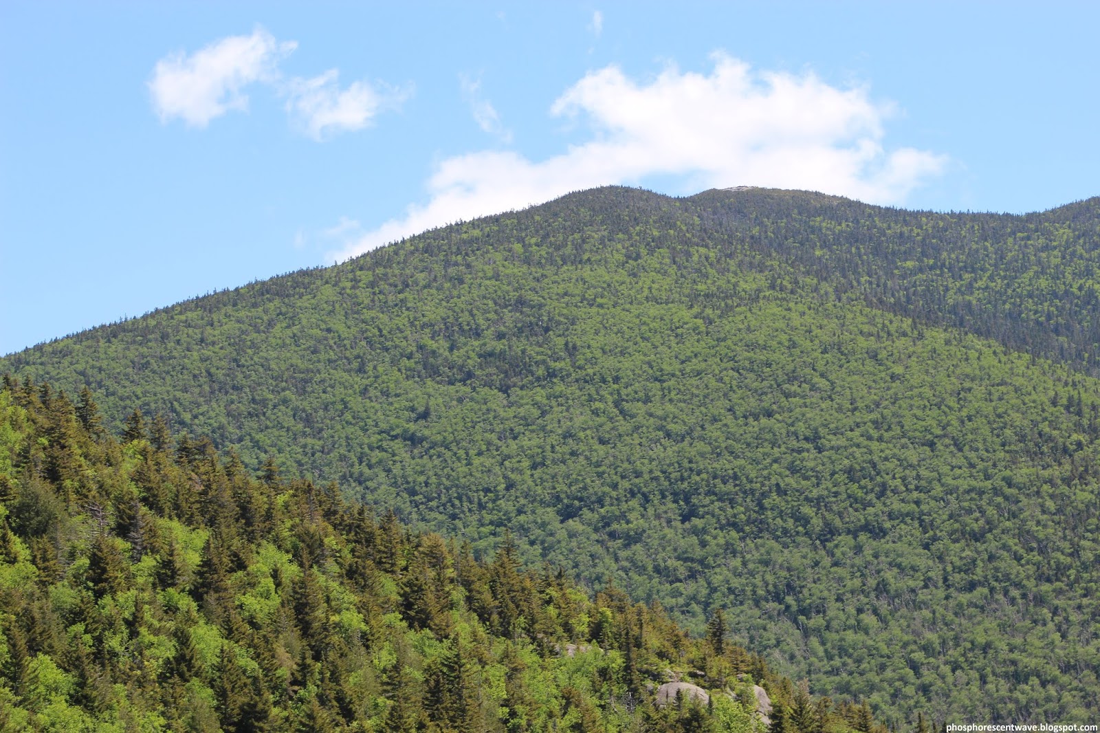
| Trees cling to steep rockfaces on the north side of Round Mountain. |
 |
| The High Peaks Range dominated the view to the southeast, including Saddleback, Gothics, Pyramid, Armstrong, and Upper Wolfjaw mountains. |
 |
| A shot a bit farther to the south, where Mount Haystack and the Sawteeth peek from behind Nippletop's limb. |
 |
| From farther up the mountain, more of southern Essex County's hills could be seen. Moose Mountain and Owl Pate are the most prominent, left and right of center, respectively. |
 |
| A view to the north showed just how much farther I had to go before reaching Giant's summit. |
 |
| View towards the southeast. Note the stunted krummholz at the bottom left, characteristic of the summit's flora. |
 |
| Dix Mountain, with its prominent rockslides and flat summit, dominated the view to the south. |
 |
| Nippletop is at the left; the shorter Mount Colvin is on its flank, right of center. |
 |
| View of the ridge that the trail traverses, along with the wilderness below. |
 |
| A view towards the High Peaks Range, this time from much higher up. Mount Haystack is left of center, while Mount Marcy rises sharply to the right. |
 |
| The Ausable Valley provided a break in the High Peaks, giving a peek to the foothills farther south. |
 |
| View southeast towards Schroon Lake, about 25-30 miles distant. |
 |
| Shot of the Ausable Club, which owns much of the privately-held land in the High Peaks region. |
|
| A view northwest reveals rocks and stunted forest on Giant Mountain's west peak. |
 |
| The village of Keene Valley, about 4 miles northwest of the summit. The school (near center) features prominently from this angle. |
 |
| A focus on the steep slopes of Giant's west peak. A house cut into the wilderness sits beyond. |
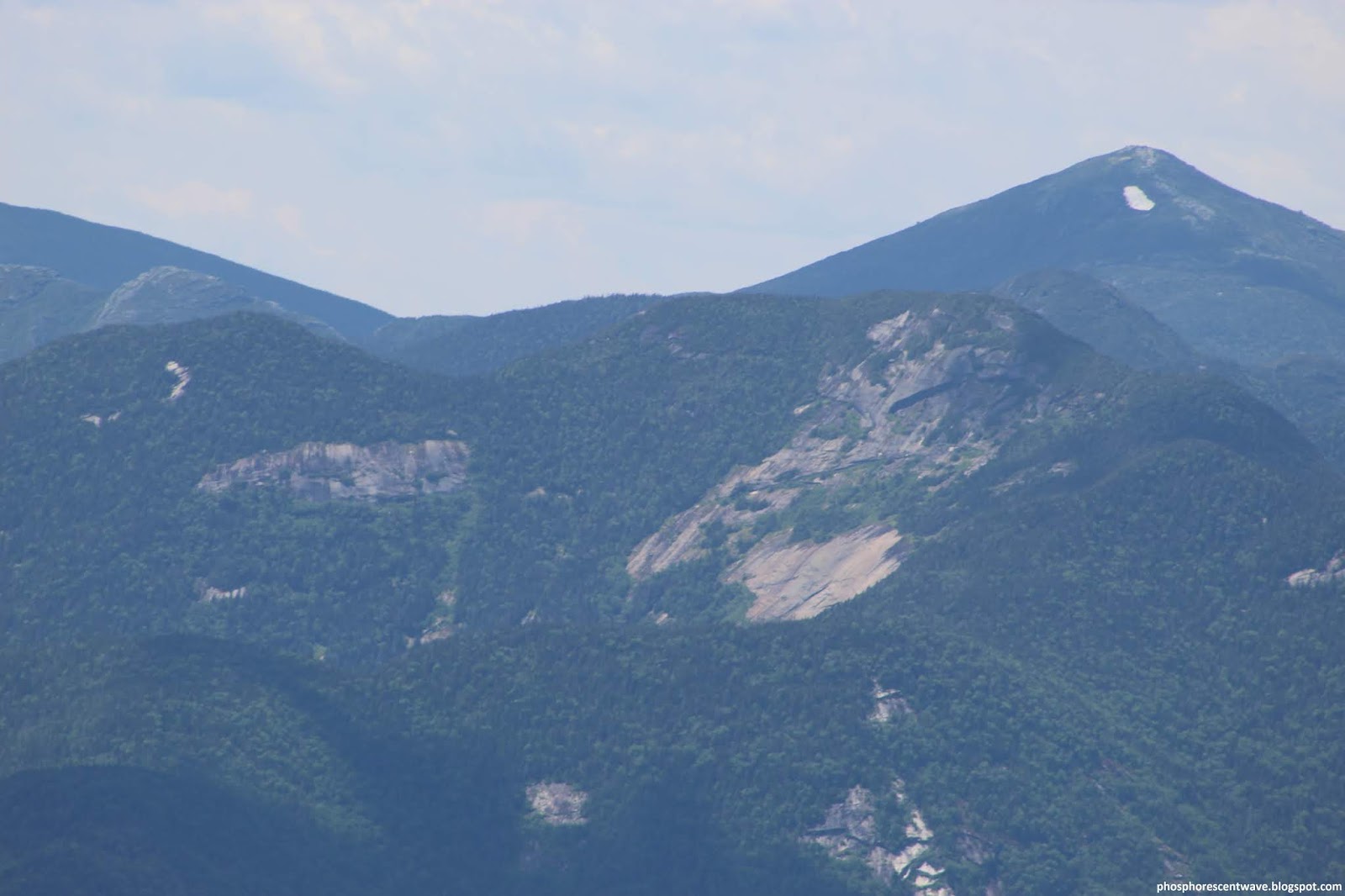 |
| This shot focuses on Mount Marcy (L), the tallest peak in New York. Note the patch of snow still present just below its summit. |
 |
| Bald Peak, a subsidiary peak of Rock Peak Ridge, is below center. The Green Mountains tower in the distance above farmland south of Vergennes, Vermont. |
 |
| View of the summit clearing of Rocky Peak Ridge. Careful inspection of the full-quality image reveals a hiker in a blue shirt on its mile-distant summit. |
 |
| A small plane buzzed through the Keene Valley as I descended the mountain. It was strange to look down to the top of a flying plane. |
No comments:
Post a Comment