Cairo NY Roads: 96/112 mi
I stopped in Cairo on my way home from work to do a bit of roadwalking in the northeast quadrant of the town, the only portion that I largely haven't walked in. This walk was a bit of a return to form; while I generally walk loops on the roads, the only feasible way to walk Ira Vail was to do the entire road, north end to south, and then back again. I used to walk a lot of roads like this in Durham around 2018-9, especially in the winter when I didn't have the daylight after work for long loops. Any loops with Ira Vail would be excessively long, as the road stretches nearly three miles with no intersections. While initial surveys suggested it to be a somewhat boring road, it turned out to have its own set of surprises.
Roads Walked: Ira Vail Road
Ira Vail Road is a small backroad that runs pretty much directly north to south, connecting Deyo Road in the north to Route 67 and the hamlet of South Cairo to the south. I parked off the side of the road near the north side, changed out of my workboots and into my walking shoes, and headed off towards the south at a brisk pace. The north portion of the road is very hilly, with a lot of forested land owned by a local Buddhist retreat (more on that later).
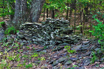 |
| An old stone wall, one of many that criss-cross the woods of Greene County, hearkens back to a time when these forests were cleared and maintained as farmland. |
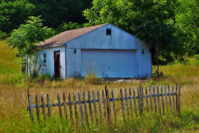 |
| Bushes sprout around an abandoned garage, some distance from a larger and more dilapidated abandoned house. |
 |
| Yellow mushrooms sprout off of a fallen hemlock tree off the side of the road. |
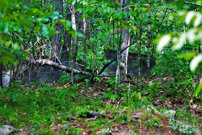 |
| A blocked-off old pathway leads up a hill to this recent ruin, located on temple-owned land. |
After about a mile and a half of forests, the road leads through a wide open farm. While electrified fences would seem to indicate some form of livestock is farmed here, I didn't see any domesticated animals, and the grasses were grown feet high, so my best guess is that these fields are currently unused, albeit well-maintained. The cleared hills at this farm made for some nice views, and the tall grasses are evidently home to a lot of animals, as I saw several deer in my short time walking here. The shoulders are very narrow, however, so I hurried past this section.
 |
| Wire fencing winds through the field, following an unused tractor path. |
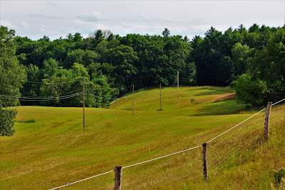 |
| Power lines and powered fence run through the cleared hills east of Ira Vail Road. |
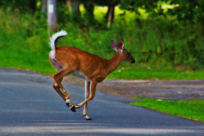 |
| One of several deer I saw runs from me as I approach. |
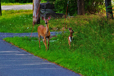 |
| Another deer, a mother with her child, watches protectively from the roadside as I pass by. |
 |
| A male goldfinch (Spinus tristris) rests on one of the unpowered lines. |
After the farm, the road returned to forest for the most part, only with a few more houses than at its northern end. Soon I came to the southern terminus of the road, where it intersects CR-67 and Sandy Plains Road just north of South Cairo. Here there was a cemetery near the intersection with a lot of very old graves, enclosed by a rusted iron gate but without any visible name. I headed back up towards the car, hoping to catch anything on the return walk that I hadn't noticed before.
.JPG) |
| A new house under construction across the street from the farm's southern end. |
 |
| Deep in the woods to the east is hidden this old, bright red shed. |
 |
| A view of the Sandy Plain Cemetery on Ira Vail Road. This seems to be an intermediate cemetery between the larger, maintained graveyards and smaller, family-owned plots. |
Since I was doubling back over the same route I had just walked, I tired to focus my attention on the forested and objectively less interesting west side of the road on the way back. There is a small creek that runs parallel to the road around its northern end, although it was mostly dry due to an ongoing drought. Other than that, though, it was mostly just standard, non-noteworthy Catskills forest.
 |
| Looking back up the farm fields, towards some buildings at the farm's northern end. |
 |
| Young swamp oak (Quercus bicolor) shoots overshadow a section of ground covered with poison ivy. |
 |
Hot weather and low rainfall had reduced this small creek to pools of stagnant water; it would later dry up completely.
|
Farther up the road, I passed the entrance to the Mahayana Temple, an Eastern Buddhist retreat center located some distance off the road. The road entrance consists of an extremely ornate gate, along with some directions on where to go once inside the property. The Mahayana Temple is home to the tallest building in Greene County, an over sixty-foot pagoda hidden deep in the peaceful woods.
 |
| The shrine-like entrance to the retreat center. |
 |
| Two identical statues guard both sides of the gate. |
 |
| A view down Novack Road, one of several dead-end sideroads that connect to Ira Vail's northern half. |
From here, it was back up the hill to my car and away towards home, finishing off a long day and what would, be unbeknownst to me, my last activity for nearly a month.


.JPG)


No comments:
Post a Comment