The Great Range is a sub-range of New York's Adirondack Mountains, consisting of a number of very steep peaks with elevations well over 4000 feet. Hiking the range is seen as difficult not only due to the mountains' size, but their remoteness, with some peaks up to nine miles from the nearest public road. I set out at the Rooster Comb trailhead in Saint Huberts NY with a goal of reaching Pyramid Peak; instead, I made it only as far as Armstrong Mountain in a dangerous and lesson-filled thirteen-mile hike for which I was embarrassingly unprepared.
The hike started at 9:15 AM at the Rooster Comb trailhead, and I knew going in that it would be some time before reaching the summit of any mountains. Rather than go over the top of Rooster Comb itself, I followed a different trail that lead straight towards the Great Range, a five-mile hike to the first High Peak, Lower Wolfjaw Mountain. This trail led through hemlock forests, transitioning to birch/evergreen once I reached higher elevations.
Before reaching Lower Wolfjaw, the trail went over Hedgehog Mountain, a small peak with no views. An unnamed knob sits along the range between Hedgehog and Lower Wolfjaw, and there were some views from near its top where I paused for some pictures.
 |
| East Porter Mountain is the peak at the left; beyond it lie countless layers of the Adirondacks' northern foothills. |
 |
| East of the Keene Valley, the mountains rapidly return to their impressive heights. |
 |
| Fifteen miles north, the familiar rocky mastiff of Whiteface Mountain rises above the limb of the nearer Porter Mountain. |
 |
| A view of Marcy Field, a small airstrip southeast of Keene. |
 |
| One of the most prominent features from this vantage point was Rooster Comb, the peak that I passed within a half mile of during my ascent. |
It was a relatively short distance from this small subpeak to Lower Wolfjaw's summit, but that distance was almost entirely uphill. Here I encountered the first serious obstacles in this hike, many of the open rock faces that are all too common in the Adirondacks. Such parts of the trail make you pause and come up with a plan of attack, sometimes having to go back and rethink things before continuing. I reached Lower Wolfjaw at 12:15, three hours after my departure and a little bit later than I had hoped.
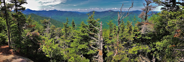 |
| A panorama from Lower Wolfjaw Mountain (elevation 4173'). Trees covered the whole summit, and the overlook was fairly limited. |
 |
| The mountain in the foreground is Table Top; to the left Mount Colden, and to the right is the MacIntyre Range, all seen to the southwest. |
 |
| A very distant view to the northwest, showing mountains and foothills into the Saranac Lakes region, some over forty miles away. |
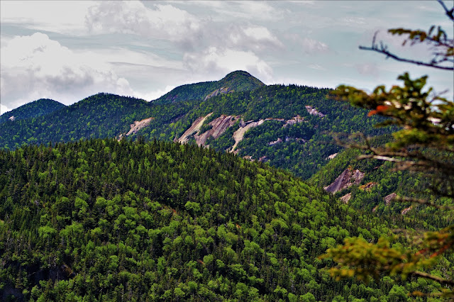 |
| In this southwest view, I could see all the mountains I planned to hike that day, including Upper Wolfjaw, Armstrong, and Gothics (the tallest one in back). |
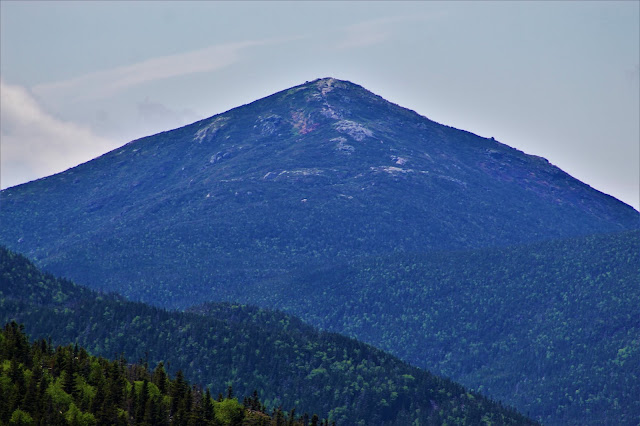 |
| Five miles southwest, the symmetrical face of Mount Marcy, the state's highest peak, sits against a grey-blue sky. Marcy's summit usually hosts snow through early July, and I was surprised to find it snow-free so early in the year. |
 |
| A close-up view of a large, steep area of exposed rock on the north face of Upper Wolfjaw Mountain. |
 |
| The rugged ridges of the Sawteeth to the south were visible throughout the hike, seen here with bright spring growth standing out against the darker evergreen trees. |
The trip from Lower to Upper Wolfjaw was just over a mile long, yet it took me over an hour to hike. The Wolf Jaw Notch, which separates the two, is around seven hundred feet deep, and fairly steep on both sides, making for some pretty serious climbing. Additionally, the less prominent Middle Wolfjaw Mountain was also in my way. This portion of the trek took me significantly longer than I had planned, and by the time I reached Upper Wolfjaw, I knew that I wouldn't be able to hike as many peaks as I had hoped to today.
 |
| A panorama from the summit of Upper Wolfjaw Mountain (elevation 4203'). Upper Wolfjaw has a nice clearing at its summit, but the lack of any substantial breeze or shade meant that the spring midges were almost unbearable, biting any exposed skin. |
 |
| Looking backwards to Lower Wolfjaw Mountain. It was disappointing to know that I would have to climb back over this to get home. |
 |
| Hedgehog Mountain sits in the foreground, off-center from the easily recognizable cliffs of Giant Mountain some six miles to the northeast. |
 |
| Green Mountain (right of center) sits midway between the nearer green slopes of Lower Wolfjaw and the more distant ride of Vermont's Mount Mansfield (distant center), nearly fifty miles to the northeast. |
 |
| A view to the east shows hills and mountains stretching out to the lowlands around Lake Champlain (right). |
 |
| The much shorter peak of Noonmark Mountain (left of center) is almost totally clear at its summit, making it a popular hiking spot due to its excellent view of the Great Range. A section of strange young forest stands out at its lower end. |
 |
| The massive outline of Nippletop dominated much of the view to the southeast. |
 |
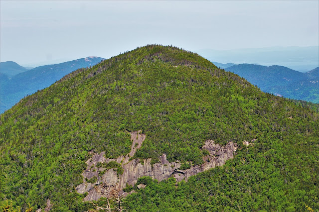
| Although closer, the Sawteeth (left of center) seem more distant here, as they are interrupted by the upper slopes of Armstrong Mountain. |
 |
| A steep rock face on Armstrong Mountain. Such features are very common in the Adirondacks, and the Great Range in particular is well-known for them. |
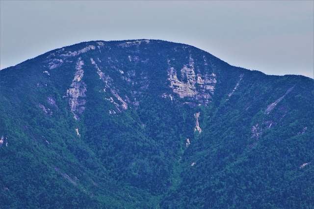 |
| A close-up view of Giant Mountain, with its sheer southern cliffs shining white in the afternoon sun. |
 |
| A close view of Noonmark Mountain's summit, with farmland in nearby Vermont in the background. |
 |
| A better shot of the Sawteeth, seen over the deep evergreen forest I would soon walk through to continue my hike. The more distant Hoffman Mountain is also visible to their left. |
 |
| Looking southeast, Mount Haystack, New York's third highest peak, appears between the limbs of Gothics (nearer) and Saddleback (farther). |
 |
| An off-centered Mount Marcy beyond Saddleback's east slope. Although I can see hikers on more distant summits in other pictures, Marcy seems totally empty, almost unheard of on a warm spring day. |
 |
| When hiking the state's highest peaks, Mount Colvin seems small and short and insignificant. From the Great Range, however, it takes on a more mountainous, even intimidating look. |
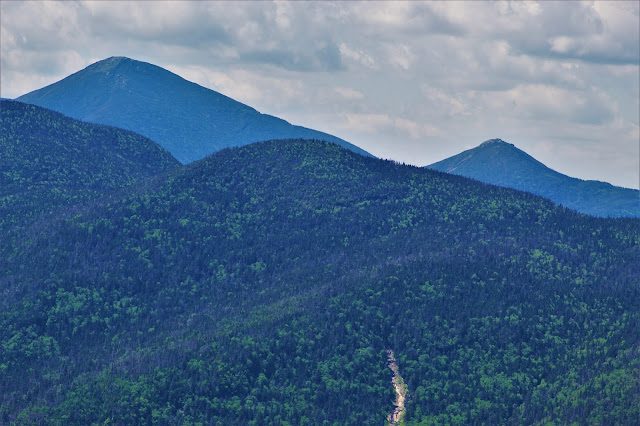 |
| Algonquin Peak (L) and Wright Peak (R), their col hidden behind Table Top Mountain in the foreground. |
Although my resources - time being chief among them - were beginning to dwindle, I resolved to power on to the next peak on my list: Armstrong Mountain. The col between Armstrong and Upper Wolfjaw wasn't too deep, and there was relatively little descending to do before the trail starting climbing upwards again. However, the descent did host a handful of spectacular views of the neighboring peak.
 |
A panorama from one of many clear ledges along the descent from Upper Wolfjaw. Armstrong Mountain, my next target, dominates the view at left.
|
While the hike up Armstrong Mountain wasn't too technically challenging, it was very steep and somewhat grueling. One area was so steep that a wooden ladder was in place to climb up maybe fifteen or twenty feet or vertical rock. At times it seemed the ascent would never end. When I finally arrived at the summit after an hour of hiking, a slight breeze kept the spring bugs away, so I took a nap for about a half hour before taking any pictures.
 |
| A panorama from the summit of Armstrong Mountain (elevation 4429'), easily the most impressive view of the day. A video I took from the top better gets across the sheet scale of it all. |
 |
| From the top of Armstrong Mountain, the nearby Gothics dominated the view. While I had planned on climbing Gothics as well, at this point it was obvious that Armstrong would be my last peak of the day. |
 |
| A view of the MacIntyre Range beyond Table Top Mountain, almost directly due west of Armstrong's summit. |
 |
| Gaps in the mountains, such as this northeasterly view, always fascinate me. Deep within the Adirondacks, lowlands afford a brief glimpse beyond the rugged peaks to the softer hills and fields beyond. |
 |
| A close-up of Gothics' summit, a goal too lofty for today. You can just make out part of the trail winding through the forest towards the bottom of the image. |
 |
| Curved segments of bare rock interrupt the forests of Gothics, bringing to mind uncomfortable fears of stumbling upon such a dangerous formation while hiking. |
 |
| Another 'gap' in the mountains shows seemingly endless layers of unbroken wilderness, forested hills fading from green to blue to grey into the distant horizon. |
 |
| Irregular rock faces on the south ridge of Basin Mountain stretch for thousands of feet, the result of ancient landslides that pulverized acres of forest. |
 |
| Hoffman Mountain is at center, with the Sawteeth in the foreground. As the Sawteeth lack the great rocky voids typical of Adirondack peaks, they have a much warmer, greener appearance. |
 |
| Big Slide Mountain is an easily recognizable and prominent peak visible from the entire Great Range, but there are few northeast-facing overlooks that provide a clear view of it. |
 |
| Yet another rockface on Saddleback Mountain is filled with sharp edges and geometric breaks. |
 |
| My farewell view of Gothics, taken just before I departed Armstrong's summit to return home. |
The hike back to the car was when things started to go wrong. I had fully tired myself out on the way up the mountains, and now had to return. However, since the Great Range is, as its name would suggest, a mountain range, this mean I would need to climb Upper Wolfjaw, Middle Wolfjaw, Lower Wolfjaw, and Hedgehog Mountains all over again. Sleeping in the sunlight on Armstrong proved to be a mistake, as I ended up with a nasty sunburn, yet this was only the start of my issues.
 |
| On my way back, I noticed this odd sight atop Upper Wolfjaw, denoting the twenty yard trail to its summit and overlook. |
During exercise and warm weather, the average human male will sweat around half a gallon per hour. I, not knowing this, had packed one gallon of water for a hike that would end up taking over ten hours. I was already rationing water when I left Armstrong, and by the time I reached Lower Wolfjaw, I was completely out.The remaining five miles to the car were done without any water and in a somewhat scary state of dehydration. Every time I stopped to rest, I fell asleep. My legs cramped non-stop. Each step made me want to vomit. By the grace of God I survived the descent and made it to the car around sunset; darkness in the forest and disorientation got me lost several times on the way.
Usually, when I climb a mountain, I feel a sense of conquest and accomplishment, like I've 'beaten' the mountain. This time, the mountain beat me. I would be out of commission for much of the next day as I recovered, using that time to order water filters and obtain supplies to try and prevent something like this from happening again. Lately I've done
other hikes that left me feeling unprepared and lucky to be alive, and while exhilarating, it's a feeling I intend to avoid at all costs. My next hike will involve bringing much more water, regardless of how much the extra weight slows me down.


No comments:
Post a Comment