Last September, I climbed
Algonquin Peak, the second-highest mountain in New York State, located in the Adirondack Mountains. I found that hiking above the treeline was more difficult than I had originally imagined. As I planned on climbing New York's tallest peak, Mount Marcy, this summer, I realized I wasn't sure if I was physically capable of a one-day, sixteen-mile expedition.
As a sort of 'dry run' for my planned "Marcy in a day" hike, I decided to hike four peaks in the MacIntyre Range, a twelve-mile hike with more elevation gain than Mount Marcy and roughly four hours of walking in the windswept regions above the treeline. Three of these peaks are considered Adirondack High Peaks. This included re-climbing Algonquin Peak, along with the adjacent Wright Peak, Boundary Peak, and Iroquois Peak. Although arduous, the hike was very informative and within my physical capabilities, paving the way for an attempt at Marcy, planned for later this week.
Although I usually try to take pictures using my higher-end equipment, many of these were taken with my cell phone. Due to the nature of this climb, some of my equipment I felt was too delicate to carry up the mountain with me. Additionally, removing my camera and lenses from their cases requires energy and time, both of which were in short supply above the treeline, so unfortunately the quality of some images suffered as a result.
 |
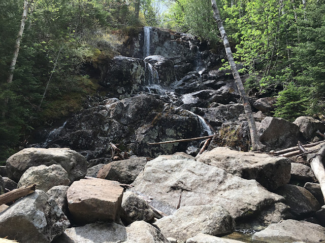
View of the McIntyre Falls, about halfway between the Van Hovenberg trailhead and the summit of Wright Peak.
|
 |
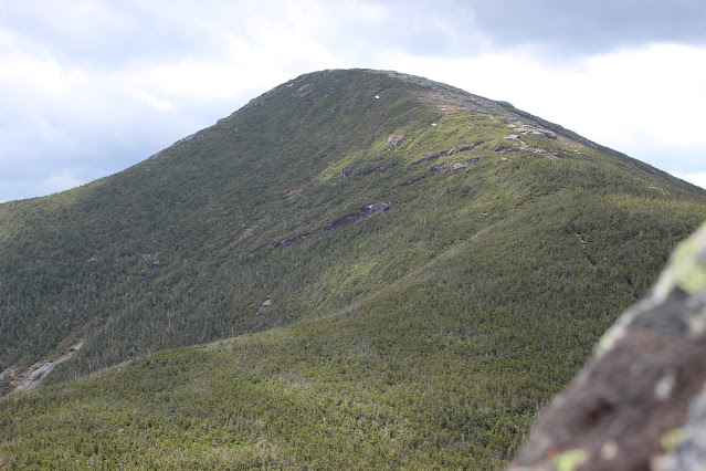
A view of Algonquin Peak from the slopes of Wright Peak.
|
 |
Heavy winds above the treeline triggered an asthma attack, forcing me to hide in some tall rocks to recover. I took advantage of this time to photograph Wright's summit.
|
 |
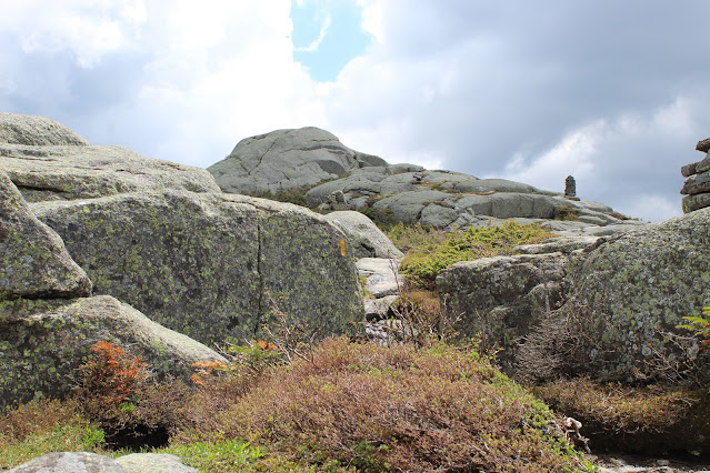
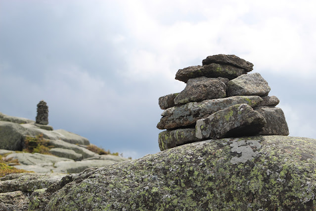
Sets of cairns approaching the top of Wright Peak. Above the treeline, markers like this are important for following the trail.
|
 |
A close view of Algonquin Peak's summit, showing shrub forest and bits of early June snowpack.
|
 |
| The trail heading up Algonquin is visible in this wider view. |
 |
Looking north from Wright Peak, Whiteface Mountain dominates the view while green spring growth fills the valley. Heart Lake, near the center, is where I started the hike from.
|
 |
Despite its low elevation compared to neighboring peaks, strong winds keeps Wright's summit free of any growth taller than a few feet.
|
 |
Striped rock faces characterize Mount Colden in this south-facing view.
|
 |
Dancing shadows, spring colors, and bare rocks characterized the view from Wright Peak, elevation 4557 ft.
|
 |
Markers and puddles atop Wright Peak, the first of the day's three High Peaks.
|
 |
View of the Marcy Brook, near the now-distant trailhead.
|
 |
Odd rock faces on the Gothics (L) and Pyramid Peak (R) resemble a poorly-rendered CGI texture.
|
 |
| Cliff Mountain's steep summit stands out amidst a sea of ridges and hills. |
 |
| A boulder atop a steep rock face makes for a good resting place on the way up Algonquin Peak. Note the difference from how this same view looked last September. |
 |
A fellow hiker reaches Algonquin's summit after a long journey.
|
 |
Looking northeast from Algonquin's summit towards Giant Mountain and the Great Range.
|
 |
A look to the southwest towards Iroquois Peak reminded me of how much farther I had to go.
|
 |
Two friends sit atop a small cliff, taking in the fantastic view.
|
 |
On the far side of the valley, Pitchoff Mountain forms a curious shape amidst more stark summits.
|
 |
A cairn farther down Algonquin's slopes, juxtaposed with the distant forest below.
|
 |
The road I rode in on. Route 73 runs along the Cascade Lakes, some eight miles north and half a mile down.
|
 |
| A cairn in front of Iroquois Peak. Compare with a similar image taken last fall. |
 |
A rockslide-induced canyon runs down the length of Mount Colden.
|
 |
Looking over Boundary and Iroquois Peaks on my first descent from Algonquin.
|
 |
As I approached the col, Boundary Peak, which had seemed practically invisible from above, rapidly became the most prominent mountain (aside from Algonquin) I could see.
|
 |
The southwest side of Algonquin was far more barren than its summit, likely because of lower temperatures, less sunlight, and stronger winds.
|
 |
Iroquois as seen from Boundary's summit. A dwarf fir forest covers the space along the ridgeline.
|
 |
Mount Marcy towers over the nearer Mount Colden.
|
 |
A large boulder atop Boundary Peak sits beneath distant Whiteface's silhouette.
|
 |
Panorama from Boundary Peak, elevation 4826 ft. According to legend, this peak once denoted the boundary between the Algonquin (north, L in picture) and Iroquois (south, R in picture) nations.
|
 |
Seen from Boundary, Algonquin seems far more barren and grey than it did from Wright, on its other side.
|
 |
| Wallface Mountain is perhaps the most notable peak in a seemingly endless sea of bright green mountains. |
 |
A closer view of Wallface Mountain, showing its unmistakable cliffs and overhangs.
|
 |
This rock face, seen here from Boundary Peak, is part of the trail up Iroquois Peak. I ascended using the crevasse on the left (the sharp split rock is about six feet tall for scale); on descent I found the shrub-covered area to the right to be a far more convenient route.
|
 |
A vast dwarf fir forest covers the area between Boundary and Iroquois. None of these trees were more than five or six feet tall. The camera here is held at eye level, while my feet were level with the trees' roots.
|
 |
Seen from Iroquois Peak, Whiteface towers over farms in the valley, while an unnamed knob on Algonquin's west slope dominates the foreground.
|
 |
Panorama from Iroquois Peak, elevation 4829. This was difficult to take, as the powerful winds kept trying to rip my camera from my hands.
|
 |
Looking back the way I came. Boundary is almost indistinguishable from Algonquin's southwest slope.
|
 |
Sunlight revealed bare forest on Algonquin's slopes, where spring had yet to arrive.
|
 |
Smooth bare rock at the top of nearby Mount Colden is quite different from the boulder-strewn fields typical of Adirondack summits.
|
 |
| My next goal. Patches of snow still cling to Mount Marcy's distant, barren summit. |
 |
A view back up Algonquin and Boundary shows that the southwest-facing slopes of both mountains are notable more barren than their other faces. Interestingly, the trail up Wright Peak with its low treeline ascends its southwest face as well.
|
 |
Big Slide Mountain pokes above Algonquin's shrub-forested limb.
|
 |
Impressive silver streak characterize the Gothics, a peak of the Great Range, home to a plurality of the Adirondack High Peaks.
|
 |
Windburnt and tired, I left Iroquois Peak quickly and aimed to get back below the treeline as quickly as possible. This boulder stuck out on my way back up Boundary Peak.
|
 |
Patches of June snow up to a foot deep covered portions of the trail on Iroquois, Boundary, and Algonquin, adding an unexpected hazard to the hike.
|
 |
| Already tired atop Boundary Peak, the view toward Algonquin seemed more tiring and less challenging than it had earlier in the day. |
 |
A farewell shot from Algonquin Peak as I headed back below the treeline, safe from the powerful winds and sunlight.
|


Breathtaking and inspiriing. I hope someday to make those climbs.
ReplyDelete