North Carolina: State High Point 18/50
10.98 mi, 3734' elevation gain, 5 hours round-trip (including breaks)
Another semester of college can only mean one thing: Another state highpoint! It's come to the point where I almost look forward to the trips down to Florida (and the hikes along the way) than I do to the actual semester. With an excellent weather forecast and plenty of free time and sunlight, I set my sights on my highest goal thus far: Mount Mitchell.
At 6684' in elevation, Mount Mitchell (known as Attakulla in the native Cherokee language) is not only the highest point in North Carolina, but also in the Appalachian Mountains, and the entire country east of the Mississippi River. It would definitely be the highest I had climbed thus far, beating out Tennessee's Clingmans Dome by around forty feet. While the Blue Ridge Parkway drives all the way up to the summit, going by car is never any fun, so I planned to hike the six-mile Mount Mitchell Trail from the Briar Bottom trailhead, over 3500 feet below the summit.
I had driven through the area on my way back from Brasstown Bald last winter, and decided that Mount Mitchell, as a very notable peak, deserved serious attention: A long hike in daylight and good weather. For that reason I decided to hike it on the way back to college in August, when the peak was snow-free, the day long, and the weather more likely to be calm. I left early in the morning on Thursday and arrived at the town of Marion NC at around 8:30 that night. I picked up supplies and headed off to a rest area to sleep in my car, saving over $100 on a hotel room (or $20 on a camping permit) like I accidentally did on my way to Katahdin back in June.
I woke up a little before six, got changed, and headed out to the trailhead, following US-80 over the mountains. I drove through several layers of fog here, which worried me a little bit about the trail and hike, but I figured the sun would be up soon to burn the clouds away. There were a lot of sharp turns on the steep road, and driving in the dark in the fog was a somewhat concerning experience.
I had a few concerns about parking, as the parking lot is down a dirt road and across the street from a campground that doesn't open until eight in the morning; the start of the trail runs through the campground. However, the trailhead is run and maintained by the USFS and, aside from being the only car there, I had no problem parking, setting up,and crossing the campground at seven. Soon I was in the woods and on my way up.
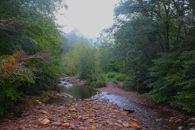 |
| Looking up the South Toe River in the morning fog from the bridge at the entrance to the campground, just across the street from the trailhead. |
Now, a word on timing and difficulty. I had read online that the Mount Mitchell Trail is considered "extremely strenuous" and "exhausting and time-consuming". According to the North Carolina parks website, hikers should allow for at least eight hours to climb the trail round-trip. I've often found that the internet tends to heavily exaggerate the difficulty of climbs, probably trying to keep more casual hikers from biting off more than they can chew.
I wanted to make it back on campus before ten that night, so that allowed around for four to five hours of climbing time. I had averaged four miles an hour under similar circumstances on Clingmans Dome last year, but with less ideal sleeping conditions and significantly more elevation gain, I was a little concerned about timing on Mount Mitchell. Additionally, I had been off my feet for the past month after breaking my toe in a bike accident, and this would be my first hike since late July; there was a good chance my toe would give me serious trouble. Still, I guessed I could finish the hike in less than five hours, and planned to return to the trailhead by noon at the latest. Worst-case scenario, I get to college a few hours late; that was an acceptable risk.
It took me only a few minutes to climb out of the fog, as the trail starts climbing right off the bat, but unfortunately the rapidly-changing weather conditions messed with my uncoated camera lens, ruining most of the day's pictures. (I think this will be the last hike with the uncoated lens; it's caused me far too much trouble). The first few miles of the trail alternated between open hardwood forest very similar to those back up north, and forest buried in an understory of magnolias and other evergreen bushes. A variety of bright mushrooms lined the trail, filling the air with all sorts of potent aromas, none of them good.
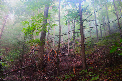 |
| Fog fills the sky above hemlock and ash trees, where a very large oak had fallen some time prior, leaving a hole in the canopy. |
 |
| Foggy lenses plague this view through a more densely-packed, magnolia-lined section of trail. |
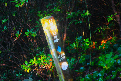 |
| Wooden markers every half-mile gave good readings on my progress in both distance and elevation. They reminded me of similar markers along the Tuxachanie Trail in Mississippi, and were quite helpful. |
After some time of climbing through this varied forest, the trail steepened significantly as it headed up Commissary Hill, a small sub-peak of Mount Mitchell with no prominence. A series of switchbacks crossed under power lines that lead to the summit, supplying the extensive facilities with electricity and communications. The cleared area under these lines allowed for recurring views to the east for the duration of the steep switchback section. The sun was just rising, and the valleys below were still filled with clouds, so looking out was nearly blinding, but it was a good visual encouragement to see just how far I had come from the trailhead, by now obscured in fog.
 |
| Looking into the bright eastern light from one of the mini-overlooks under the power lines. |
One past the switchbacks, I emerged into an environment wholly different than that below. The varied hardwood forest was replaced by tremendous spruce and fir trees, with a handful of birches and not much else in the way of flora. Severe weather prevents high-altitude evergreen trees in the Northeast from getting to these sizes, but in every other way it was nearly identical to the alpine forests back home. I always find it interesting how similar the forests are throughout the eastern US; from Alabama to Maine to Michigan to Missouri, the trees are all comfortingly familiar.
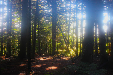 |
| Sunlight flares through fogged lenses in the high-altitude spruce forest on Commissary Hill. |
Somewhere near the top of Commissary Hill, the Mount Mitchell Trail intersects a horse trail and circumnavigates the summit ridge. Here a sign warned that the summit was still over a mile and a half away, and estimated that reaching it would take another ninety minutes. Evidently this trail has a big problem with more casual hikers underestimating its length and difficulty and ending up stranded at night. I cut the estimated time in half and set a goal to reach the top within 45 minutes; I would end up beating this by a few minutes.
Although the trail conditions were for the most part pretty straightforward for a hike of this magnitude, there were a few areas up above 5000' that were a little hairy, mainly due to weather conditions. The skies were clear by the time I reached the summit area, but the mountain had been in clouds all morning and probably most of the night, and spruce forests are excellent at trapping moisture. There were a few sections of exposed rock that were incredibly slick and uneven, and although none of them were quite scrambles, it was the only part of the hike where I really had to watch where I stepped.
 |
| Steam rises from a section of exposed rock near a spot dominated by stunted deciduous trees. |
 |
| A section of slanted trail in some denser spruce forest. |
Nearing the top of the mountain, the trees in the forest began to shrink, their growth stunted (albeit not significantly) by heavy winters, high winds, and possibly the slightly limited oxygen. The humidity along the whole hike was fairly severe, as one might expect in North Carolina in August, but near the summit, it combined with mid-morning sunlight peeking through the moisture-holding evergreen forest to make things quite nearly intolerable for a denim-clad northerner like me.
 |
| Sunlight illuminates the web of an orb-weaver spider, spotted during my last break before the summit. |
 |
| Forest above 6000'. Note the smaller size of the trees, in spite of the forest's equal age. |
Soon I reached the summit, and was for the moment the highest man on dry ground east of the Dakotas. Despite being my highest elevation reached thus far, the moment didn't seem quite incredible; perhaps I was caught in the rush of climbing as quickly as possible to expedite my trip to college, or maybe I was thrown off by the development of the summit. Aside from a parking lot and observation deck, there's also an interpretive center, a concessions stand, and various other buildings cluttering the high point. I hung out at the top for awhile before proceeding to the observation deck, resting, taking pictures, and enjoying the moment.
 |
| The sign marking the summit actually sits a few feet below the highest spot, which is occupied by the observation deck in the background. |
 |
| A memorial to Reverend Elisha Mitchell. Mitchell, a 19th-century geologist, was instrumental in proving the height of the mountain that now bears his name, and fell to his death at the aptly-named Mitchell Falls. |
 |
| Mount Mitchell NC, elevation 6684'. State High Point 18/50. |
It was around 10:30 when I reached the summit, but the place was pretty deserted, with only a handful of people on top, all of whom had driven rather than hiked. I suppose it was pretty early on a Friday morning, but
Clingmans Dome had been more populated under similar circumstances last year. There was a family on the observation deck when I arrived, but after a few minutes they left, leaving the top of the Appalachians all to myself.
 |
| Looking towards flatlands to the east, while dissipating overcast fills the nearer foothills. |
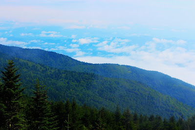 |
| The undercast clouds obscured most of the landscape, but were beautiful enough in their own right to make up for it. |
 |
| A map of North Carolina, geographically oriented, marks the summit, with a marker located at the spot in the map where Mount Mitchell is. |
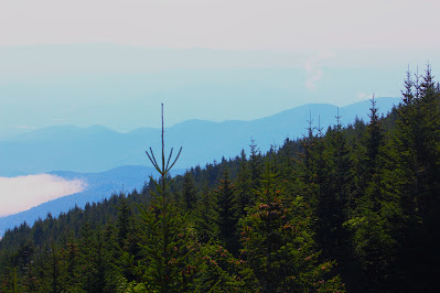 |
| Looking out towards the invisible distant sea past the limb of Commissary Ridge. |
As foggy lenses were beginning to render my pictures unusable, I swapped out my narrower, coated lens for more directed mountain pictures. What really drew my attention here was the undercast over the valley below, not completely covering the distant ground but wisping through, offering glimpses of the forests and fields below. I found it interesting how Mount Mitchell, despite being the highest point on the east coast of the US, is so close to the eastern end of the Appalachians, and almost everything to the east was flat plains.
 |
| A closer shot to the east where the mountains meet the plains. Lake James, folded into the foothills, is visible to the upper right. |
 |
| Looking northeast towards Table Rock, the more distant peaks rapidly disappear into the mid-morning haze. |
 |
| Clouds and mountains fight for control of the skies beyond the limb of Maple Camp Bald. |
 |
Peeking through the clouds from above reveals a quarry on the side of a distant hill.
|
While the cloudy valley below was captivating, the humidity and undercast made it fairly difficult to see, so I turned my attention to the surrounding mountains. Mount Mitchell is located in the Black Mountains, a sub-range of the Appalachians, and many of the surrounding peaks are also over six thousand feet in elevation. Like when I climbed Clingmans Dome last year, most of the peaks to the west were hidden in the morning clouds, but the nearest summits were occasionally visible, glimpsed for moments as the clouds circled their lofty tops.
 |
| The slope-like 'summit' of nearby Maple Camp Bald isn't in fact barren, but rather covered in small shrubs rather than the usual high-altitude spruce-fir forest. |
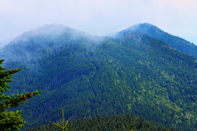 |
| Mount Craig (L) and Big Tom (R), the two nearest peaks to the north, were only visible for a few moments, their tops scraping the base of the low western cloud ceiling. |
 |
| This official-looking marker is embedded in the floor of the observation deck, some fifteen or so feet above the actual ground. I couldn't find a proper USGS survey marker on the true summit; it may be buried beneath the deck. |
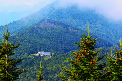 |
| Cloud cover was more problematic to the south, but a gap in the clouds (and trees) revealed a restaurant along the road just below the summit of Hallback (center). |
I felt like I wasn't properly appreciating being on top of the entire eastern half of the country, and of course the state of North Carolina. Perhaps doing so many hikes and so many high points has taken some of the allure away. In any case, I needed to get going if I had any shot at making it back to the trailhead by noon, so I took a few farewell pics from the summit and left as soon as the next group (travelling by car, of course) arrived.
 |
| Looking out over the foothills. By now some of the undercast had dissipated, but proper clouds from the north were already beginning to descend upon the flatlands. |
 |
| Dobson Ridge is probably the most prominent of the outer foothills, standing out here against the distant haze. |
 |
| Sunlight shines brightly below the clouds in this shot of the Blue Ridge Parkway winding its away around a mountain ridge. |
 |
| Each gust of wind brought to light new wilderness views, each strangely illuminated beneath the opaque fog. |
 |
| The power lines that criss-cross Mount Mitchell continue on towards Bald Knob farther to the south. |
With a tad of reluctance and a bit of urgency, I left the summit and started back for the trailhead. I ran into a lot of people who were on their way up; evidently a lot of people had begun their hikes later in the day. I did a bit of trailrunning on the way down, but with the damp trails and with gravity adding to each step it was fairly rough going, so I ended up alternating between running and more traditional hiking. Once I hit the switchbacks I stopped for more pictures now that the sun was higher and the clouds were less shiny.
 |
| One of the power lines, seen stretching into the distance from the point where they stop climbing and start moving parallel to the mountain ridge. |
 |
| Seen beyond the power lines from well below the summit, the foothills seem far nearer and taller than from above. |
 |
| Now level with the clouds, the hills stretch out to the horizon, where Lake James can again be seen in the distance. |
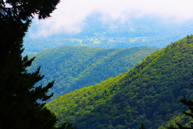 |
| Sunlight bathes the green limb of Commissary Ridge from the last of the switchback overlooks. For the first time I was once again close enough to make out features on the ground in spite of the August humidity. |
After plunging back into the magnolia-choked forest, my pace slowed a bit as my body didn't quite want to keep up with my legs. Surprisingly the descent wasn't too much of grind; the trail is pretty steep the whole way, and racing the clock kept my mind occupied so I never really got bored.
I passed one hiker on his way up who asked if the summit was clear enough for a view "worth the climb". This was a challenging question for me, since I didn't climb for the view, I climbed to get to the top of the state; the view was merely a plus. I told him that there was a good view while I was up there, with clouds on one side of the mountain and clear skies on the other, but I couldn't speak as to the current weather conditions. He thanked me and continued on his way.
Soon I was back to the car, just after 12:00 for a round-trip time of just under five hours. However, the trip didn't end there. The fastest - and prettiest - route back to the highway from here was to take the Blue Ridge Parkway down the mountains into Asheville. Famous for its scenic views, I had never actually driven the scenic road before, and I was curious if its overlooks would compare to the views from Mitchell and other mountain summits in the area.
 |
| Clouds descend upon Hallback as seen from one of the overlooks on the Blue Ridge Parkway. |
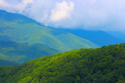 |
| The Mount Mitchell Overlook usually gives of good view of the highpoint, which by now was totally eaten up by clouds. I found myself hoping that lone hiker had made it to the summit in time to see the views. |
 |
| The clear-cut path of a power line is the only manmade interruption into the forested valleys below. |
From here the trip back to college should have been pretty straightforward, but it turned out to be anything but. The drive down the Blue Ridge Parkway became less than incredible when clouds moved in and the low speed limit slowed my progress. My phone took me through the mountains of north Georgia on backroads, and with my legs cramping from the hike, the inability to use cruise control became seriously upsetting. Rush hour traffic in Atlanta and thunderstorms in Alabama slowed me even more, but I made it back to campus around 10:30 with one more state highpoint conquered.


No comments:
Post a Comment