Cairo NY Roads: 87/112 mi
After a (lazy) week's recovery from Katahdin, some poor weather, and a brief stint in the hospital (which turned out to be no big deal), I was ready to return to hiking. However, with the holiday weekend shrinking my paycheck and filling the trails, I determined that another trip to the Adirondacks was out of the question, and headed out on a hot Friday morning to walk a section of road in Cairo. This route, covering residential Bross Street, the high-traffic Route 23, and the more moderate Lake Mills Road, was fairly well-balanced, and was be the last walk I have to take in the town's densely-populated center.
Roads Walked: NY-23, NY-32, CR-41/Lake Mills Road, Bross Street, Jerome Avenue, Krieg Road, Old Lake Mills Road
I parked in downtown Cairo at a gas station with a wide parking lot I've used frequently in past walks and headed up Bross Street, here a one-way road. I've walked this section of Bross Street before, between Main Street and Route 23; it's a heavily residential area that's well-known to locals, and I had several friends growing up who lived on it. On a Friday morning there wasn't too much traffic or activity, and my concerns of alarming people with my camera never materialized.
 |
| Narrow, grassy sidewalks line Bross Street as it leaves the center of town towards more residential areas. |
 |
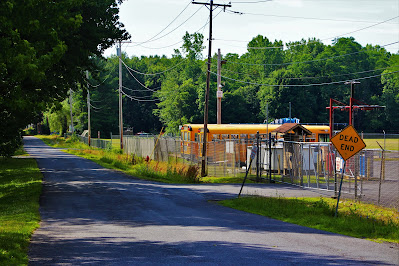
| Once a thru road decades ago, William Dinger Road now dead-ends behind the Cairo-Durham Elementary School, where its buses are stored. |
The next part of the walk was the most dreaded: Route 23. As a four-lane, 55 MPH highway, walking Route 23 through Cairo is fairly dangerous, and it's not exactly scenic, but I want to walk all thru roads in the town, not just the one I like. This section of 23 climbs some small hills and cuts through some interesting rock layers. A bridge near the turnaround point (the intersection with Route 32) runs over Lake Mills Road, giving me a view of the day's future.
 |
| Looking northeast into oncoming traffic along Route 23. |
 |
| Looking back south from the bridge over Lake Mills Road. |
After heading back down Route 23, I turned north down a part of Bross Street that most people are less familiar with. After leaving downtown Cairo, the nominally residential road winds through some very rural, much less-populated areas south of the Catskill Creek. This section of road contains a few houses and some swamps before it veers off into a dead-end street that I dared not walk down.
 |
| Shrubs and small trees growing from an algae-topped swamp along Bross Street. |
 |
| A side view of a blooming swamp rose (Rosa palustris). Dozens of these pink flowers filled the swamps along the road. |
 |
| A tree with a very large burl in some recently-cleared land. |
Bross Street turns east before reaching the Catskill Creek, so I followed another road I had never even heard of before, Krieg Road, to cut over to Route 41. This road was pretty rural, with only a few structures, and entirely forested except for the power lines that cut across it. I've been noticing in my recent walks that Cairo has a lot of powerlines, but looking at the maps, it appears to be the same single set of lines that just cross nearly every road in town.
 |
| Looking straight down the power lines reveals a distant ridge. |
 |
| An old trailer sits amid the cleared land below the lines to the northwest. |
At the end of Krieg Road I headed north on Lake Mills Road and soon encountered a beautiful sight: A great bridge over a wide, clear area of the Catskill Creek. The clearing, around 600 feet wide, looked down over the Catskill and significant rock fields on its north banks. The actual water, pooling in deep areas near the south bank of the river, looked perfectly cool and crystal-clear. July had arrived in full force; it was extremely hot and humid, and I was overwhelmed with a childlike desire to climb down and swim in the creek. I felt like a kid on summer vacation, with no cares in the world except not overheating.
However, as I was dressed in jeans, carrying an expensive camera, and walking a bridge dozens of feet above the creek, climbing down for a swim was out of the question, so I settled for some pictures of the water.
 |
| Graffiti, a rare sight in rural towns, on rocks near the bridge. |
 |
| Looking upstream over the wide river, Blackhead and Black Dome rise over the treetops. |
 |
| The cool, shallow waters of the Catskill Creek flow through a field of water-deposited rocks and silt. |
 |
| One in a series of small waterfalls and rapids along the creek. |
 |
| Looking downstream, where the hills to the east rise beyond the camera's field of view over the creek. |
 |
| One of the deeper areas on the south bank that seemed perfect for swimming. |
I didn't walk too far north of the creek, meeting up with Warren Stein Road in about half a mile, and then headed back towards the way I had come. I didn't stop for many pictures at the bridge on the return walk, but I did notice two things that had escaped my eye on the way up. The first was a very patriotic display of a large flag and a bronze eagle perched atop a rockface on the creek's south end. On the opposite side of the road from this was a sign designating the location as a DEC-approved waste dumping site. It probably wouldn't be a good idea to swim in the creek here after all.
 |
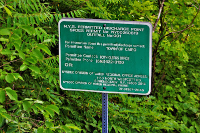
| Contact information fills this small sign along the Catskill Creek, just down the road from Cairo's water treatment plant. |
 |
| This large bronze eagle adorns a patriotic display overlooking the creek and the road. |
Here I headed down Old Lake Mils Road, a small side-road that splits off from Route 41 and then re-links with it later on. This road was significantly more hilly and twisty than the main road, and I can understand why the road was re-routed for heavier, faster traffic. Here I walked through an abandoned resort, "Villa Veronica", that from limited research seems to have been abandoned for at least two decades. The buildings were all empty, their exteriors collapsing, their rooves covered in growing weeds, and the emanated with the smell of urban decay. However, some old cabins on the property appeared to be in a state of repair, and I wondered what kind of dedication it takes to restore such long-abandoned buildings.
 |
| One of the main buildings of the Villa Veronica, just a few feet off the side of the road. |
 |
| Some of the old resort's larger buildings, bowing and overgrown with vines and bushes on the roof. |
I returned to Lake Mills Road proper and headed back north a bit to cover the part of the road I had bypassed to take the loop road. This was an area I was very familiar with; a family friend of 20+ years lives in this area, and I had been walking this section of road for decades. I passed the water treatment plant, an overgrown pond, and a collapsed building near the bridge on Route 23. This building burned to the ground around ten years ago, and shortly afterward, a woman was found frozen to death inside. Since then the building and property have become heavily overgrown, and the whole area has a somber feel.
 |
| Ruins of the burned-out building hide behind trees and tall weeds. |
 |
| Algae growing on a small pond outside a housing complex. |
 |
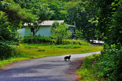
| A cat scurries down the end of Marie Drive, a dead-end sideroad near town. |
Passing under the bridge below Route 23 led me into a totally different environment. It's around here that Route 41 changes from Lake Mills Road to Jerome Avenue, entering downtown Cairo. Jerome Avenue is a very narrow road, lined with houses and businesses built into the side of a hill. Walking this stretch of built-up street was somewhat dangerous due to the blind hill and lack of shoulders, but it revealed a part of Cairo I had never really recognized before. All these buildings were old, and could be downright quaint if they were cleaned up and well-maintained. Cairo has a lot of potential, and were it a little less abandoned, it would have a lot of charm.
 |
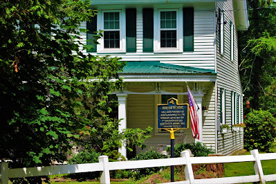
| The historic Sayre Home on Jerome Avenue. |
 |
| Local businesses moving into town, renovating buildings for commercial use. |


No comments:
Post a Comment