Sullivan County: New York County High Point 12/62I had been working in the distant town of Neversink NY for several weeks, and as always, I was looking for any opportunity to make the ninety-minute commute 'worth it' by hiking after work. Working ten-hour shifts outdoors, and with so long a trip home, I'm usually too exhausted to spend my time hiking. However, on this particular dreary, cloudy Tuesday, work let out a little bit early, so I jumped at the opportunity to bag the nearby county high point.
Before working there, Sullivan County wasn't a place I had really explored; it's mostly rural, with very poor towns and cities, and its topography consists more of long rolling hills than of towering mountain peaks. Beech Mountain, the county's high point, isn't technically on public land, but it's very close to DEC-maintained trails in the Willowemoc Wild Forest. It was also a mere twenty minutes from the job site, and I knew I probably wouldn't be in that area again any time soon.
I headed over as soon as I got off, a bit concerned about the poor weather conditions but determined to reach the top of the county. The forecast called for rain to begin at 4:00, and I was starting my hike at 2:00; trip reports online suggested a three-hour round-trip hike but I was certain I could beat that. I parked at a pullout on Hunter Road, about three miles south of the mountain, and after a brief walk up the road I discovered a better parking area along Beech Mountain Road. This, it would turn out, was only my first mistake of the day.
 |
| A deer spots me while crossing Beech Mountain Road. |
 |
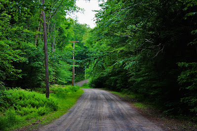
| Looking up the windy road on my way to the true trailhead. Proper planning would have prevented this extra walk. |
The main path up Beech Mountain, the Flynn Trail, follows Beach Mountain Road the whole way up with one exception. At the trailhead is a private residence that hasn't given the DEC an easement, so the blue-blazed Flynn Trail bypasses the property, starting at the east side of the road. However, I began following the trail on the west of the road, the yellow-blazed Logger's Loop. I soon realized my mistake, thanks to the well-labeled trail junctions, but designed a new plan on the fly and determined it wouldn't add more than a quarter mile to my trip.
 |
| A well-maintained granite gravestone alone off the side of the trail. |
The Logger's Loop trail leads to the Big Rock trail, and both go through similar areas of forest typical of the southwest Catskills. There was a bit of open country along the Logger's Loop, but after that was mostly wide open forests of maple and beech, with fern-covered and largely shrub-free understories. This trail headed north and stays fairly level with moderate elevation gain at first. It steepens significantly as it climbs the mountain's edge, eventually intersecting with the Flynn Trail - where I had wanted to go all along.
 |
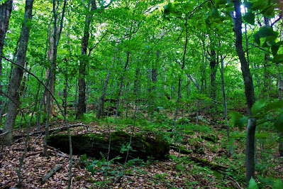
| Large trees - that I can't seem to identify - dominate an open area along the Logger's Loop. |
 |
| The trail runs through a dense stand of tall, young sugar maples, seeming foreboding in the overcast lighting. |
 |
| Junction of the Big Rock and Flynn trails. |
Now that I had linked back up with the Flynn Trail, I could follow my original plan again. The Flynn Trail peaks at an elevation of just under 2900', well short of Beech Mountain's 3118' high point. I followed the trail until I reached roughly the high point, at least as best as I could guess, which is about a half-mile southeast of the high point. Here, roughly a quarter mile from the trail junction, I turned north off the trail to start my bushwhack along Beech Mountain's summit ridge.
 |
| The steep, wide, fern-covered path up the Flynn Trail past the junction. |
 |
| Denser beech forest, looking up from the spot where I left the trail for the bushwhack portion of the hike. |
Ascending the ridge was pretty simple going at first. I was trying to remain just over the west side of the ridge's wide edge, acutely aware of the fact that I was on private land. Satellite imagery shows a cabin or building of some sort on the east side of the ridge, and I wanted to stay away from it, but following the exact 'edge' of the ridge was just the most sensible way to climb. After awhile, I crossed a blazed 4x4 trail, apparently rarely used. This was the approximate halfway point to the summit; from what I can tell, the trail leads to the cabin on the far side of the peak.
 |
| Crossing the 4x4 trail that leads to the private cabin. |
Shortly after crossing this trail, I was faced with two new obstacles. The first was a series of fern-covered rock scrambles; on its own, this wouldn't be more than a fun, easy challenge. However, at the same time, the rain began. It was just a little drizzle at this point, just enough to be annoying, but the forecast had called for thunderstorms within an hour of rain beginning. With the rain starting now, well ahead of schedule, I feared that the storms were well on their way, and hurried up the ridge. |
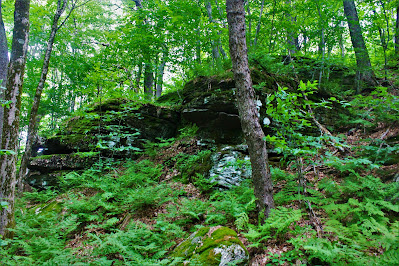
| The first of several rock outcrops. This was was fairly easy to circumvent; I climbed up the less rocky section at right. |
 |
| A second outcrop was less avoidable, and required directly touching the now-wet terrain. I was going to get wet anyway, but I had avoided it up to this point. |
After a series of outcrops, I finally arrived at the wide summit plateau, which, as the mountain's name would suggest, was choked with young beech trees. The understory was so dense it was difficult to move, in places reminiscent of the summits of Woodpecker Ridge and Richmond Mountain, both at notably higher elevations. With everything damp from the now persistent drizzle, moving around left me both tired and wet.
Here I was faced with another problem: Determining the highest point. Beech Mountain's summit is very flat and wide; USGS survey maps place nearly ten acres of land within the 3100' elevation contour. Most maps place the highest point towards the southern end of the summit plateau, but it seemed like there were some slightly higher areas farther to the north. I don't have a sight-level, and it wouldn't have done me much good anyway with such dense undergrowth. My solution was to trudge around the whole summit area like I did with Northwest Bearpen, an exhausting process, but easier than discovering I missed the true high point and having to come back.
 |
| An example of the dense beech understory. The entire summit was pretty much as dense or denser than this. |
 |
Beech Mountain, Sullivan County NY, elevation 3118'. NY County High Point 12/62.
I didn't want to put my camera on the ground and risk getting it wet, so I propped it up in a tree branch, inadvertently resulting in a blurry picture. |
Given the imminently inclement weather, I didn't stay on the summit for long, heading back down the way I came. Traversing the wide summit plateau, I was a little worried about getting lost, but I popped out in a place that looked exactly like where I had climbed up. I followed the ridgeline again, this time willingly walking the east side of the ridge out of curiosity, wondering if I could see any sign of the cabin. I didn't, and soon crossed the little trail again, confirming I was on the right track down the mountain.
 |
| More dense beeches, along with a thick carpet of moss, just below the mountain's summit. |
My hike became gradually more miserable on descent as the rain intensified and I became wetter and wetter. After awhile, it seemed like I had been bushwhacking for too long, and a quick check with the GPS confirmed that I was way off course. I had come down too far on the east side of the mountain and missed the trail entirely; getting back would require climbing another hundred feet or so. Now I was wet, tired, annoyed, and vaguely lost, and it took some time to circumnavigate half the mountain and link back up with the trail. On the way, however, I passed many more rock outcrops, climbing through some of them, and crossed a number of old, overgrown trails that other highpointers have reported using in their ascents.
 |
| Hiking over downed birch trees along a mossy rock outcrop. |
 |
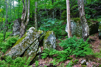
| Broken bedrock and glacial erratics dot the slopes of Beech Mountain. |
The rest of my descent wasn't great. I was late getting back on the trail and soaking wet. The weather conditions made my camera lens fog up so I was unable to take any useful pictures whatsoever. Descending the Flynn Trail was interesting, but I was severely distracted by the swarm of mosquitoes that immediately formed around me. I have never dealt with mosquitoes like this on a hike; there were so many I gave up trying to kill them eventually. A long hike in humid weather with no water is exhausting and probably not the best idea, but I made it back to the car in just over two hours - exactly as planned - and headed home after a long day. Another county down.


No comments:
Post a Comment