A bit of a return to form. After looking through some pictures taken during my Durham roadwalking campaign last autumn, I decided to enjoy the fall foliage in a similar manner this year, before the trees become bare. So last Friday, I walked a stretch of County Route 3 in Conesville NY, in the southern portion of Schoharie County. Conesville is a very isolated town, so small it doesn't even have a post office, and has a rather eerie feel to it, as though I was walking in the aftermath of an apocalyptic movie. However, wide open famland along the Manorkill valley provided beautiful views of the northern Catskills and their foothills.
 |
| Cattle graze at the edge of a field. Conesville is a heavily agricultural community. |
 |
| Cornfield, hayfield, and forest, all in the same shot. |
 |
| Huntersfield Mountain, Schoharie County's tallest peak (which I climbed back in August), was very prominent from Route 3. |
 |
| Mount Richmond rises over a forest of larch and pine. |
 |
| Sunlight dances on Richtmeyer Peak, the southeast border of the Manorkill Valley. |
 |
| Young, dense beech forest blanketed the steep slopes to the valley's north. |
 |
| Hayfields roll out under a multicolored mountainside. |
 |
| Richtmeyer Peak, seen looking east down Route 3. |
 |
| The peak to the left is South Mountain; the evergreen-covered peak to the right is the Ashland Pinnacle. |
 |
| A broken fence divides fields beneath the col between Richmond and South mountains. |
 |
| Close-up on Richtmeyer Peak from over four miles away. |
 |
| Ditches along the wayside were lines with these periwinkle flowers. |
 |
| Sign at the end of Durham Road in central Manorkill. |
 |
| The Manorkill Cemetery has been the main cemetery in Conesville for over two centuries. |
 |
| A view west along the valley shows the mountains of Delaware County, including Utsayantha (L). |
 |
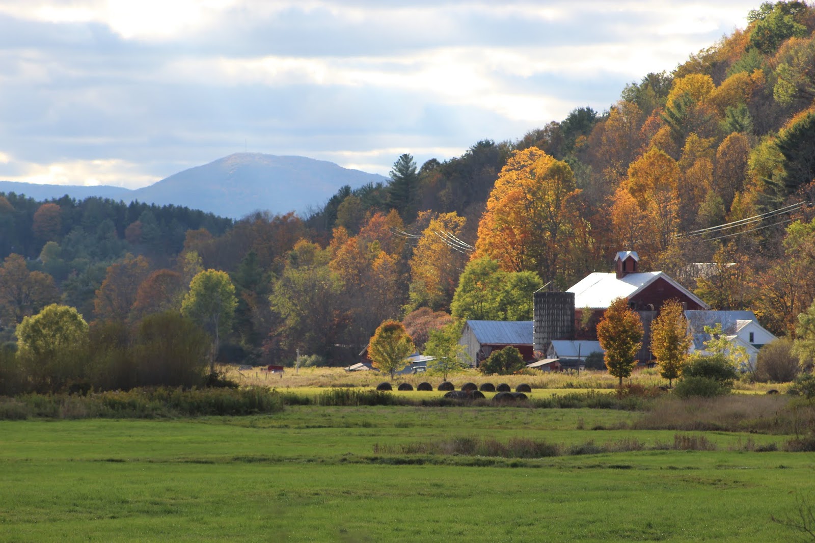
| View of a farm in the center of the valley. |
 |
| Mount Ustayantha watches over the farm and its surrounding foliage. |
 |
| Fall colors interspersed with stoic pine trees on the far side of the valley. |
 |
| Historical marker at the old Richtmeyer Tavern, now abandoned. |
 |
| A car photobombed this picture of the old tavern, but I thought it added character to the image. |
 |
| The majority of Conesville's buildings are in a state of disarray, including the historical tavern. |
 |
| Sunset and clouds light a rainbow of colors on Huntersfield Mountain. |
 |
| I found this mosaic pained on the road-facing door of the above barn. |
 |
| Mount Richmond's many colors seen through a break in the trees. |
 |
| Long after the aspens have given up, the larch trees retain their yellow needles, while dark green hemlocks remain unchanged. |
 |
| This old trailer had smoke coming from its chimney. Its decrepit state, like much of the town, was somewhat reminiscent of a post-apocalyptic movie or TV show. |
 |
| Sunset's beams light the northeast slope of Huntersfield Mountain. |
 |
| Colors at sunset along the Manorkill, upstream from the bridge on Haner Road. |


No comments:
Post a Comment