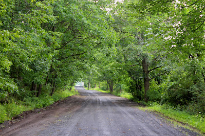
Still Hill, Westerlo town highpoint. Elevation 1744'. Albany County highpoints 2/13.
I've been working on hitting a somewhat random selection of town highpoints near my house on days when I don't have the time or ability to reach larger, more important peaks. Of the six towns that border Durham, I had done the highest point in all except Westerlo. This clearly needed to be remedied and, with thunderstorms forecast all day long, Friday seemed like the day to do it. I left the house in a brief break between two torrential storms and headed up to the rural town to the northeast.
The Westerlo highpoint, named Still Hill on topographic maps, is located right on the border between Westerlo and Rensselaerville to its west. A dirt dead-end road, Righter Road, runs right over the crest of the hill, ending at a farm just north of the highest elevation contour. I wasn't sure whether the highpoint proper would be on the road or off in the woods to its east, but I was prepared for a short bushwhack if necessary.
The drive to the highpoint went through a lot of beautiful countryside with towering stormclouds to the east and the west and sunny blue skies between. I wasn't able to stop for pictures as I was most concerned with reaching Still Hill before the rain started up again.
I pulled onto Righter Road and found much to my disappointment that the highpoint seemed to be some distance east in some very well posted woods. This is a tiny road with one house on it and just being here was asking for trouble, never mind adding trespassing to the list. Thankfully, analysis of the maps showed that this apparent maximum was actually outside the highest elevation contour, and a second highpoint, visibly similar in height to the north, seemed to be the true summit.
This highpoint was right along the road, although land on either side seemed roughly even in height. This is a similar situation to Sligo Hill, the Greenville highpoint, which is also on a dead-end road. I called the crest of the road my highpoint since it was visibly at least equal to the surrounding terrain if not slightly higher.
 |
| Looking south from the summit, towards the other maximum down Righter Road. |
 |
| Still Hill, Westerlo town highpoint. Elevation 1744'. The building behind me is part of the farm at the end of Righter Road. |
 |
| Looking east into the oak forest off the road, showing the equal to lower elevations. |
There were some oddities on Righter Road that caught my attention. Satellite imagery showed that several large metal buildings, including one right at the highpoint, are fairly new constructs. The land is very well posted for an area where it appears nobody would have much reason to go. Additionally, there was a house farther down the road completely wallpapered in what appears to be hundreds of vinyl records, including the roof, windows, and doors. This strange house clearly hasn't been lived in in some time but someone went through the effort of decorating it very strangely.
 |
| One of the large warehouse-like structures at the summit. |
 |
| The odd record house overlooks the valley but trees obscure most of the view. |
Whatever secrets Still Hill holds, it will have to hold them for a little longer. With Westerlo under my belt I headed home to relax as more and more storms rolled through the region.

No comments:
Post a Comment