Virginia - State High Point 16/50
Despite the many drawbacks of the twenty-four hour drive from college in west Florida to home in New York, the opportunity to travel through almost the entire Appalachian Mountain range is worth making the trip every semester. While taking a dedicated trip to the southeast for hiking would require days of time - and hundreds of dollars - making stops along the necessary drive to college allows me to bag highpoints in a (relatively) short timescale, and on a budget.
Mount Rogers, at 5729 feet, is the highest point in the state of Virginia, located in the southwest part of the state right along my route home. Rogers had been on my radar for a long time; concrete plans to hike it back in January were made unrealistic by last-minute heavy snow and a frigid cold snap. Since then, it had been the next state high point on my list, and in late April I started seriously preparing for it. I picked up new poles and some other supplies the week before and planned on using Mount Rogers to break them in.
Thursday afternoon, I finished my last final exams, ate lunch with friends, finished packing my car, and left campus a bit later than expected. The ride north went smoothly until Birmingham, where I missed a turn and soon found myself lost some distance north of the city. I spent the evening wandering around rural Alabama, following the GPS on my phone which took me mostly parallel to the interstate. There were some beautiful views in this part of the state, with a lot of hills along Lake Guntersville and plateau-like mountains farther north. The scenery reminded my a lot of upstate New York, and I imagined that Greene County's pejorative nickname - 'the Alabama of New York' - was surprisingly topographically accurate.
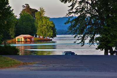 |
| A view of Lake Guntersville from a gas station I stopped at. Had I had a less stringent time budget, I would have loved to explore the area some more. |
As night fell I finally returned to the highway west of Chattanooga. I had reserved a hotel in Bristol and hoped to make it there by midnight, but getting lost (as enjoyable as a drive as it was) pretty much ruined that schedule. I drove the north-south width of Tennessee in the dark and got to Bristol around one in the morning, heading straight to bed.
I planned to hike Mount Rogers from the Massie Gap trailhead in the Grayson Highlands State Park, from the southeast. Taking the Appalachian Trail from the west is a shorter and more conventional route, but the trail from the southeast went through miles of open shrubland, promising extensive views and a local population of wild ponies. This seemed a much more interesting hike, albeit somewhat longer (eight-ish miles), but the state park didn't open until 8 AM, preventing an early start. With my late arrival time at the hotel, I set a late alarm and figured I could get to the trailhead at nine.
I had a lot of trouble sleeping, and didn't get out of the hotel until almost embarassingly late in the morning. The GPS took me on a route that circumnavigated the mountain from the north, driving through beautiful views and narrow, winding mountain roads, with all the scenery bright green with new spring growth. Although the weather had predicted clear skies all day, I found the uppermost peaks engulfed in clouds, but held out hope that they would lift by afternoon.
 |
| From the north, Mount Rogers was totally hidden by clouds. |
After paying the seven-dollar entrance fee, I parked, geared up, and headed off at around eleven. The trail started out fairly moderate, a good mixture of open shrubland and small patches of forest. The terrain was pretty rocky and the were some good views to the south, as I was still below the cloud deck. Although I didn't see any ponies yet, I kept stepping in evidence of their presence. There weren't many other hikers; most people wouldn't want to hike a mountain in the fog, but for me this was the only chance I would get for months.
 |
| Forests along the ridge below the bright morning fog. |
 |
| Tiny wild strawberries (Fragaria virginiana) growing along the trail. |
 |
| Clouds pass over Haw Orchard Mountain to the south. The ascent afforded impressive views of this prominent peak. |
 |
| Watching clouds eat the mountains above the bright spring trees. |
Unfortunately, as I climbed, the clouds began to move in, instead of out as I had hoped. Soon I was in dense fog, and the wind was starting to pick up. I took care to keep my camera sheltered from the wind-driven fog particles and held out hope that the summit of the mountain might be clear above the clouds. Soon I reached a critical junction with the Appalachian Trail, which should have taken me the rest of the way to the summit.
 |
| Markers at the end of the state park at the trail junction, where the real mountain approach begins. |
I signed a register book at the junction. The papers inside were all loose, out of order, damp, and filled with Mount Rogers summit attempts and Appalachian Trail thru hikers. After this register, however, I got turned around in the fog and began ascending the wrong trail. The Rhododendron Gap Trail runs parallel to the AT for much of the ascent up nearby Wilburn Ridge, but never approaches the top of Mount Rogers. With the fog only intensifying, it would take me several miles to realize this mistake.
 |
| The rocky path at a turn on the Rhododendron Gap Trail. |
Oblivious to my mistake I continued upwards, hiking the consistent uphill trail. Soon I stumbled upon a large outcropping of rock to the left of the trail. There were several smaller summits I had hoped to bag on my ascent, most just a little off the main path. I had planned to navigate these mostly by sight, but with the thick fog, I couldn't tell what was what, so I decided to just run up anything that seemed like it might be a named peak. I headed off-trail and started wandering up the side of the hill, a side trip that soon turned into a bushwhack through incredibly dense bushes and difficult-to-navigate boulders.
 |
| The sides of the rocky ridge gradually fade into view through the fog. |
 |
| Looking up to the outcrop's barren top. |
With my clothes - and, more worryingly, my camera - thoroughly soaked, I finally reached the top, only to discover a trail right up to the summit area. I descended this trail to discover it linked right back up with the Rhododendron Gap Trail, only a few dozen yards from where I had split off to hike it. (I would later learn, to my even greater dismay, that this wasn't a named peak at all, just a large rocky outcrop). I decided not to make any more random sidetrips; it was already noon and I was behind schedule enough as it was.
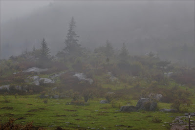 |
| Evergreen trees and large shrubs cover a hill of exposed rock. |
 |
| Looking down from the outcrop's 'summit', a distant trail junction can be seen. |
After returning to the trail, the Rhododendron Gap Trail crossed the Appalachian Trail for the last time. Unaware that I was on the wrong trail, I disregarded the junction and continued straight on in the wrong direction. The conditions changed rather dramatically after this; near the top of Wilburn Ridge, one of Mount Rogers' sub-peaks, the trail levelled out, and the tree/shrub ratio changed.
 |
| A stunted spruce tree standing out in the fog. |
 |
| The plants were less leafy and more colorful above 5000 feet, where spring was still in its early stages. |
After heading through a wooded section, the trail and surrounding area opened up with more green grass and red bushes. I wasn't planning on stopping here, but an odd noise prompted me to turn around. Behind me, standing in the small trees on the side of the trail, were four ponies, three adults and one foal. They didn't seem to care about me or even stare at me, just seeming rather bored. These trails see a lot of traffic, and I imagine the animals are very used to people. I took a few pictures and continued on my hike, having accomplished my secondary goal of seeing the wild ponies.
 |
| Three of the horses along the trail, including the foal. |
 |
| The fourth, hiding in the brush a little farther away. |
As I moved on past the ponies, the sun came out and somehow shone through the fog, casting shadows below the grey sky. The fog gradually began to clear; although it remained too dense to navigate by sight, it was at least brighter out and not as wet. I climbed along the open mountainside and soon came to a T-shaped intersection. This was my first indicator that I wasn't on the right trail; such an intersection wasn't expected until the top of the next ridge. I took out my phone - which somehow had service - and tried to figure out my next move.
 |
| Spring views went a little farther in the thinner fog up the mountain. |
 |
| A spruce tree stands out above the smaller, redder bushes. |
 |
| Whispers of spruce groves on the very edge of visibility. |
After a moment of deliberation, I decided to head left (west) at the unexpected junction. The summit of Mount Rogers was to the northwest, and it was possible that I had the elevation of the trail wrong. (I would later learn that this was the Crest Trail, which never comes closer than ~300 feet to the summit). However, I came across another sign that I was on the wrong trail: Cows. A cow and a bull, both with tags in their ears, were even more unexpected than the trail junction, and a nearby gate across the trail simply reinforced that. I was forced to the conclusion that I was, in fact, going in the wrong direction.
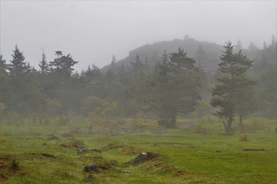 |
| Trees along the more heavily forested Crest Trail in the clearing fog. |
 |
| A domesticated cow was a surprise in a park known for wild ponies. |
 |
| Bulls can be dangerous so I took this picture quickly from a distance before moving on. |
Here I was faced with another decision: Do I backtrack a half-mile to the junction and reassess, or just bushwhack up towards the mountain? The Appalachian Trail runs across the ridgeline, so I knew that if I went up for long enough I'd find it, but the bushes were thick and soaking wet. In the spirit of adventure, however, I decided to push through and turned off the trail. There were a few little animal paths through the dense bushes, but for the most part it was rough going, pushing straight through with little regard for comfort, a much longer version of the short climb from earlier. The fog began to truly disappear at this point, but I was so focused on keeping my bearings and getting out of the thickets that I hardly noticed.
 |
| Fog disappearing above the dense trees. |
 |
| Low clouds over the nearby Cabin Ridge hide part of a beautiful view. |
Pretty soon I reached the top of the ridge and stumbled upon a little campsite. After weaving my way through a few more, I was back on the Appalachian Trail, where I was supposed to be. Up here there was pretty much straight spruce forest with intermittent clearings off the sides. The fog had lifted, although low overcast remained, and the going was much easier. Although thoroughly soaked by the bushwhack, I was confident that I would soon reach the summit, dry out, and return with few difficulties.
 |
| Spruces and close clouds along the Appalachian Trail. |
I arrived at another junction with a beautiful view of the mountains nearby. This sight was dismaying for multiple reasons: Firstly, I had a strong suspicion that this was the trail I had just been on, and if I had simply kept walking, I would have ended up here anyway (this turned out to be true). Secondly, when I tried to take a picture, my camera failed. It started throwing error codes, flipping the shutter non-stop, and generally acting like it was possessed. My hardy little camera had finally been beaten. After putting up with fog and rain and clouds for the past two miles, I was finally treated to a beautiful view, and my camera had turned into an $800 paperweight (neckweight?). I spent a good five or ten minutes trying to fix it, but gave up, took a few pictures with my phone, and moved on. Maybe it will work again when it dries out, I thought.
 |
| Looking up towards the summit from the upper junction. |
 |
| Although this area is well below the local treeline, it reminded me of high-elevation trails in the Adirondacks. |
Continuing to the next junction was pretty easy following the AT. I passed a few hikers and campers at the Thomas Knob lean-to, and beyond this was a lot of open country with fantastic views to the south and west. It was as though God were taunting me, finally giving beautiful scenery now that I couldn't take any pictures of it. God wouldn't do that, of course, but at this point I was mad at the mountain for breaking my camera. Emotion turned into energy which helped me climb faster, and soon I arrived at the junction with the Mount Rogers spur trail, only a short climb from the summit proper.
 |
| Clouds and distant sunlight over the expansive Helton Valley to the southwest. |
 |
| The summit plateau of Mount Rogers, where the open grasslands turn to dense spruce forest for the final hundred feet. |
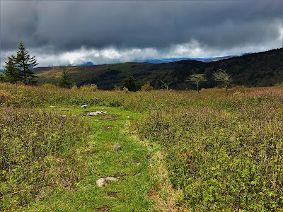 |
| Looking across Cabin Ridge in the western shadow. |
I headed up the Mount Rogers summit trail and made quick work of the final half-mile of the hike. This was all spruce trees, like high-altitude summits up north, although they were covered in dense moss, giving a Cascades-like feel to some areas. My anger at the mountain, the clear trail, and the more pleasant weather allowed me to reach the summit quickly.
 |
| Spruce trees and sunlight on the final summit stretch. |
.JPG) |
| The 'quarter' at the highest point, marking the roof of Virginia. |
I stopped at first at a large rock at the end of the trail, which had a USGS survey marker and some odd carvings in it. As I paused to eat lunch, however, I noticed an obviously taller rock a few yards away. Upon further investigation I discovered another survey marker in this rock, denoting the true highest point. It seemed odd that there were two markers so close; from what I can tell, the county line between Smyth and Grayson Counties runs along the summit of Mount Rogers; it could be that one marker is along the boundary, or that the boundary just misses the high point, making the slightly shorter rock the highest point in Smyth County, and the higher rock the highpoint of Grayson County. I wondered how many people have stopped at the first marker, missing the real summit and only reaching the second highest point in Virginia.
 |
| Selfie with the higher survey marker. |
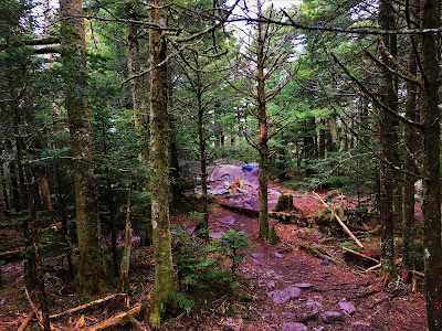 |
| The summit from the top, looking back towards the shorter rock. |
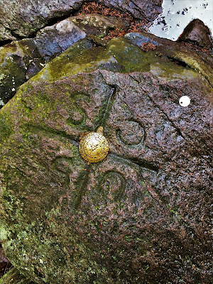 |
| The lower survey marker and cryptic carvings surrounding it. |
There were no overlooks or cairns at the summit, and I soon descended back down. Pretty much as soon as I emerged from the wooded summit area, the rain began. Not just windy fog and drizzle like before, but a torrential downpour. I threw on my jacket and soldiered on out into the open clearings, having already accepted the fact that everything I owned would be soaked by the end of the day. My only real concern was my phone; its badly broken screen made water a serious danger, and I still had fourteen hours of driving to do and needed to be able to contact family. I only occasionally took it out for pictures when I was in dry, dense woods or during brief periods of low intensity.
 |
| Spruce shrubs and grassland below the summit on descent. |
 |
| The Helton Valley again, now made hazy by rain. |
On my way down, I made a point of following the Appalachian Trail directly. This would prove to be far more difficult than I had expected; although the AT is clearly marked, Mount Rogers is totally criss-crossed by trails, and many junctions are poorly labelled. A similar problem with excessive (albeit unofficial) trails got me lost on Fir Mountain last summer, so I wanted to be very careful here. I climbed over a number of side-peaks, one of which was Pine Mountain, and another the true summit of Wilburn Ridge, but with the rain, fog, and confusing trails, I couldn't be sure which was which. I ran into a number of hikers here, and we joked about the rain in passing. It didn't seem to be letting up any time soon.
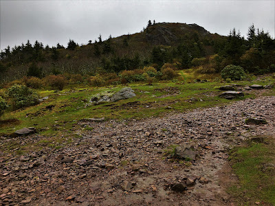 |
| Looking back at one of the sub-peaks, probably Wilburn Ridge. |
After descending the last major bald, I realized I was following the wrong trail, and backtracked to a junction nearby. I would end up returning to this junction several times as the Appalachian Trail seemed to have disappeared. This spot has over a dozen junctions within a few yards of each other, and it was incredibly frustrating trying to figure out exactly where I was supposed to go. Eventually I made it onto the right path and started descending the ridge via the AT. This runs parallel to the route I took up, but has different views and features, so still kept my interest in spite of the increasingly wet conditions.
 |
| Passing the same four ponies again. The foal is white on its left side (seen earlier) and brown on its right (seen here). |
 |
| Swamps, spruces, and fog-enveloped mountains reminded me of hiking in Maine as a child. |
The rest of the descent went fairly quickly, as I was soaked, behind schedule, terrified that my phone would die, and eager to get off the mountain. The rain calmed down a bit later in the day, although it never completely stopped. Hiking a different route down, though accidental, allowed me to see some new things, such as a deep rock crevasse just off the trail in a forested area below Wilburn Ridge. I used the bathroom frequently on descent, despite drinking nothing after the summit; I suspect the rain running down my face kept me over-hydrated for the last two hours.
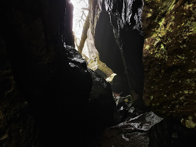 |
| Climbing through the rock crevasse, probably fifteen to twenty feet deep. |
 |
| Trail and signage in fog just before plunging off the ridge. |
 |
South Wilburn Ridge was on my optional itinerary for the day if I made good time. As I left the mountain three hours later than expected, I didn't climb it.
|
Returning to the car wasn't nearly as much of a relief as you might think. My camera was broken. My clothes were soaking wet, and everything dry was packed away. I had a fourteen-hour drive home that would have to be done mostly at night now. The hike was pyrrhic victory, but it was a victory nonetheless. Mount Rogers put up quite the fight, but I won. My phone had miraculously survived the rain and I had defeated the mountain to bag my sixteenth state high point. Only thirty-four to go.
The adventure didn't quite end there. I got lost trying to leave the mountain (no cell service to get directions back to the highway) and spent two hours driving through the gorgeous spring mountains of southwest Virginia on twisty - and sometimes dangerous - mountain roads. When I finally returned to the highway I was treated to five hours of constant rain and stop-and-go traffic. I didn't reach Pennsylvania until nightfall, got my credit card stolen (temporarily) by a sketchy gas station, and the only sleep I got all night was an hour at a rest area north of Scranton.
By sunrise I got off the highway in Oneonta and drove NY-23 all the way home. The May forests and fields and morning fog were a glorious return gift, welcoming me back to New York after four long months. I got back to the apartment just before seven, at which point it was too light out to sleep. It was Saturday, my twenty-fourth birthday, and I would have to survive a day of festivities on barely an hour's rest. Still, I was home, alive, and one highpoint richer than I was the day before.


.JPG)


No comments:
Post a Comment