Last week I headed down to Lexington NY to hike my thirty-first Catskill High Peak in my penultimate high-peaking hike. Located just outside of the eponymous town of Halcott, this mountain sits near Vly and Bearpen at the western end of the Catskills. With a summit elevation of 3520', Halcott is the second-shortest high peak after Rocky, and like Rocky it has no trails to the summit, requiring a bushwhack. I came prepared for a serious - if short - trailblazing trek up the peak's steep eastern slope from the trailhead on Route 42.
 |
| Rocks and cliffs above the 'trailhead', a parking lot along Route 42 with no actual trail. |
 |
| A view of Halcott Falls, a mid-sized waterfall just a few yards south of the trailhead. |
 |
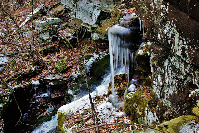
| Thick icicles hang from a smaller, frozen portion of the falls. |
 |
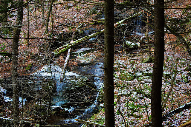
| The unnamed stream that hosts the Halcott Falls continues up the mountain; I followed it a short distance and found a series of smaller waterfalls farther upstream. |
 |
| Following advice from trail guides, I left the first stream and headed south, where I would encounter a second. The forest in between was incredibly beautiful, filled with odd piles of rocks and moss-covered boulders all over. |
After leaving the stream near the trailhead, I walked south, wandering through some beautiful swampy and rocky areas. Soon I arrived at the second stream, and I planned to follow this one all the way to the headwall below the summit. However, to my surprise I discovered a fairly well-beat and easy to follow herdpath, which stayed on the north side of the second stream and followed it uphill. Naturally I followed this, not sure how far it would go.
 |
| A shot of the second stream through hemlock trees on the way up. The trail wound through several hemlock groves, making for an incredible environment to hike through. |
 |
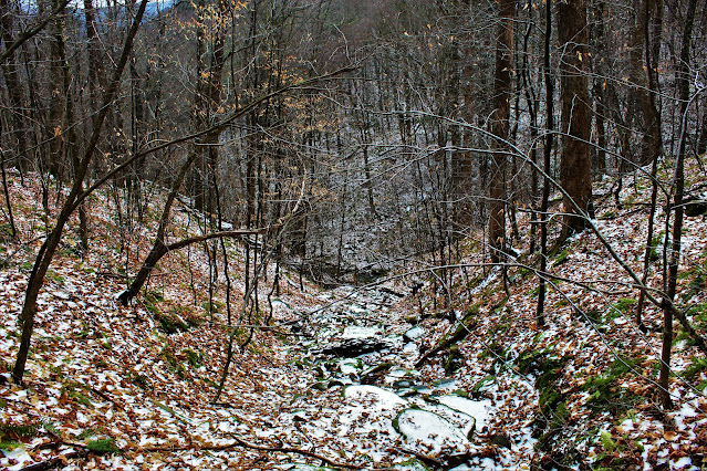
| The trail crossed several little streambeds, including this one just above the snow line, providing limited views of the surrounding hollow. |
 |
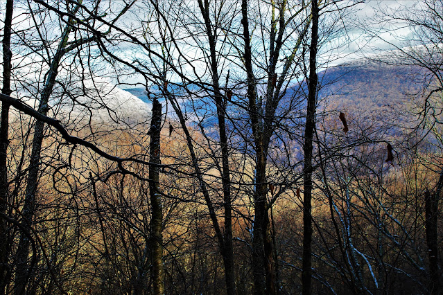
| At higher altitudes, bare trees provided limited views of Balsam Mountain and Deep Notch to the northeast. |
 |
| A closer view of the notch. Route 42, where the trailhead is, runs through the bottom of Deep Notch. The mountains surrounding it, Sleeping Lion at left and Balsam Mountain at right, are bright white, topped with rime ice. |
Pretty soon, I reached the headwall, and the stream ended fairly abruptly. Here, things started getting serious. The trail headed right up the side of the mountain, up some pretty steep slopes for the final half-mile or so of the ascent. This was right around the ice line, where the entire mountain - trees, rocks, dirt, etc - was covered in slippery ice and overlaid with loose snow. This part of the ascent was the most dangerous, but also the most beautiful.
 |
| The afternoon sun, obscured by clouds, shines through the white, ice-encrusted forest. |
 |
| The thick and opaque ice crystals that covered the trees reduced visibility almost as much as leaves do in the spring. |
 |
| A close view of a small branch, showing the intricate crystals of rime ice that coated the entire forest above three thousand feet. |
 |
| Trees on this steep slope of the mountain are fairly small; this large maple is an exception. Note the white-tipped forest and steep angle of the surrounding terrain. |
 |
| A view of a small rock formation just below the summit. Unlike most of the Catskill mountains, Halcott's steep upper slopes have a notable lack of large boulders, rock faces, and cliffs, making the ascent somewhat safer, if also a little more boring, than other peaks. |
Soon I arrived at the summit, a relatively wide, flat area populated by low trees. Owing to its comparatively low elevation, Halcott Mountain lacks the dense conifer forests that characterize the Catskill High Peaks. (Evergreens are also missing from nearby Bearpen and Vly; the western Catskills receive more moisture than the rest of the range, which may also be a factor). The summit doesn't sport much of a view; a rock near the summit canister hosts a limited view, but it was covered in ice.
 |
| A wide view of Halcott Mountain's summit, a small clearing surrounded by a vaguely short forest. |
 |
| A close-up of the summit register, covered in tiny ice crystals. The register informed me that a sizeable group had climbed the mountain that morning, explaining why the herdpath was so easy to follow. |
 |
| All Catskill summit canisters bear the mountain's name on the inside. Halcott's rather humorously includes a phonetic spelling; the mountain (and town) is pronounced 'Hawkitt', a pronunciation not known to out-of-towners. |
 |
| Dense ice covered this tree trunk, giving it an almost glowing appearance. |
 |
| The only view from Halcott's summit looks towards Big Indian Mountain, a much higher High Peak also covered in ice. |
 |
| Elaborate crystals coat these tiny branches of trees near the canister. |
I stopped at the summit for lunch, but the winter's cold kept me from lingering too long, and I was soon on my way. Despite the icy slickness of the mountaintop, I miraculously descended without any falls or slides. I decided to follow the herdpath all the way back to the trailhead, past where I had stumbled upon it on ascent, and it brought me along a row of cliffs parallel to Route 42 in the notch. This final stage solidified Halcott Mountain as one of the most beautiful hikes I've taken, despite the lack of appreciable views.
 |
| Frozen waterfalls lined these small cliffs near the base of the mountain. |


No comments:
Post a Comment