Lone and Rocky are two of the thirty-three Catskill High Peaks, located in western Ulster County in the southern Catskills. Unlike many of the region's peaks, these two mountains have no trails to their summits, and can only be climbed via 'bushwhacking', which is basically just wandering to the top of the mountains using a map and compass. In my quest to hike all the High Peaks, I headed off to the trailhead in Denning NY to do my first hike in the Catskills since
Rusk Mountain back in mid-June.
Every guide I read online said some version of the same sentence at some point: "Do not attempt this hike alone". Naturally, I ignored this advice. While hiking Lone Mountain is fairly straightforward, Rocky is notorious, considered the most difficult bushwhack in the Catskills on account of the extremely dense foliage at its fir-covered summit. For my first serious, long-distance bushwhack (over ten miles), I came prepared with maps, a compass, lots of water and electrolytes, and long sleeves and a machete to deal with Rocky Mountain.
The hike I took began at the Denning Road trailhead in Denning NY, and follows the Phonecia-East Branch trail at first. Once this trail crosses the Neversink River, I turned off to follow the river northeast along an unmarked herdpath known as the Fisherman's Path. This trail runs parallel to the river through impressive hemlock forests.
 |
| A view upstream along the Neversink from the last of three bridges along the blazed trail. |
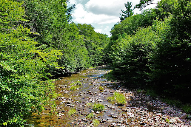 |
| A wider shot from the same spot. After crossing this bridge, I would head off the main trail. |
 |
| Afternoon light dances across lush green moss that grows beneath hemlocks on the banks of the Neversink. |
 |
| That same moss grows on some of the rocks in the crystal-clear river where the forest's shade keeps it cool. |
 |
| A downed hemlock along the Donovan Brook. This brook was the last landmark before I left the Fisherman's Path to bushwhack up Lone Mountain. |
After crossing the Donovan Brook, the Fisherman's Path links up with a fairly well-beat unmarked herdpath which heads up Lone Mountain. Impatient, I decided to leave the Fisherman's Path almost immediately after crossing the brook, sauntering into the woods with little idea as to where I was. I headed up a ridge along Lone Mountain's lower slopes and soon linked up with the herdpath. This path was very inconsistent, at times being hard to spot, at others hard to miss. In general, it became clearer the farther up the mountain I climbed, until soon enough I found myself at the summit.
 |
| Untrailed Catskill peaks have their summits marked by orange canisters, where aspiring 35ers can log their hikes. |
 |
| Another herdpath at the summit led to a nice overlook a few hundred feet east of the canister. The prominent hill to the center is Little Rocky, named for the nearby High Peak. |
 |
| Castle point, a jagged peak located in the Awosting Preserve about twenty miles to the southeast, is another notable feature of the view. |
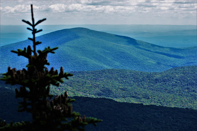 |
| Ashokan High Point, one of the more popular Catskill peaks, stands here behind a fir tree in the shadowy foreground. |
 |
| Twenty miles beyond Little Rock's limb are the jagged peaks of the Mohonk Ridge, home to developed (and expensive) hiking trails in the Mohonk Preserve. |
 |
| A tiny portion of the Hudson River is visible passing through the Hudson Highlands, over forty miles to the south. |
 |
| A wider shot of Castle Point and the forested hills of Ulster County before it. |
 |
| This August has seen unusually early color; traces of yellow, orange, and red were already abundant in the forests below. |
 |
| Leaves of a bush at the summit were already a beautifully dark red-green color. |
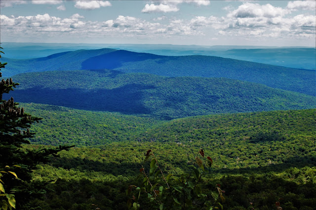 |
| A wide-angle shot from the overlook, with Little Rock left of center. |
 |
| Another wide shot facing slightly more east, including Ashokan High Point (L) and Little Rocky (R). |
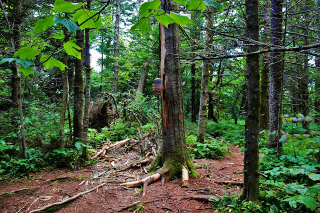 |
| The forest at the summit of Lone Mountain. The canister is pinned to a dead tree (it'll be hard to find when the tree falls), but the surrounding foliage is surprisingly tall and diverse for such a high elevation (~3720'). |
Now, the serious part began: The hike from Lone to Rocky. Although the span between the two summits is only about a mile and not exceptionally steep, the extraordinarily dense forest atop Rocky Mountain makes this section of the hike infamous, and I had been anticipating it for years. Not far from the top of Lone Mountain, the herdpath abruptly disappeared, and I was on my own for the remainder of the journey.
Soon afterwards the dense fir forest began, and it was just as difficult as I had been led to believe. Dead fir branches snapped off as I pushed through the thick brush, while live ones snapped back, thwacking me as I walked through. On several occasions I had to close my eyes to protect them; wearing goggles is often recommended for this hike. My long sleeve shirt protected my arms from being torn to shreds by the evergreen onslaught as I wandered vaguely upwards, never sure where exactly I was headed.
The forest's intensity decreased somewhat as I reached the summit plateau. From here I followed a series of openings, perhaps herdpaths, perhaps just natural formations, each one ending within sight of the next. Soon, one led to the mountain's summit. Oddly enough, I wasn't the only person on the summit; someone else's ski pole and pack were beneath the summit canister. I headed to a nearby overlook, and by the time I returned, they were gone; I never actually saw the other hiker.
 |
| A view of the orange canister at the summit of Rocky Mountain, a relief to see informing me that my upward trek was done. |
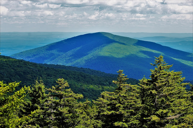 |
| Ashokan High Point dominates the southeast-facing view from Rocky Mountain's limited lookout. |
 |
| At the right is Mombaccus and Little Rocky Mountains; to the left is the Kanape Valley that separates them from Ashokan to the north. |
 |
| Directly east of Rocky Mountain is an unnamed subpeak of nearby Balsam Cap, covered as one might expect with balsam fir trees. |
 |
| A view straight to the south shows the impressive fir trees that surround Rocky's summit. At only 3494', Rocky is by far the shortest of the 35 Catskill High Peaks, and the trees at its top don't have the stunted characteristics of the higher mountains. |
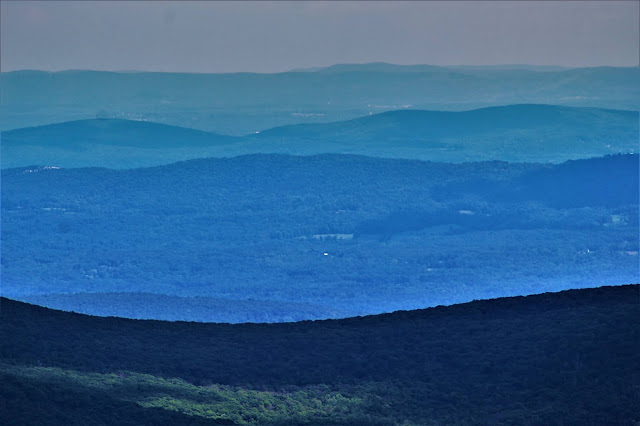 |
| A view southeast across the river into the hills of western Putnam County, some of them fifty miles away. |
 |
| A wider view from the overlook shows Ashokan High Point (L), Mombaccus and Little Rocky (R), and the tall firs surrounding the summit. |
 |
| A view of Rocky's summit. This is the summit 'clearing', as the forest here is orders of magnitude less dense than on the rest of Rocky Mountain. |
While a herdpath allegedly leads down from Rocky's summit, I couldn't find it, so again I decided to head out and trailblaze my way through the woods. Using a machete to cut through dead fir branches I worked my way down the steep northwest slope of the mountain. Soon the fir forest gave way to more deciduous forest farther down, which, while just as thick as the evergreens, wasn't nearly as pointy, and was therefore much less painful as leaves slapped me in the face.
This fascinating hour or so of off-trail exploring eventually led me to the far upper reaches of the Neversink River, so far up the mountains that it seemed crystal-clear. I felt like some explorer who had just stumbled upon an exotic paradise, still unseen and untouched by man - or at least until I found a deflated balloon stuck in some bushes. Still lacking a proper trail, I followed the Neversink downstream for the next few miles. This part of the hike was a lot of fun; I had ample supplies, several hours of sunlight, and no fear of getting lost; so long as I followed the river, I would get where I was going.
 |
| Moses cling to the edge of the colorful smooth rocks along the Neversink River. |
 |
| A series of mossy cliffs on the south bank of the river (R) rose to probably 15-20 feet in some places. |
 |
| A large brown mushroom. Many mushrooms covered the ground during this hike, especially around the river. |
The Fisherman's Path runs almost the full length of the Neversink River, but upstream from the Donovan Creek it's almost imperceptible. I spent the next hour or so of my hike playing "herdpath or creekbed" with the elusive trail, always keeping the river within earshot. Once I passed the Donovan it was easy going back to the trailhead, finishing up what was probably one of the most fun hikes I've done in a long time, and wrapping up my 23rd and 24th High Peaks.


No comments:
Post a Comment