One of my (admittedly optimistic) goals for this winter break is to finish climbing the thirty-three Catskill High Peaks, and I wasted no time getting started. I had climbed twenty-nine already, leaving over four left to go. The easiest and shortest of these remaining peaks was Vly Mountain, a 3529-foot peak in the town of Halcott. Vly Mountain is officially considered an 'untrailed' peak, but a heavily used and informally blazed herdpath leads straight from Route 3 to the summit, making it one of the easiest hikes in the range. Given the wintry conditions and my relatively recent return to the northeast, I figured it would make an excellent first hike.
The town of Halcott is a bit of a local geographical oddity. The sparsely populated town (258 people as of 2010) is located deep in the mountains, and the only road connecting it to the rest of Greene County is a decrepit 4x4 path designated County Route 3. This path isn't useable for most vehicles, so county highway trucks must travel into neighboring Delaware County to reach the town. I knew that my low-clearance sedan would be no match for Route 3, so I parked where the pavement ended and hiked up from there.
 |
| Mossy rocks line an unnamed creek that runs alongside the 'highway' in Johnson Hollow, painting a line of green through the grey-brown winter woods. |
 |
| An old, rusted sign is slowly being devoured by this tree along the road. |
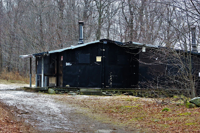 |
| This all-black hunter's cabin, located at the col between Vly Mountain and nearby Bearpen Mountain, marks the highest point on the road and the start of the trail up Vly. |
I turned right (east) at the high point of the road and began my ascent. I made good time at first; the herdpath was marked with bright blue spray paint, and footprints in the snow at higher elevation made it difficult to miss. As I climbed higher, the ground became covered not only in snow, but in a thick layer of slick ice, making for a few dangerous situations. However, while the path was constantly uphill, it was rarely very steep, and soon I arrived at the summit.
 |
| A dusting of snow covers the moss-enveloped boulders of Vly Mountain, seen through the thick underbrush just off the trail. |
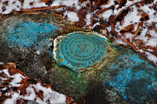 |
| In addition to the usual summit canister, Vly Mountain's summit is denoted by a USGS survey marker. Similar markers are found on North Dome and a handful of other high peaks, but are generally a rare sight in the Catskills. |
 |
| This boulder at the summit might provide an overlook in better conditions, but with the ice and snow I wasn't risking climbing on top of it. |
 |
| Rime ice coated the branches of the weather-stunted trees at the top of the mountain. |
I didn't stay long at the summit; the lack of views, combined with strong winds and cooler air, provided little incentive to sit around. I signed the register and soon headed back down the mountain. Descending mountains is often more difficult than ascending, and this is doubly true in the winter months, when snow and ice make for very slippery conditions. Combined with fatigue and general coldness, I was sure to take extra caution returning to the road.
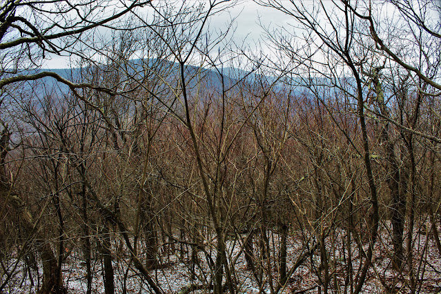 |
| Peaks in nearby Delaware County rise above the bare treetops in the closest thing you'll find to a view from Vly Mountain. |
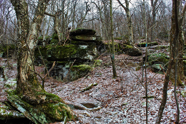 |
| Rock outcrops along the herdpath. The trip up the mountain consisted mostly of ordinary trails, broken frequently by rocky obstacles such as these. |
 |
| A view of the easy-to-follow trail beat through the snow, looking back up the way I came. |
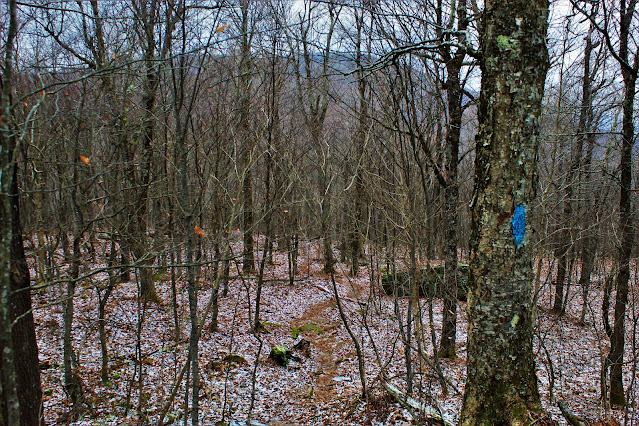 |
| Bearpen Mountain is vaguely visible through the trees above the cleared path. Informal blue blazes, such as the one at right, marked the trail the whole way up. |
 |
| Hiking Vly in the winter provides some semblance of a view, or at least a good perspective of the elevation, which green leaves would obscure at other times of year. |
 |
| Large, ice-covered outcrops are more difficult to descend than they are to climb; this one required a bit of forethought before moving forward. |
Once I returned to Route 3, I headed back down to the parking area pretty quickly. On the comparatively easy, clear terrain of the dirt road, below the ice and snow, I made good time on my way back, stopping only to take some photos of the surrounding area.
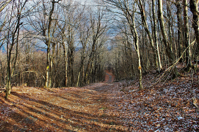 |
| The sun poked out from the clouds for just a moment to illuminate this shot down Route 3 north, heading down the north side of the mountain towards Lexington. CR-3 runs concurrent with snowmobile route S-70 north of the col. |
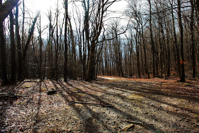 |
| A view of the col between Vly and Bearpen Mountains along County Route 3. This point, at 2805', is the highest-elevation toll-free public road in the entirety of New York. |
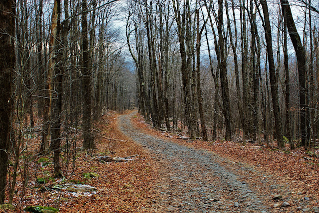 |
| Route 3 heading back down towards Halcott. This rocky trail is also probably the roughest 'highway' in the state. |
 |
| A number of side-trails on the east side of the highway, even more decrepit than the main road, are labelled 'A' through 'D', marked with red spray paint on trees. Land alongside the road to the south of the col is heavily posted and privately owned. |


No comments:
Post a Comment