Although I've lived most of my life here in upstate New York, I originally grew up in northern New Jersey. As such, the state's highest peak, appropriately named High Point, was quite familiar to me in my childhood. However, until this past week, I had never hiked to its summit. Following a route along the Appalachian Trail, I took advantage of cool clear weather on a windy Thursday morning to hike to the summit. At 1803 feet in elevation, the somewhat diminutive mountain is the sixth state high peak I've climbed in the past year.
 |
| The relatively level trail up the side of the mountain was littered with boulders made of conglomerate. |
 |
| This large boulder had split in half; while the trail goes around it, walking through it was more fun. |
 |
| Forests of the shrub-habit bear oak (Quercus ilicifolia) cover High Point, providing views of the summit's impressive monument from all along the trail. |
 |
| An elevated wooden observation deck just a short distance below the summit provides excellent views of the peak itself. |
 |
| Looking southeast, the hills and farmlands of northwestern New Jersey extend as far as the eye can see. |
 |
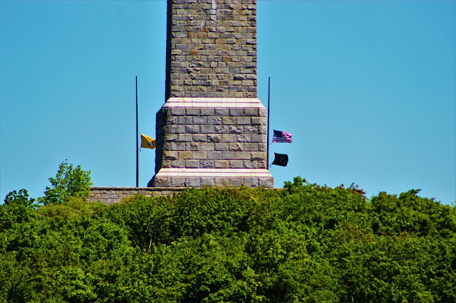
| A close-up of the monuments base, with national and state flags flying at half-mast in strong winds. |
 |
| Windows at the top of the distant tower (still closed due to COVID at the time of my hike). A metal staircase leads to the tower's top, where the windows provide a limited view of the surrounding countryside from over 2000 feet. |
 |
| Farmland surrounds Bearfort Mountain to the southeast. |
 |
| Despite its temperate climate and low elevation, High Point's very rock terrain means that many areas have only shrub-height trees, providing views of the summit on approach. |
 |
| A view of the High Point Monument from along the trail, just below the summit. |
 |
| Some bird of prey swooped past me as I arrived at the summit; by the time I got the camera ready, it was already some distance away. |
 |
| One of two plaques at the base of the High Point Monument describes its history. |
 |
| Rural farmland in Sussex County. Many people are surprised to find the extent of rural land that exists in the New Jersey Skylands; from the summit of the mountain, I couldn't see any built-up or suburban areas inside the state. |
 |
| Rolling hills and forests are occasionally cut by farmlands in this view south of the summit. |
 |
| The Kittatinny Mountains stretch southwest along the Delaware Water Gap, home to one of the largest expanses of forest in North Jersey. |
 |
| On the left side of this image you can see a cell tower near the trailhead and, just below it, the much nearer observation deck. Peaks of the Kittatinny Mountains stretch out beyond. |
 |
| This unnamed hill to the southwest stood out in a seemingly endless field of forest. Beyond it, sharper hills in nearby Pennsylvania continue, dulled by humidity. |
 |
| A forested cliff in Milford PA towers above farmland along the Delaware River, just under ten miles distant. |
 |
| A view of the heart of the tri-state area, with the cities of Matamoras PA (L) and Port Jervis NY (R) visible above Jersey forest in the foreground. |
 |
| Hotels along the Delaware, just south of Matamoras, boast a clear view of High Point from their upper floors, and presumably of the cliffs behind them as well. |
 |
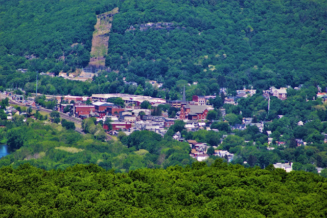
A nice picture of the city of Port Jervis NY. Port Jervis is one of the southernmost "upstate" cities, with an architecture and culture typical of small upstate population centers.
|
 |
| In October 2018 I climbed Table Mountain in the southern Catskills, and noticed that I could see High Point from its summit. This May I returned the gesture, viewing Table and Peekamoose (center) from High Point. |
 |
| Another shot of the distant Catskills, most notably Ashokan High Point (L) and Twin Mountain (R). The latter is located in Hunter NY, over sixty miles away. |
 |
| A north-facing shot from the summit, showing the more gentle hills of the Shawangunk Ridge heading into southern New York. |
 |
| The more distant hills of the Taconic Mountains, extending into Massachusetts and Connecticut, seem small due to their distance. Alander Mountain is the hill left of center, and Brace Mountain is near the right end. |
 |
| This USGS survey marker denotes the highest elevation in New Jersey, and is located just south of the base of the tower. |
 |
| A panorama taken from the observation deck, with an excellent view of the peak and tower. |
 |
| A panorama from the summit itself, seen from the base of the tower. |
 |
| A view looking up the tower, standing in its shadow. |


No comments:
Post a Comment