After recovering from my hike of the MacIntyre Range the previous week, I headed out on a whim to hike a few roads in the town of Windham. This 6.4 mile loop covered the entirety of High Peak and Cross Roads, along with bits of other roads, and briefly took me over the border into neighboring Durham. This was my first dedicated roadwalk in Windham, although I had previously done a number of hikes in the town.
I took this walk with minimal planning, and thus some things were very different about it. I didn't bring my preferred camera lens, and thus many of my pictures were plagued by poor focus and contrast. This was enhanced by poor weather conditions; high humidity and bright, overcast skies make for terrible photography. Nonetheless, it was an enjoyable walk, and I did get a number of interesting pictures from it.
Roads Walked: NY-23, High Peak Road, Old Road, Cross Road
 |
A lone truck drives down Route 23 beneath Elm Ridge.
|
 |
Destruction of this long-abandoned house was stopped halfway through, leaving half of a house along the highway.
|
 |
Cave Mountain rises above a turn in the road. The mountain's opposite slopes are home to the popular Ski Windham Resort.
|
 |
A swamp along the Silver Creek at the foot of Elm Ridge.
|
 |
Recent roadwork on Cross Road left still-living grasses covered in solidified tar.
|
 |
A view of the Elm Ridge parking area, the north trailhead for Windham High Peak and the Escarpment Trail. Although crowded on nice weekends, it sat fairly empty on a late Wednesday morning.
|
 |
Patches of tall buttercup flowers grew along both sides of Cross Road.
|
 |
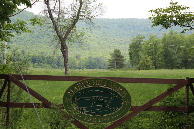
| Signage at the base of Mary's Hill Farm, located at the crossing of Old Road and Jennie Notch Road. |
 |
| Mount Zoar rises over hayfields at Mary's Hill Farm. |
 |
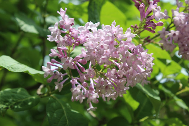
Although long dead in the valley, lilacs along Old Road were just starting to bloom.
|
 |
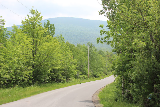
| Windham High Peak rises over High Peak Road, looking significantly less impressive than it does from the valley. |
 |
These pink wildflowers covered the roadsides on High Peak Road. Despite some research, I can't seem to figure out what they are.
|
 |
Bridge at the foot of Silver Lake along Camp Oh-Neh-Tah, a now-defunct Girl Scout camp.
|
 |
This old windmill stood along the Silver Creek, just down from the bridge and dam.
|
 |
A view of Mount Zoar from a rare clearing along High Peak Road. As Windham is mostly forested, mountain views and clearings are surprisingly rare.
|
 |
Descending High Peak Road towards Route 23 gives an impressive view of the Durham Valley. Severe humidity obscures much of the view in this image.
|
 |
Another shot of Zoar, heading west along Route 23.
|
 |
Hills and trees in the valley peer over the guardrail along a particularly dangerous section of Route 23.
|
 |
Signage at the town line. As Windham is located inside the Catskill Park, all of its street signs are brown instead of the traditional green.
|


No comments:
Post a Comment