Pensacola city highpoint, elevation 125'.
There's not a lot of opportunities for peakbagging in the Gulf Coast, owing mainly to the lack of peaks. While I'm in my long stretches at college in west Florida, however, I get bored of not climbing pretty quickly. Back in New York, I had been working on town highpointing for some time, a hobby that's not quite possible in the South due to the wide expanses of unincorporated land. Even counties are too flat to properly highpoint; Escambia County FL has 32 highpoint candidates, requiring a serious amount of dedication to complete.
However, by Thanksgiving break, I wanted to reach the highpoint of something, so I started scouring topographical maps to determine the highest point in the nearest city, Pensacola FL. USGS survey maps indicate that the highest ground is near the airport in the city's eastern portion. A low ridge to the south of Creighton Road, west of Eastgate Park, is the only area inside the city over the 120' contour line; the ridge's highpoint is just outside the city limits. ArcGIS data shows this spot at around 125' elevation somewhere to the east of Audubon Drive.
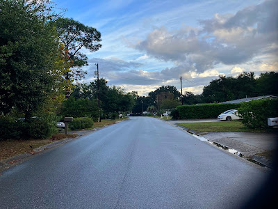
I headed out in between thunderstorms on an afternoon, partially to get supplies for a n upcoming Thanksgiving trip to Dallas. While I was in the area, I hopped over to the highpoint area, driving around for some time to determine the exact highest point. It was hard to tell given the flatness of the ground, but from what I could tell, a rise on the west end of Adrian Road seemed optically to be the highpoint, and I stopped here outside a house of many cats to take my summit pictures.
 |
| Looking east from the highpoint at the crest of the hill. |
 |
| Looking east towards the end of the road. The tree at right shows some fall colors uncommon for the area. |
After taking a few quick pictures, I hopped back into the car and headed back to campus to continue packing.

No comments:
Post a Comment