Northwest Willse Hill, elevation 1602'. Montgomery County highpoint, NY county highpoints 19/62. Solo ascent via Vickerson Road. 1.32 mi, 118' gain, 16m RT.With no weekends left in New York I figured my quest for county highpoints was pretty much over for the summer. However, on Sunday the rest of my family took off work so we could take a final drive before going back to school and I decided to consensually hijack the trip. As appointed navigator I was already planning to lead us vaguely northwest and if we so happened to pass near the Montgomery County highpoint in the process, then it would only make sense for me to hop out of the car and bag it.
 |
| View in the town of Stark from a road near Willse Hill. |
Vickerson Road is an ostensibly thru road that climbs from the Montgomery County side of Willse Hill to its higher end in Herkimer County, but realistically it's only traversable by farm equipment. We headed up from the Herkimer County side and made it just past the old farm cemetery before the car could go no further. Here I hopped out and jogged up the trail towards the county line.
 |
| Vickerson Road on its way up the hill. The 'road' is similar to some wide trails I've hiked and gave the walk-up highpoint a somewhat hiking feel. |
I arrived at the crest of the road which is right at the county line and found to my north what must be Northeast Willse Hill. The highest point is located at the top of a field and I had read in past trip reports that summer ascents were undesirable because it was difficult to travel through the corn. This year, however, the farmer had grown hay and it looked like it had been cut at some point in the past week. I hopped over a rusty metal gate (no posted signs though) and began sprinting for the highpoint, not wanting to leave my family waiting for long. |
| Looking up towards the highpoint. The county line splits the field even and the Montgomery County highpoint is near the right side. |
The top of the field has two maxmia, one to the west and one to the east. The west one is definitely higher but I wasn't sure where the county line fell so I tagged both just to be safe. (It would turn out upon further investigation that the west highpoint falls in Herkimer County so I'm glad I bagged both). There's a very newly-built shack right at the top of the field with solar power that made me a little nervous about being there but the land was unposted so I didn't worry too much. I took the requisite summit pictures and headed back down quickly. |
| Northwest Willse Hill, elevation 1602'. Note the brown shack in the background. |
 |
| The view looking south from the summit over the hayfield. |
I ran quickly back towards the car, not knowing how far I had gone or how long I had taken already. Vickerson Road is very rocky, which is uncommon in the low-lying Mohawk Valley, but was also very muddy at the time and I had to be careful running down. A few times I paused to appreciate the very boreal environment of the muddy, rocky, heavily forested trail. I had expected more of an open farm road and I was pleasantly surprised to find a much more enjoyable (and shaded) trail instead.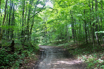 |
| Cresting a small rise in the road west of the highpoint. |
 |
| Dark forest of hickory and oak envelops the trail on descent. |
I made it back to the car with plenty of time to spare and on the verge of an asthma attack. I felt bad hijacking a family drive to tag a highpoint but everyone agreed that it was a cool way for them to see unusual and off-the-beaten-path places like the farm road and old cemetery. With that in mind we set off again and I started directing us farther west towards Oneida County. |
| Looking southwest from the spot above the cemetery where we stopped the car. |


No comments:
Post a Comment