Cairo NY Roads: 103/112 mi
Finally back in New York for the break, I headed out roadwalking in northeastern Cairo. I'm only a few walks away from finishing the town, something I hope to do over this break, and this early walk covered quite a few miles of remaining roadways. I parked at the Potuck Reservoir along the town's northern border with neighboring Coxsackie, then headed southwest in a loop around some hills backroads I had never driven before.
Roads walked: CR-28/Schoharie Turnpike, Deyo Road, Harold C Myer Road, Rudolph Weir Jr Road
 |
| Looking south on Webber Lake, one of several bodies of water that crosses this stretch of Route 28. |
 |
| Snow and trees on the north side of Webber Lake. |
 |
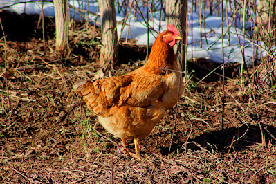
| I walked through a flock of chickens on my way, guarded by one extremely large turkey. This Rhode Island Red didn't seem to care about me or my camera. |
 |
| Ripples in the snow cover this low in a field off Deyo Road. Compare to the same spot back in July. |
 |
| An unnamed creek runs back and forth across Harold C Myer Road. |
 |
| Snow covers the stone walls that criss-cross the woods in the town's easternmost reaches. |
 |
| Harold C Myer Road ascends near the summit of Indian Ridge, providing views towards Potic Mountain to the east. |
 |
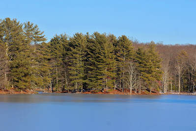
| Pine trees cover small islands and peninsulas in the north half of the Potuck Reservoir. |
 |
| A crater in the ice marks where some passerby had recently launched a rock into the frozen pond. |
 |
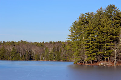
| Another view of the Coxsackie side of the reservoir. This reservoir provides water for the nearby town of Athens. |
 |
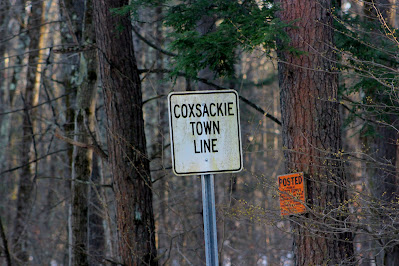
| An old sign marks the border between Coxsackie and Athens. As the Coxsackie-Cairo border runs along Route 28, this marks the point where all three towns meet. |
 |
| Afternoon glare brightens the south (Cairo) side of the reservoir. |
 |
| A view of the Schoharie Turnpike where it crosses the reservoir, with nearly road-level ice on both sides. |


No comments:
Post a Comment