Back in 2018, I began seriously pursuing my interest in hiking following a January solo ascent of Windham High Peak. I set a goal, which at the time seemed very distant, of climbing all of the Catskill High Peaks, the summits in the Catskill Mountains with elevations over 3500'. At the time, there were thirty-five such peaks; private landowners restricted access to Graham and Doubletop in 2021, lowering the number of climbable mountains to thirty-three. Over the next four years I hiked with a sense of purpose, learning from each hike and becoming a more experienced and healthier person as a result.
This Tuesday, I climber Friday Mountain and Balsam Cap, the final two high peaks, and completed my quest. A fitting finale to my long-held goal, these two are considered some of the most difficult climbs in the Catskills. Like many of the high peaks, they are bushwhack peaks, lacking formal trails. Intermittent, hard-to-follow herdpaths wrap around the mountains, but many die out and disappear, leading nowhere. To make matters worse, Friday Mountain's summit lies atop a series of incredible cliffs, buried in dense fir forest, making it perhaps the most inaccessible of all the high peaks.
Nonetheless, I headed out, armed with cold weather gear, supplies, and an overwhelming anticipation of bagging my final high peaks.
 |
| The parking area on Moon Haw Road is right along the Wittenberg Brook, which runs off the nearby Wittenberg Mountain, another high peak that I climbed back in August 2018. |
 |
| A view along Friday Ridge. The ascent up Friday Mountain first climbs a huge, steep ridgeline; while a switchback herdpath exists, I couldn't find it on ascent, and accidentally wandered onto private land, discovering a small cabin. |
 |
| Rock slides and outcrops along Friday Ridge. This was one of the first of a seemingly never-ending, ever-intensifying series of ledges and cliffs that put even North Dome to shame. |
 |
| Frozen waterfalls spring from a large rock above the ridge. Temperatures in the high teens had frozen the countless tiny springs that emerge from Friday Mountain, covering the cliffs with beautiful - and dangerous - sheets of white ice. |
 |
| The easiest ascent up Friday's walled summit is from the west; I made an attempt from the east but quickly became overwhelmed and turned back. This rock face is just one of countless that I attempted to scale or circumvent before finding an easier way. |
 |
| More thick, slick ice formations near the base of a rock wall. I eventually found a herdpath to Friday's summit, but much of the path was covered in dangerous ice deposits such as these. |
 |
| Pictures cannot do Friday's cliffs and rockfaces justice, especially with little sense of scale. I walked along the base of this rock wall to find a way around, its steep sides coated in ice and frozen moss. |
Friday Mountain is considered such an incredibly difficult climb that even the 3500 Club places their summit register hundreds of feet from the true summit, which is buried in deep, dense balsam fir forest rivalling the notorious Rocky Mountain. As the 'summit' canister is at the mountain's far east side, I attempted an ascent from the east that quickly turned disastrous. Reluctantly I returned downwards and soon discovered an informal path known as the Rim Trail that connects Friday and Balsam Cap. From here, a fairly well-worn herdpath to Friday's summit was easy to find. An overlook exists several hundred feet below the mountaintop with excellent views to the east and south, atop one of the many rockfaces.
 |
| Ticetonyk Mountain rises to the north (left) of the Ashokan Reservoir to the east. |
 |
| A view south along the Bushwhack Range shows my final target, Balsam Cap (R), along with the notable Ashokan High Point (L) in the background. |
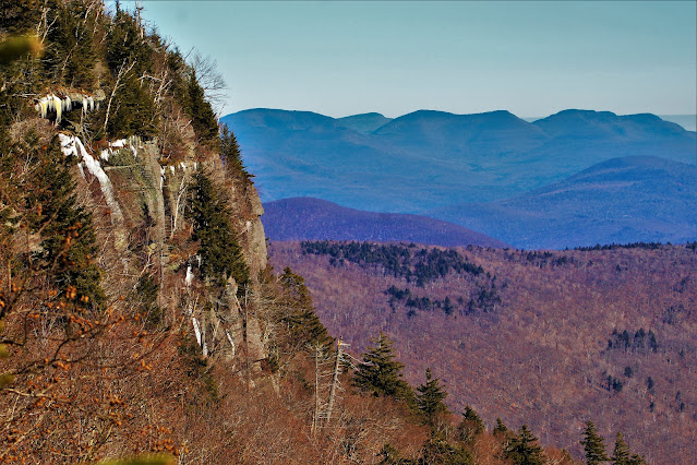 |
| Hundred-foot cliffs on Friday cut into this view of the Devil's Path Range. From left to right: Sugarloaf, Kaaterskill, Twin, Indian Head. The balsam trees on the cliff are easily thirty to forty feet tall. |
 |
| Another view of Ticetonyk, a rather prominent mountain from this vantage point. The highest hill in the background is Alander Mountain, forty-five miles to the east in the southern Taconics. |
 |
| The Ashokan Reservoir dominates the southeast view from Friday Mountain. Located on the Esopus Creek, this 120 billion gallon lake is one of New York City's primary water sources. |
 |
| A view south to Ashokan High Point, a popular hiking spot in southern Olive whose 3082' summit has one of the Catskill's highest prominences outside of the high peaks. |
 |
| Grey sunlit forests cover the layers of ridges in the valley below, the closest leading towards Balsam Cap's summit. |
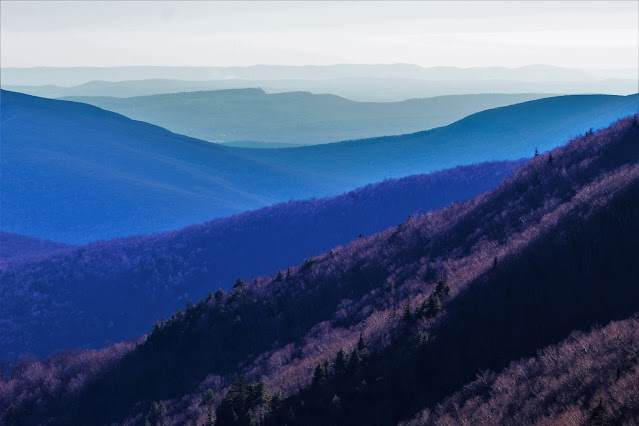 |
| Sky Top, an irregular formation in the Mohonk Preserve to the south, is an easy-to-spot landmark visible from most peaks in the southern Catskills, seen here through the col west of Ashokan. |
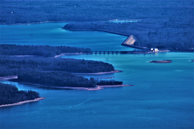 |
| A close-up of the control system and bridge along the Ashokan Reservoir. A complex series of tunnels and pipes transports the mountain water almost a hundred miles south to the city, giving many New York foods their distinctive tastes. |
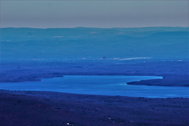 |
| A closer shot at the east end of the reservoir. Hills in northwestern Connecticut rise above the Hudson Valley and the Kingston-Rhinecliff Bridge (right of center). |
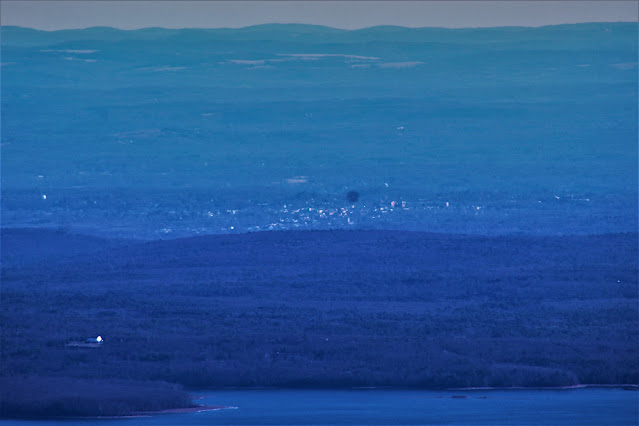 |
| The city of Kingston looks tiny despite its distance of a mere ten miles. Essayist John Burroughs once wrote of the southern Catskills, "Here the works of man dwindle". |
 |
| A view northeast shows Plattekill (L) and Overlook (center) Mountains, the southern end of the Catskill Escarpment, with peaks of the upper Taconics visible beyond. |
Friday Mountain is one of the only bushwhack peaks to host a view, and has by far the most incredible view of any of them. I soon headed up towards the summit, somewhat worried about finding the canister, since it isn't located at the highest elevation. However, the herdpath leads directly to it, and the spot also hosts a very limited view. The path continues inwards towards the true summit through the thick forest, but fizzles out very quickly.
 |
| An incredibly blurry picture of the canister and dark, dense forest beyond. Cold temperatures and high winds made seeing very difficult at times. |
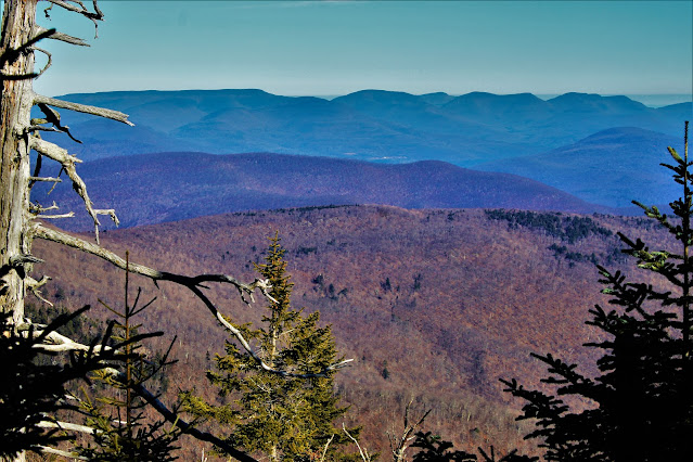 |
| A view from near the summit canister includes the Devil's Path Range, with the addition of Plateau Mountain at left, with its distinctively long summit plateau. |
 |
| A shot of Twin (L) and Indian Head (center) mountains to the north with a cloud deck behind them. |
Descending from Friday Mountain was dangerous at times due to the steepness of the trail and the icy conditions along much of it. Once I was back on the Rim Trail, the hike up to nearby Balsam Cap was very easy and much quicker than I had expected. The trail was pretty easy to follow most of the time; in a few spots it split apart in different directions, but always seemed to link back up with itself. Soon I reached the summit of the thirty-third and final Catskill High Peak as the bright orange summit canister came into view.
 |
| The canister at the summit of the aptly named Balsam Cap, ironically fastened to a paper birch, one of the only non-fir trees in sight. This marked the end of a four-year-long journey to the top of all thirty-three high peaks. |
 |
| After a bit of searching I found a very limited overlook north of the summit with a view of Cornell (L) and Wittenberg (R) mountains, two peaks of the Burroughs Range. |
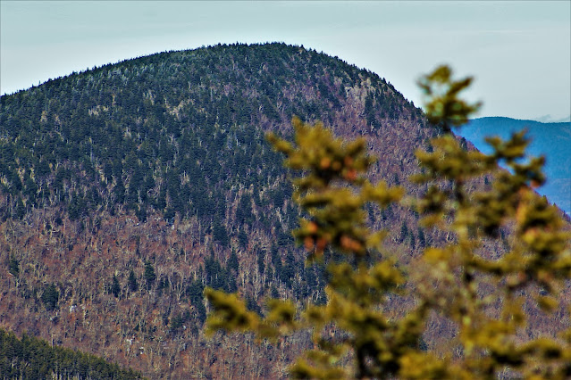 |
| A close view of Wittenberg's sharply rounded summit. Note some prominent cliffs on its east (right) side. |
 |
| From this angle, Cornell seemed similarly shapes, its summit covered in denser fir forests than its easterly neighbor. |
It has long been my opinion that reaching a peak's summit does not constitute having 'conquered' the mountain until the hiker is safely off the trail. The descent from Balsam Cap went relatively quickly, as now that I was on a herdpath, it was fairly easy to follow all the way down. I lost the trail a few times crossing some rockslides; hikers tend to walk on the boulders rather than the ground, leaving no visible path, but I picked it up again and soon had returned to my car, with no more high peaks left unclimbed.
So what now? For four years, one of my main hiking goals was to finish the Catskill High Peaks, and now it's finished. However, the world has no shortage of mountains to climb, and while climbing all of them is impossible, I intend to give it the best try I can. Membership in the 3500 Club, a mountaineering group dedicated to hiking the Catskill High Peaks, requires members to climb four peaks again in the winter months, which is my immediate short-term goal for the rest of January. Beyond that are the Adirondack High Points, state high points, county high points, and a wide array of mountains and goals that I look forward to hiking and completing in the years to come.


No comments:
Post a Comment