Spruce Knob was the third and final mountain stop in my Trip of Three Highpoints, following Davis and Hoye-Crest
the previous day. As the highest point in the state of West Virginia, a state famous for its mountains, I had some pretty high expectations for the peak. I originally planned to hike the eleven-mile Huckleberry Trail to the summit, but a very late start and rainy weather led me to "cheat". Rather than hike to the summit, I drove up, walking the half-mile Whispering Spruce Trail, a much easier, shorter, and less satisfying way to the summit. While I still "count" the peak for highpointing purposes, I would like to return in the future and hike it properly.
I had gotten a hotel for the night in the nearby city of Elkins WV. The drive from Elkins to Spruce Knob runs through some very rural parts of West Virginia, with houses becoming less common once I entered Monongahela National Forest. On my way to the peak, I stopped at a junction of two major roads, where open fields provided a spectacular view of the Seneca Rocks, an otherworldly geological formation near the mountain.
 |
| The southern portion of Seneca Rocks, seen past a power line. The formation is extremely thin, like a knife's edge; the southern peak is accessible only via technically challenging rock climbing. |
 |
| The more substantial northern portion, its blade void of trees. The whole formation is made out of quartzite, a very hard sedimentary mineral. |
Not far from this formation, I turned off onto the long, twisty access road that heads up the side of Spruce Knob. There was intermittent fog along the incredibly narrow road, and the occasional car coming down made for some close passes. Soon I reached the summit and started down the Whispering Spruce trail, armed with my camera and a lingering sense of shame for not doing the full hike. The trail led first to a stone observation tower at the state's highest point.
 |
| Blooming milk thistle (Silybum marianum) along the trail, one of the plethora of wildflowers in bloom on the summit. |
 |
| High trees and low clouds made for a very limited view from the top of the tower. |
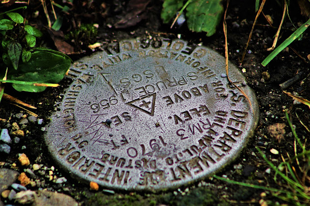 |
| The USGS survey marker denoting the highest point, embedded in the ground at the base of the tower. |
I didn't linger long at the tower, mostly due to the lackluster views, and headed back along the trail. The path winds along the edge of the mountain's summit, with a number of overlooks in various directions. The first one I stopped at faces east, over the Germany Valley and into the cloud-enveloped mountains on its far side.
 |
| The clouds passing between me and the mountains provided one of the most incredible views I have ever seen so far. |
 |
| Trees and clearings seem to fight for dominance on this small, unnamed knob just below the summit. |
 |
| Heavy clouds made for unfortunately poor lighting conditions, made more obvious in this zoomed-in shot of a distant farm. |
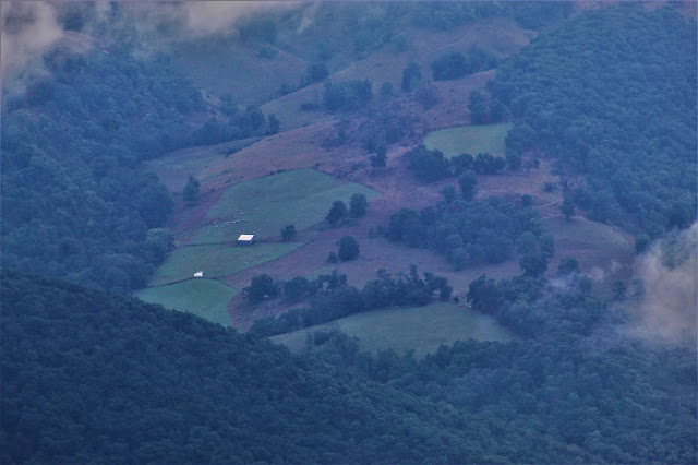 |
| Grazeland and pasture cover the steep, rocky slopes of the mountains in an area unsuitable for farming much else. |
 |
| More open fields. Much of the mountain range to the east, around Pike Knob, was covered in such farms. |
 |
| I've always found aerial, distant rural views to be particularly captivating, perhaps due to their simplicity. |
 |
| Backcountry dirt roads connect these distant farms, evoking memories of the previous day's tripoint mishap. |
 |
| A phenomenal view of low morning clouds passing through the narrow mountain valleys. |
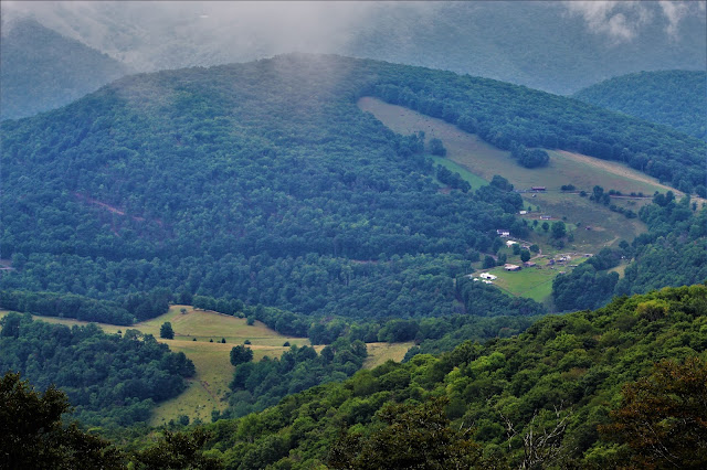 |
| Farms and buildings colonize the edge of another forested dome. Most of the peaks in this area are unnamed, very different from the heavily mapped mountains of New York. |
 |
| Clouds and mountains get equal share of this shot, with many of the mountains covered in still-unbroken forest. |
 |
| Many of the fields seemed totally disconnected to any adjacent civilization; perhaps hidden trails run through the forest, or maybe they're the results of logging or fire. |
 |
| Some of the nearer landscape seemed greener than its more distant counterparts, made a dull grey-blue by the clouds and haze. |
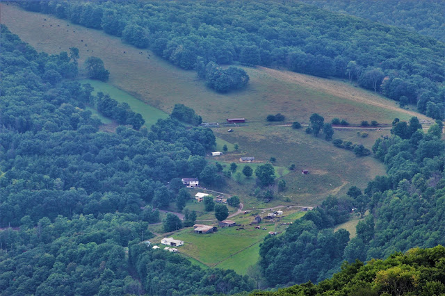 |
| A collection of houses and buildings, probably the most concentrated settlement visible from this overlook, at the edge of an expansive field. |
Farther along the trail was another overlook, this one spanning out to the south. Signs along the trail outlined many points of interest allegedly visible from this overlook, but clouds made most of them impossible to see on this morning. There was a bit of a rock field below this overlook, so I walked around it a bit trying to get the best shots of what few landscapes I could see.
 |
| Although mid-August is still summer in West Virginia, the color difference between the spruce trees and deciduous forests foreshadowed the approach of fall. |
 |
| One low cloud seemed to reach down to touch the top of a distant radio mast in the middle of otherwise unscarred wilderness. |
 |
| Probably the most expansive view of the day, looking southeast over the forested mountains and hills for which West Virginia is most famous. |
 |
| Another shot of equal clouds and mountains. Low lighting again belies the narrow field of view of this shot. |
 |
| Far in the distance, fields emerged from beyond the cloudy veil. Rather than detracting from the beauty of the mountains, I find them to add to it by outlining the intricate shapes of the mountainside. |
 |
| A closer view of the little rural community from earlier, showing more of the detritus scattered around from generations of working the land. |
 |
| A single spruce tree stands out against the front of a less steep area along the same mountain range in the distance. |
 |
| Far out among the greenery and hills, I spotted an observatory, taking advantage of the state's most elevated region. |
 |
| A single beam of mostly-unobscured sunlight lit up a goldenrod-filled meadow in the valley below for just a few moments before I left the last overlook. |
 |
| A view of the moss-covered spruce forest that covered the entire summit. I couldn't find my wide-angle lens so getting pictures of the surrounding environment was difficult. |
I was running low on time, so I had planned for Spruce Knob to be my one and only stop for the day before beginning the long drive home. However, early on my return trip, I came across a scenic overlook along US-48, near the town of Bismarck WV at just under 3000'. I pulled off the highway and stopped to photograph the view, which was fairly expansive, as its elevation was lower than that of the lingering clouds.
 |
| Power lines cut across a nearby hill while the mountains of the Greenland Gap rise in the background. |
 |
| A rockface at a quarry just below the overlook. Mining and quarrying are the predominant industries in this area. |
 |
| The hills here are criss-crossed with power lines, making for clearings very different from those visible from Spruce Knob. |
 |
| I found this one shot to be incredible, with layers of mountains behind the nearer cleared-out hillside. |
 |
| A closer shot helps put things in perspective; a human being on the nearest hill would be barely visible at this level. |
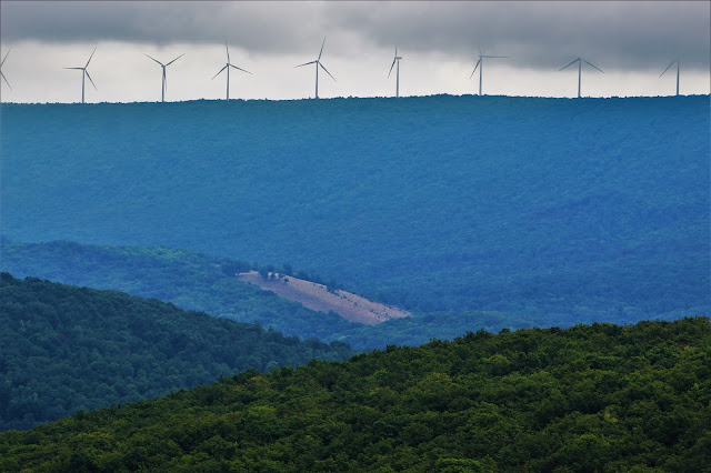 |
| Despite the region's lingering reliance on coal power, massive numbers of windmills seem to line every ridge and hill in the surrounding area. |
 |
| In the distance, turbines catch the sun's light while simultaneously disappearing into the clouds. |
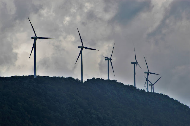 |
| Allegheny Front, the hill behind the overlook, is also lined with wind plants, providing a relatively close view of the otherworldly structures. |
 |
| A view of one turbine, peeking over nearer trees on the hill. A speck of blue peers through the cloudy backdrop. |
 |
| As the wind was blowing, I couldn't take many close-up shots without them coming out blurry. For another sense of scale, probably a dozen people could easily fit on the rectangle holding the turbine itself. |


Amazing shots!
ReplyDelete