As summer neared its close, I embarked upon a two-day trip to visit, among other places, three state high points in the central-eastern US. After parking issues prevented a planned hike up Katahdin and inclement weather kept me from hiking in the Adirondacks or Catskills, I decided to use my week off to do some sightseeing that wasn't so weather-dependent as hiking. My first day planned trips to the Mount Davis, the highest point in Pennsylvania, and Hoye-Crest, the highest point in Maryland. Of course, I needed more than a few short hikes to justify a two-day trip, so I targeted a number of different points of interest along the way.
It was a roughly seven-hour drive before reaching my first few stops in southwestern Pennsylvania, and the drive was intermittently nice. I left before dawn in torrential rain, which continued for roughly the first hour of my drive. Once I hit PA, the rain stopped completely and the clouds started to break up, making for a sunny trip. The highway I drove went through a series of tunnels that cut through some mountains. Once I neared my first stops, the clouds returned and intermittent rain resumed.
My first stop was the Flight 93 National Memorial in Shanksville PA. This stop ended up being far more powerful and time-consuming than I had expected. I had planned to spend around half an hour here, but ended up spending closer to two hours. The museum portion especially (where photography isn't allowed) was incredibly moving. I was very young when 9/11 happened, and remember very little about it, so I was a bit surprised by how strongly the memorial affected me. I think this stop was something that I needed to do, and something that nobody should pass up the chance to see.
 |
| A view from below of the Tower of Voices, a 93-foot tower containing forty uniquely-tuned chimes to memorialize the forty passengers of Flight 93. |
 |
| A wide shot of the tower. The forty chimes are wind-powered, and unfortunately calm wind meant that I wasn't able to hear them chime. |
 |
| The memorial's flag flies in front of approaching storm clouds. |
 |
| The walkway into the main memorial has steps laid out in a sort of walking timeline of the attacks, an immediately sobering welcome to the site. |
 |
| An overlook by the visitor's center shows the whole area of the field, apparently an abandoned mine. The actual crash site is towards the right, while a parking lot and building is at the left. |
 |
| A view of the overlook and poignant visitor's center structure from the trail that leads to the crash site below. |
 |
| The "wall of names", the main portion of the memorial which contains the names of all forty victims of the attack. Notable third from the left is that of Todd Beamer, credited with starting the heroic attempt to fight the hijackers, ultimately diverting the plane from its intended target and saving countless lives. |
 |
| The granite rock in the distance marks the crash site and the final resting place of the plane's passengers. |
 |
| A shelf built into the memorial's black stone walls hosts mementos left by visitors and family members of the victims. |
 |
| A view across a bridge which spans a wetland on the property that serves as a symbol of regrowth. |
The Flight 93 memorial really caught me off-guard as to how moving and sobering it was. Perhaps not the most cheerful way to start a trip, but definitely something incredibly important and powerful.
From here, my next target was to climb Mount Davis, the highest point in Pennsylvania. Although Pennsylvania is riddled with mineral-rich mountain ridge, its high point sits in the middle of a relatively flat plateau near the southern border with Maryland. A well-used but poorly-maintained footpath, less than a mile in length, leads from the parking lot on Mount Davis Road to the high point and summit observation deck. The drive to the parking spot goes through some very rural parts of PA, including several roads inhabited entirely by the Amish, with no power lines and lots of horse-and-buggy traffic. It was raining out when I arrived, and light rain would continue for the duration of my hike.
 |
| Two little purple mushrooms, possibly Cortinarius violaceus, sprout from under a tree root extending across the trail. |
 |
| The high point itself is surrounded by several plaques describing the history of the area, many including racially insensitive language (such as the "redman" used here). Disclaimer plaques assure the public that the issue is being addressed. |
 |
| Unlike ever other state high point I've been to, the USGS survey marker for Mount Davis is located not in the surface rocks, but atop a large boulder maybe five feet off the actual ground. Its precarious position atop the triangular boulder has led to its rapid decay over the years. |
 |
| A view looking southwest from the observation tower at Pennsylvania's highest point, 3213 feet in elevation. |
 |
| A more directly west-facing shot, showing the forests and intermittent fields of the surrounding areas. Views in other directions were obscured by clouds. |
 |
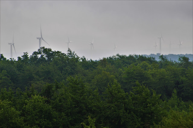
| A wind farm to the south runs along the summit plateau of Mount Davis. |
 |
| One massive Norway spruce (Picea alba) towers over the surrounding forest, a second, smaller specimen growing beside it. |
 |
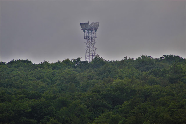
| Fog and clouds form a monotonous backdrop to this communications tower, located across the street from the trailhead. |
 |
| A closer view of fields and a farm west of Salisbury, darkened due to dense cloud cover. |
 |
| In spite of the heavily agricultural economy in much of rural PA, the area around Mount Davis is dominated by forests, with fields and farms the exception. |
 |
| Ripening red berries of a poison sumac bush (Toxicodendron vernix), seen from above while descending the observation tower. |
 |
| One leaf of the black gum tree (Nyssa sylvatica), bursting with early autumn colors, sits upon the sandy soil along the trail. |
My initial goal after visiting Mount Davis was to head to the tripoint where Pennsylvania, Maryland, and West Virginia meet, which would lead to the most interesting event of the trip. I've visited several other tripoints this summer, including the DE-MD-PA and CT-MA-RI spots, and some research indicated that there was a marker at the MD-PA-WV point. According to online directions, the monument would be located down Virginia Lane, a dirt road which straddles the border between Pennsylvania and Maryland. I had planned to drive in from the Maryland side, but got turned around, and ended up finding the road's signed other end in West Virginia.
As it turns out, Virginia Lane is not actually a public road, but a driveway, and the man who lives there was very upset that I was trying to drive down it. He blocked the road with his vehicle and told me on no uncertain terms to leave. I apologized and asked if he knew where the tripoint was, but he just adamantly repeated that I needed to get off his road, which I did. After this experience (on my first time visiting WV at that), I decided to abort the tripoint and head on to my next stop.
My next stop was Swallow Falls, a state park in western Maryland consisting of several small waterfalls. While the waterfalls were what pulled me in, the best part of this park was hiking through Youghiogheny Grove, the last remaining stand of old-growth hemlock forest in Maryland. As eastern hemlocks (Tsuga canadensis) grow very slowly, some of the trees in this park are likely over three hundred years old. Hemlocks are by far my favorite tree, and seeing such large and healthy specimens was fascinating.
 |
| Ferns and mosses coat the ground in Youghiogheny Grove. Hemlock forests cast canopies so dark that few plants can grow on the forest floor; when a tree dies, the area immediately becomes overgrown with eager colonizing plants. |
 |
| Tolliver Falls, a small two-step waterfall along the Tolliver Run. |
 |
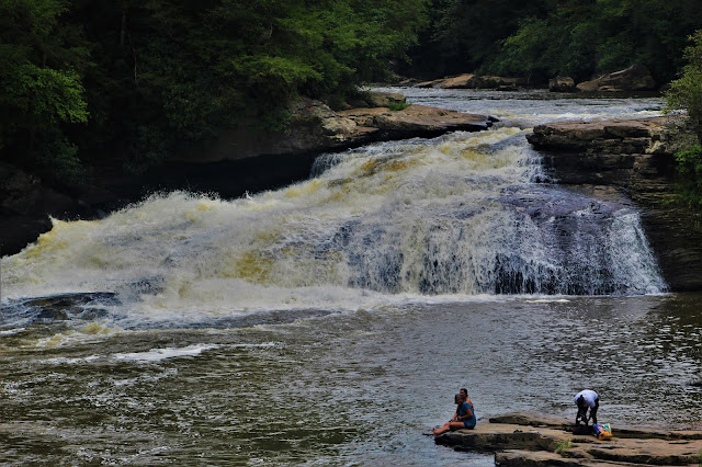
| Despite its small height, Upper Swallow Falls is rather impressive due to its wide, delta-like shape and powerful flow. Rainy weather made for high waters on this visit, which is always a plus for waterfalls. |
 |
| A side view of Lower Swallow Falls. The actual falls are more impressive than this picture would suggest; they drop probably ten feet at least. |
I was significantly behind schedule at this point, both from the Flight 93 memorial and getting lost around the tripoint. Still, I had one final stop to make on my first day: Hoye-Crest. Although Hoye-Crest (formally called Backbone Mountain) is the highest point in Maryland, the trail to the summit goes entirely through West Virginia, a relatively short and incredibly steep path from US-219 to the highest point. It was foggy and getting dark from the evening, so I made sure to make this stop quick.
 |
| Wind turbines line the ridgeline of Backbone Mountain, seen here from a clearing along the trail, their tips reaching into the low clouds. |
 |
| A view looking west over some clear-cut forest into the hills of Preston County WV. |
 |
| As far as I can tell, this prominent hill below the trail is unnamed. The open clear-cut forest through which the path ran was very remote, and I couldn't shake the feeling that I was somewhere I wasn't supposed to be. |
 |
| Sign at the summit of the mountain, briefly detailing its importance and history. |
 |
| A view east into Maryland from the summit, at an elevation of 3360 feet. The forests here are incredibly remote for such a relatively small state. |
 |
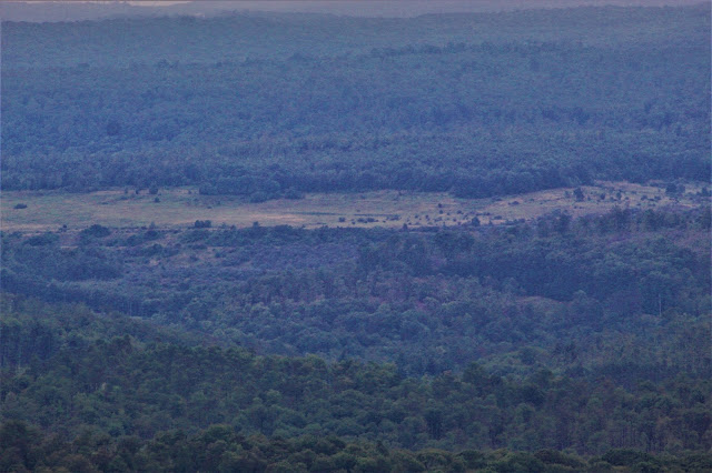
| A close-up of a distant clearing. Due to its terrain and inaccessibility, this strip of unforested land is most likely an abandoned mine or quarry. |
 |
| Early autumn colors fill a clearing beneath power lines in the valley below. |
 |
| I often photograph survey markers at highpoints, having done so for NY, NJ, RI, NH, DE, and PA (missing MA, VT, and CT). For Hoye-Crest, I'm fairly certain the actual survey marker is located beneath the enormous pile of rocks that marks the highest point. |
 |
| These red trail markers, installed by the Highpointers Foundation, assured me that I was on the right trail while I hiked through the clear-cut area. |
 |
| Another view west into West Virginia, from above the clear-cut area. Descending clouds had obscured the more distant hills by the time I descended. |
 |
| Farm buildings sit scattered across rolling green fields, broken intermittently by rogue stretches of forest. |
 |
| Looking directly east, folded layers of hills hide farms in the valleys below, while fog obscures those on the hillsides. |
 |
| A close view of a distant farm, made grainy by the low light and heavy fog. |
The heavy clouds made for an early dusk, during which I drove through many remote rural towns deep in the coal country of West Virginia before arriving at my hotel. The first leg of my trip, and by far the most eventful, was done.


No comments:
Post a Comment