The first day of May was the first day all year it was warm enough to sweat, so naturally I took to the streets for some exercise. For this walk, I followed a 6-mile loop of several roads, including Route 32, in north Greenville and south Westerlo NY. Part of this brought me through Greenville's town center and its commercial district to the north. I had walked the Newry Lane portion of this circuit in July 2019, but lost the pictures I took due to a corrupted memory card. This also marked the first time I'd ever walked in the town of Westerlo, although I only did about a mile over the town line.
Roads Walked: NY-32, Irving Rd, Newry Ln, CR-38, CR-405
 |
| The parking lot at the Greenville strip boasts spectacular views of the Blackhead Range to the south. |
 |
| Windham High Peak towers over a store in north Greenville. |
 |
| Historical marker at the site of Greenville's first school, which is now long demolished. |
 |
| Windham dominates the view along Route 23 approaching downtown Greenville from the north. |
 |
| Blackhead peers through green-tipped trees in this view from Irving Road. |
 |
| Early flowers prepare to bloom on a young tree. |
 |
| Recent downpours had swollen the roadside drainage ditches to the size of small rivers. |
 |
| A bee collects pollen from a lone dandelion, growing through a crack in the pavement. |
 |
| Two signs at the end of Newry Lane. |
 |
| Having crossed into Westerlo, I looked back over the county line into the much more familiar Greenville. |
 |
| Windham rises over a field along Route 405, bound by two leafless trees. |
 |
| Pentagon sheds are a common sight in the hill towns of Albany County, but this is the flattest one I've yet seen. |
 |
| A lone truck speeds east along Route 405. |
 |
| Stoppel Point peeks through a divot in the forested terrain. |
 |
| Even from a county away, Windham High Peak dominates the skylines in South Westerlo. |
 |
| This flashing red signal is the closest to a proper stoplight you'll find in Westerlo. |
 |
| A solar farm at the junction of NY-32 and CR-405 hosts incredible views of the Blackhead Range. |
 |
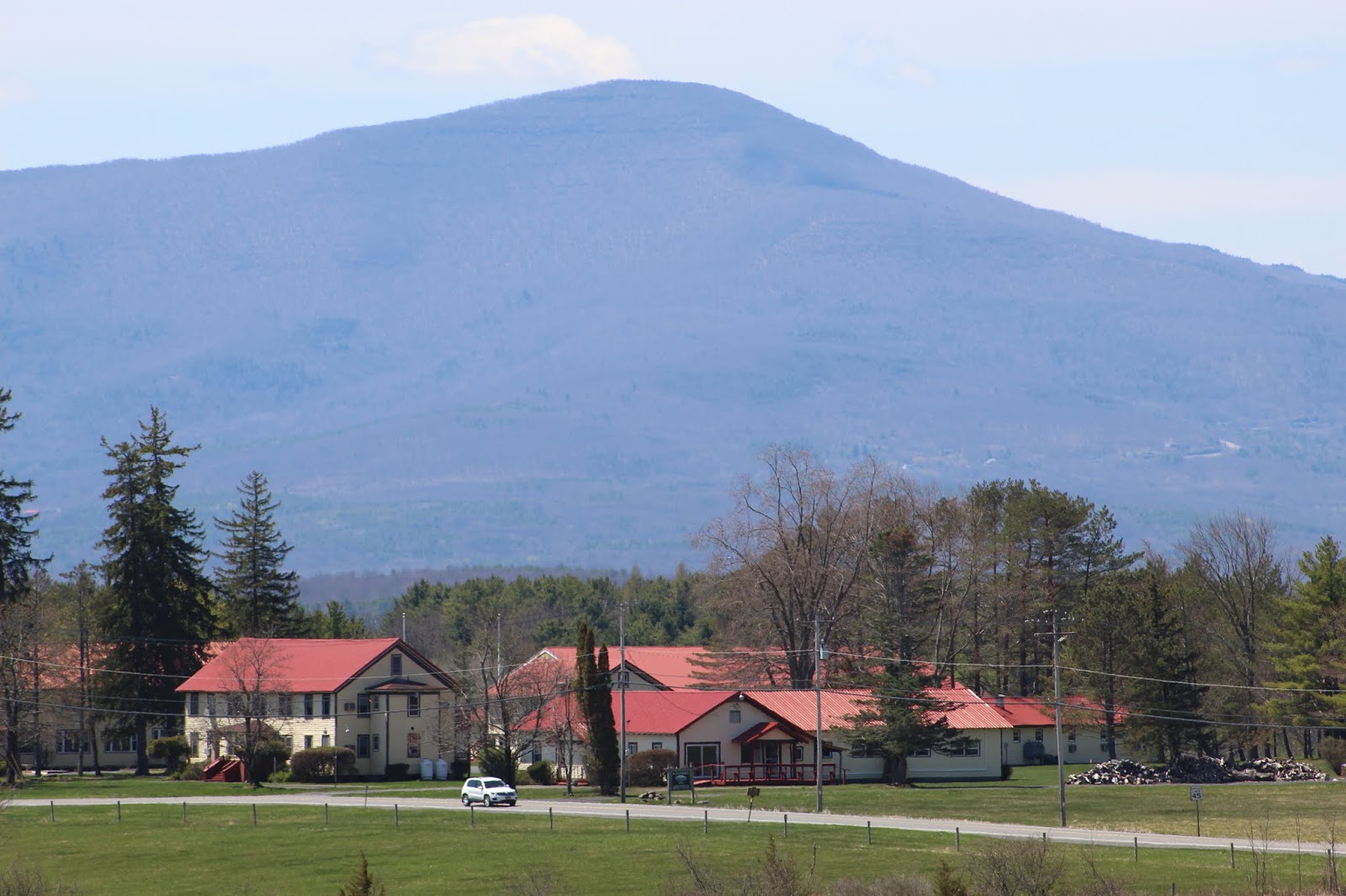
| Windham presides over the St. Vartan Camp, situated on the county line. |
 |
| A closeup of Blackhead, with tiny specks of ice still visible at its summit. |
 |
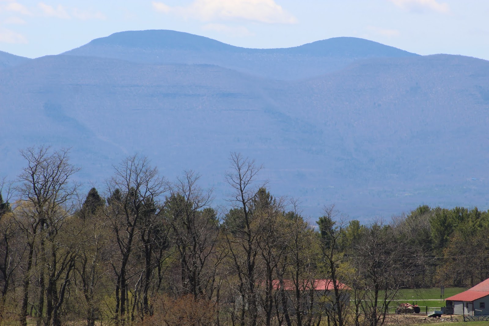
| Black Dome (L) and Thomas Cole Mountain (R) rise over the nearer ridge of the Catskill Escarpment. |
 |
| A closer shot of Windham and the red-roofed St. Vartan buildings. |
 |
| Farther west, Mount Zoar hangs over fields and forest in Westerlo, Greenville, and Durham. |
 |
| A building at St. Vartan sits atop a hill, from this angle a stark contrast to Windham's imposing silhouette. |
 |
| From closer, the camp building seems to almost rival Windham's size. |
 |
| Looking back from Route 32 to the sizeable solar farm in South Westerlo. |
 |
| Cattle and a calf graze in hilly fields near the county line. |
 |
| An old historical marker at the county line describes Albany County as the "Mother of Many Counties". |
 |
| Mount Hayden, half obscured by foreground hills. |


No comments:
Post a Comment