Following the year's first snowfall, I took a Saturday evening and climbed a hill in south Conesville to watch the sunset. This very prominent spur to the north of Richtmyer Peak, topping off at around 2450 ft, was covered in a spruce plantation until about eighteen months ago, when it was clear cut in its entirety. The New York State DEC allows for sustainable forestry activities on state land, and this cutting in South Mountain State Forest took place under their guidelines. However, with the hill cleared and the timer and equipment gone, the land below has returned to public use. This post will have a lot of pictures, as the 360-degree views from the summit were astounding.
 |
| On my way to the mountain, I stopped in Potter Hollow at the historical Potter Hollow Schoolhouse. |
 |
| Historical marker at the schoolhouse. |
 |
| A closeup of North Richtmyer's summit from some distance up the untrailed hill. |
 |
| A southward view over spruce trees towards Huntersfield Mountain, seen from partway up. |
 |
| A panoramic south-facing view from the summit. Mount Richmond is at left, Huntersfield Mountain is left of center above the Manorkill Valley, and Steenburg Mountain is at the right. |
 |
| The steep pine-covered figure of Mount Steenburg was too large to get in one show with my wide-angle lens, so I had to use my phone's camera. |
 |
| A view over cleared and uncleared sections of the spruce plantation. |
 |
| Leftovers from the logging operation cover the summit. |
 |
| Mine Hill and Mount Jefferson are prominent in the distance to the northwest. |
 |
| The rolling forests of Conesville and Gilboa stretch out beyond Steenburg's evergreen-coated limb. |
 |
| Huntersfield Mountain, its summit encased in hoar frost, dominated the view to the south. |
 |
| The fresh snow and oblique sunlight presented a beautiful environment, but they made climbing through the forest's remains quite difficult. |
 |
| A closeup view of the clean November snow. |
 |
| I used my long-range lens to scan the countryside for interesting points, such as this gradually darkening field. |
 |
| In the midst of dead winter forest, a single stand of larch trees cling to their colored needles. |
 |
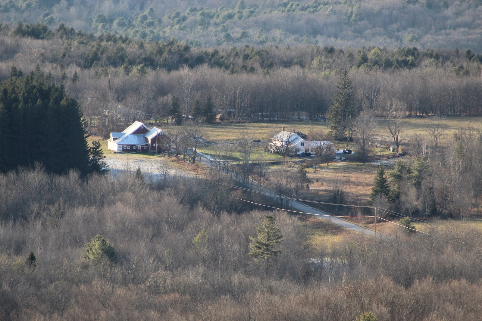
| Bits of snow linger in the shadows by this farm on Durham Road. |
 |
| The distant Utsayantha Mountain looms over the Manorkill Valley, dominating the western view. |
 |
| Pine Mountain cuts off the left side of this view of Delaware County's Moresville Range. |
 |
| A closeup on hoar frost along the top of Mount Richmond's summit ridge. |
 |
| It's interesting to think that just two years ago ago, this snow-covered clearing looked entirely like the bits of forest visible at the top right of this image. |
 |
| The rays of sunset paint the snow-covered logs and thorn bushes gold at the near side of the clearing. |
 |
| Late autumn larch forests line the hills to the northeast of the summit. |
 |
| A single standing birch trunk watches over the larch-colored hills and distant peaks of the Helderberg Mountains. |
 |
| A spruce seedling seems to have burst through the previous night's snow, although it was probably there before the snow fell. |
 |
| Bare brown forests stretch out towards the Berkshire Taconics. Massachusetts' Jiminy Peak is left of center. |
 |
| A wide-angle view of the Manorkill Valley and the mountains rising above it to the southwest, my fairwell to the snowy summit. |
 |
| A wider shot from my phone has more accurate colors; here you can see the whole south and west views at sunset. |
 |
| Unbroken snow covered this bramble-encumbered maple stump quite beautifully. |
 |
| The northern slopes of Mount Pisgah, seen from partway down North Richtmyer's northwest face. |


No comments:
Post a Comment