Earlier this week, I walked the western portion of CR-67 in Durham NY, finishing one of my final walks in my quest to hike every road within the town limits. The weather was quite warm, even for late April, and intermittent clouds and sun made for a beautiful walking and picture-taking environment. Unfortunately, clouds soon encroached, and I raced a coming storm back to the car over the length of the five-mile walk.
 |
| View of the Catskill Escarpment through trees from near the spot where I parked. |
 |
| I found the clouds spectacular enough that the sky was more beautiful than the earth for much of the walk. |
 |
| Patches of these upside-down periwinkle flowers lined the road in some spots. |
 |
| Windham High Peak peers over trees. The maple trees here leafed out on the 22nd, a full two weeks earlier than normal. |
 |
| Windham, Kate, and Zoar beneath a three-layer backdrop in mid-afternoon. |
 |
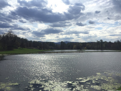
| This pond along Route 67 was a popular swimming spot until the death of a local boy some years ago. |
 |
| Historical marker along the road, near the small Wright Cemetery. |
 |
| Looking down CR-67 towards the west, where highlands in Schoharie County rise in the distance. |
 |
| This barn used to be a local landmark, but a snowstorm a few years ago destroyed its more remarkable features. |
 |
| Zoar, Ginseng, Hayden, Nebo, Ritchmeyer, and Pisgah line the horizon. By now the clouds were becoming worrisome. |
 |
| This house is designated as a historic place (note the plaque at its lower right), but research has failed to reveal any information about it. |
 |
| I found this purple flower at the intersection of Route 67 and Schoolhouse Road. |
 |
| Windham dominates the skyline here while clouds continue to consume the skies. |
 |
| Indentations reveal this reassurance marker was once marked CR-53, a shorter road in Athens. |
 |
| By the time I returned to this lake, the weather to the southwest had become downright dreadful. |
 |
| Rolling hills along the Catskill sit beneath a great divide in the clouds. |


No comments:
Post a Comment