In mid-April I embarked on my first mountain climb of the month. Parking atop the seasonal unmaintained Turnwood Road, I hiked to the summit of Balsam Lake Mountain, and seeing I had abundant time and supplies continued to the neighboring Graham Mountain. Both are considered Catskill High Peaks (summits over 3500'), and Graham Mountain is the seventh-highest summit in the Catskills. The weather was very warm and sunny, enough to give me a slight sunburn, but the snow and ice on the mountains kept me from becoming too overheated.
I do apologize for the amount of images in this post, it's significantly more than I usually put up. Since this was a very long hike (almost nine miles), there were a lot of interesting things to photograph that I can't bear not to share.
 |
| View north from the village of Fleischmanns on my way to the trailhead. Looks much clearer without fog. |
 |
| A straight shot looking north on NY-30 as it crosses the Pepacton Reservoir in Andes NY. |
 |
| I got out at the reservoir and walked across the bridge. This is a shot looking east from its center. |
 |
| Morning clouds over the west half of the Pepacton. |
 |
| A southward view from low along the trail reveals some of the western Catskills' ridges. |
 |
| The trail crosses a tributary of the Black Brook before rapidly steepening up Balsam Lake Mountain. |
 |
| A spring bursts out from a boulder known as 'Moses Rock' on Balsam Lake Mountain. |
 |
| Moss-covered boulders provided the only greenery on Balsam Lake's lower slopes. |
 |
| Near the mountain's summit, dense fir trees rose up through deep snow and thick ice. |
 |
| View of the fire tower on Balsam Lake Mountain. It is one of only two surviving fire towers on the Catskill High Peaks; several others remain on shorter mountains in the region. |
 |
| View east from the fire tower, looking over the seasonal ranger's cabin. The prominent peak to the right is Graham Mountain. |
 |
| Although the tower's cabin was locked, its upper steps still provided spectacular views, such as this northward vista. |
 |
| Looking southwest, the Catskills could be seen to gradually drop off to lowlands past Sullivan County in the distance. |
 |
| The trails near the summit were very dangerous, with thick, slick ice covering very steep slopes. The forest was too thick in many places to find a different way around. |
 |
| The trail up Graham Mountain is unmarked and unmaintained, but was easy to follow because it apparently becomes a river in the springtime. |
 |
| Bare trees and snow at the col between Balsam Lake and Graham. |
 |
| This overgrown northward view below the summit of Graham Mountain looks towards the distant Bearpen Mountain, which I had climbed two weeks prior. |
 |
| At the summit of Graham Mountain were the ruins of an old relay station, abandoned after a helicopter crash in the 1960s. |
 |
| A more open view northwest is available from the summit, looking over much of the western Catskills. |
 |
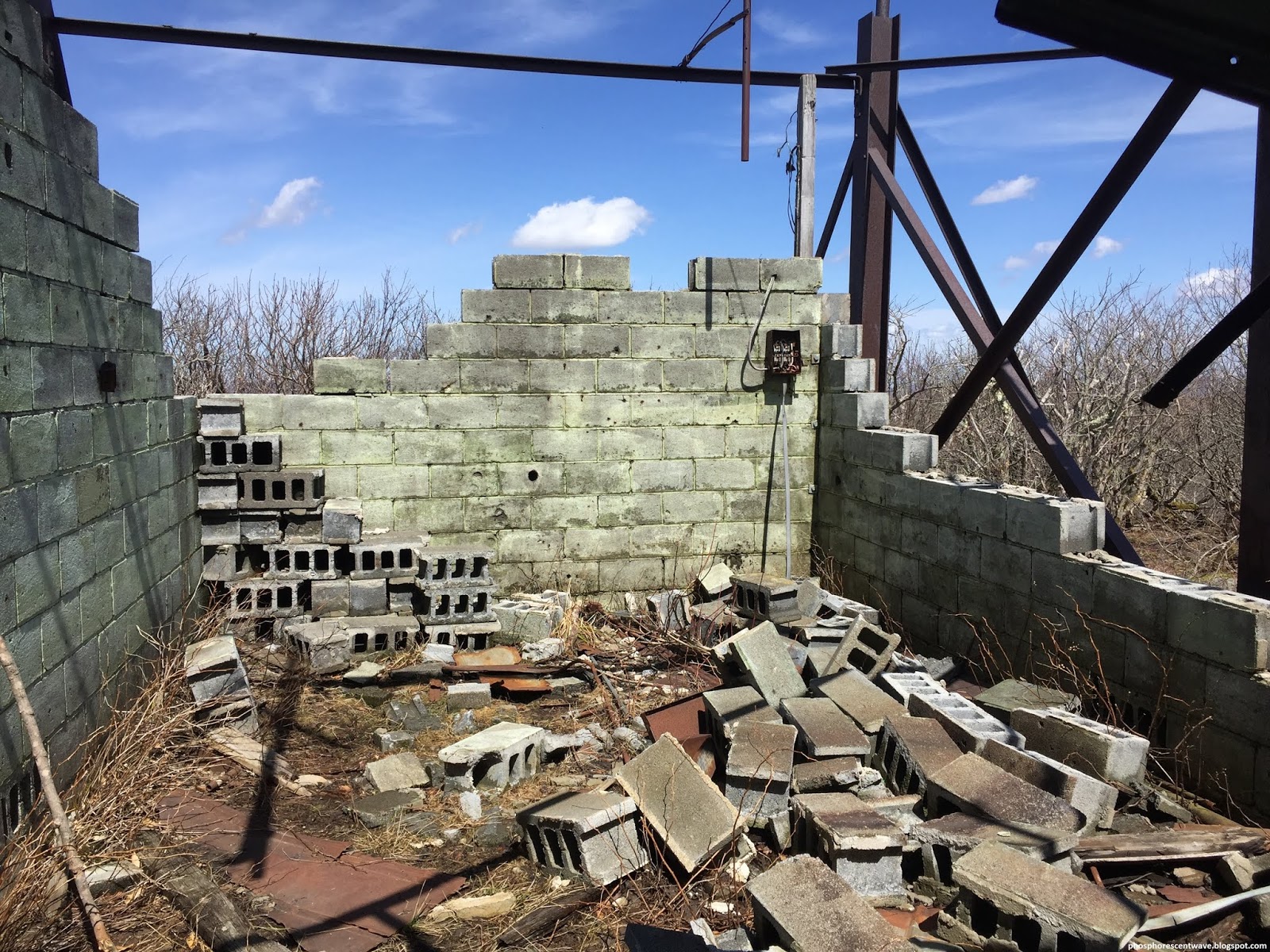
| A look inside the abandoned station. The rusted metal and broken concrete made the area seem like a nasty infection waiting to happen. |
 |
| The walls of the structure are very unstable, but offer excellent views. This northeastern shot shows mountains as distant as the Blackhead Range. |
 |
| A view east through the structure's remnants offers limited views of Big Indian, Doubletop, and the Burroughs Range. |
 |
| This northward lookout is found near the proper summit, on higher ground several hundred feet from the station surrounded by dense pygmy forest. |
 |
| On my descent from the mountain, I took a less-popular, but marked, trail, which was also overrun by meltwater. |


No comments:
Post a Comment