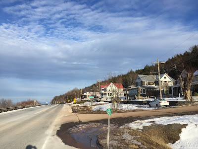
02-17-2019: Durham, NY

This is the 'something different' I referred to in my previous post. Snow cover has effectively prevented me from continuing my roadwalking endeavor. There are no more roads in Durham where I can safely park to go walking, a point made very clear by my getting stuck in the snow for two hours last Friday. I am unwilling to move on to any other town before completing Durham, especially now that I'm so close.

So I've started something new. The idea of this is to give a total overview of the town of Durham. I visited every hamlet and populated place in the town and documented them, giving a brief but comprehensive view from a wide variety of locations and environments within the town's borders. For each hamlet I include a picture of the center of town, a natural environment, and, if applicable, signage denoting the location. This is Durham at a glance.

First, some numbers. In the 2010 census, Durham had a population of 2,725, and an area of 49.4 sq mi, giving it a population density of 54.1/sq mi. It is located in the northern Catskill Mountains along the Catskill River, with elevations ranging from 340' near the eastern town line to over 2900' at the summit of Mount Pisgah in the southwest. The town is very rural, dominated by dairy farms and hayfields, with much of the land consisting of second-growth forest. Aside from agriculture, its main economy is tourism, and it is home to many resorts and summer festivals. I will touch somewhat on history here; far more in-depth historical information can be found at the town's website: https://www.durhamny.com/history/70-history.html

The first hamlet I stopped in was Oak Hill, a somewhat substantial and very historical settlement along the Catskill Creek in the Squirmer Valley. This hamlet contains many buildings listed on the National Register of Historic Places, as its position along the creek was very important to early millers.

Sign in Oak Hill. Note the bridge on the sign, signifying the Catskill River's importance to the hamlet's early growth.
View of Acra Point, Burnt Knob, and Windham High Peak from near the historic Oak Hill Cemetery.
View from the center of Oak Hill. Some of these buildings date to the late 18th century.
After Oak Hill, I moved southwest to the hamlet of Durham (not to be confused with the town). Durham sprung up along the Susquehanna Turnpike during the early 1800s, before the construction of railroads made the mountainous trail obsolete. Its population has been declining fairly steadily since then, as the steep mountain soil makes for poor farming.
Sign in Durham. Note the coach at the inn; inns were a mainstay of the town's economy for much of the early 1800s.
View over pasture land towards Cook Mountain, past the center of town.
Downtown Durham along CR-20. Again, many of these buildings are centuries old.
From Durham I headed up the mountain to West Durham. Located high on the slopes of Mount Pisgah, West Durham was once a thriving community, its economy founded on the many inns that provided shelter to wearied travelers. When the Susquehanna Turnpike was active, West Durham was located about a day's ride from the port town of Catskill, and therefore was a popular stopping point. Aside from a few farms, little remains of the community today.

View of Acra, Windham, and Mount Zoar, along with the Hudson Valley, from the overlook in West Durham.
View from the center of the dwindling hamlet.
From West Durham I traveled east to the hamlet of Cornwallville, a place far more populated than West Durham, enough so that it has its own post office and cemetery. This hamlet was always agriculturally-centered, so the movement of travelers away from Durham had little effect on its economy or population.

A recently-erected sign in downtown Cornwallville. The church is a historic building from the valley that was moved up the mountain when the hamlet was established.
View northward from Sutton Road, one of the most beautiful roads in town.
A cluster of buildings in downtown Cornwallville.
From here I headed farther east to the hamlet of Hervey Street. Located at the crossroads of two similarly-named roads, the only thing of note in Hervey Street is a historic bridge, built by famous bridgebuilder Jeremiah Cunningham in the early 19th century and still in use today. This hamlet has been a ghost town for over a century; I struggled to find any buildings at all in it.

View of Windham High Peak over a swamp, near the hamlet's center.
Image taken from the center of Hervey Street, with a whopping three buildings. There are three more on the other side of the bridge.
Hopping from one nonexistent hamlet to the next, I moved southward up the mountain to Durso Corner, an area settled along the mountainside back in the 1800s. Time has abandoned this village, and all that remains today are a few houses along a dead-end road, kicked to the wayside along the busy NY-23 as it heads to (mildly) more interesting places.

Although commonly called the 'Windham Overlook', this impressive view is actually located in Durso Corner.
Durso Avenue runs through the center of Durso Corner, seen here.
I followed NY-23 west from here, and still farther up the mountain, to the hamlet of East Windham. Although it shares its name with the neighboring town of Windham, and it is geographically and culturally associated with it, this hamlet along the highway and High Peak Road is technically part of Durham. It contains a few buildings and businesses, most profiting off the spectacular views from the mountainside, but isn't substantial enough to warrant a road sign.

Windham looms over Route 23 in East Windham.
Houses along the highway near the town line.
From here I headed back northeast and somewhat down the mountain to South Durham. This hamlet was once more populated when NY-23's predecessor, the South Durham Highway, ran through its center. The construction of the road route bypassed the town somewhat, and its population declined rapidly.

Sign along NY-23 pointing to South Durham.
Impressive view of Acra Point from the highway heading towards the settlement.
The old highway and some buildings in central South Durham.
Certainly the least of all these hamlets, however, is definitely Sunside. Designated as an area by the town government, the hamlet of Sunside essentially consists of two resorts and a handful of summer homes, straddling the border with neighboring Cairo along the Bowery Creek. Sunside has the lowest elevation of any of the town's hamlets, a dramatic change from the loftier settlements to the south.

Rapids on the Bowery Creek in the Blackthorne Resort. This spot is popular for swimming during the summer.
Central Sunside along CR-20, consisting of... basically nothing.
However, I saved the best for last. By far the most prosperous section of Durham is the hamlet of East Durham. Home to nearly half the town's residents, East Durham profited from both the Susquehanna Turnpike and the short-lived Canajoharie-Catskill Railroad that succeeded it. Following an influx of Irish residents around the end of the 19th century, the town shifted gears and became a cultural focus. A number of residents still speak with Irish brogues and participate in the culture, and many road signs are in Gaelic. Although tourism, mostly cultural, was at its peak in the 1950s, it remains the mainstay of the town's economy, with various parks, resorts, and festivals keeping the town afloat in the summer months.

Sign in East Durham, focusing on the railroad. A fatal accident in East Durham was one of the reasons for the railroad's closure in the 1840s.
View southwest, towards mounts Hayden and Pisgah, at sunset.
Downtown Durham, showing some of the resorts and restaurants. The sidewalks, the only ones in town, were installed several years ago.
While I plan on continuing roadwalking as soon as possible, I also wish to continue pursuing this method of exploring the area around me. Comprehensive looks at towns, section by section, will allow me (and by extension you) to see far more of the world, far more quickly, than methodical walking will.

No comments:

Post a Comment