
High Point Cliff, elevation 1390'. Guilderland town highpoint, Albany County municipal highpoints 7/13. Solo winter ascent via Long Trail. 2.33 mi, 144' gain, 41m RT.
I had just left the Knox town highpoint at Tabor Hill in an afternoon attempt to reach the summits of three towns in Albany County, part of my recent interterm focus on town highpoints. My next stop was the highest point in the town of Guilderland, a hike that involved minimal elevation gain and a fairly simple stroll through the woods. However, things were a bit more complicated than that.
Town highpointing isn't really a major ambition for most, so I have to manually find the highpoints for each town by comparing topographic maps and satellite elevation data. Guilderland posed an unusual problem, however, as its western border with Knox is difficult to define.
Some maps, including the USGS topographic maps, show the border as a straight line from the New Scotland town line to the Bozen Kill creek. This would put the highest point at just over 1400' about a quarter mile west of the Helderberg Escarpment. Other maps, such as the Albany County website, show a jagged border running the edge of the Escarpment. This puts the highpoint at 1390' on the Escarpment's rim, a spot appropriately named High Point Cliff.
The green-blazed Long Path winds through the northern portion of Thacher State Park, stopping at High Point Cliff along the way. Somewhat fortuitously, it passes over the 1400' contour line on the way, meaning it reaches the highpoint regardless of where the border is. I think the 'real' border most likely follows the Escarpment, as most local government sources place it there, but I was glad to be able to grab both just to be sure.
I parked at the trailhead in Knox along Old Stage Road. Guilderland contains some fairly affluent suburbs of Albany, and I was intrigued to see that my car was by far the most beat-up among the many at the trailhead. I passed several people on the hike, mostly walking dogs.
The Long Path runs over some fairly level terrain with occasional ups and downs. The forest here is mostly hardwood with intermittent hemlock groves. It crosses a field at one point, and a number of old rock walls cross the path. I could hear the gunshots of hunters in the distance. It was snowing intermittently as I hiked, and I prayed that the accumulation wouldn't be serious enough to effect my drive home.
 |
| A snowy hemlock grove near the approximate location of the western highpoint candidate. |
 |
| One of several stone walls along the trail. |
It didn't seem to take too long for me to arrive at the second, 'most likely' highpoint, High Point Cliff. I was a little surprised to have the spot to myself, but far from disappointed. The cliff boasts impressive views of the surrounding landscape, looking over Guilderland, Albany, and the whole Capital Region. To the south, the dramatic cliffs of the Helderberg Escarpment rise from the flatter plains to the east. In the distance, industrial smoke disappeared into the low fog that blocked out the Berkshires across the Hudson River.
 |
| Looking south along the Helderberg Escarpment. Cliffs on its edge are part of Thacher State Park. |
 |
| Open plains mixed with forests and fields extend towards the east. |
 |
| More forested areas to the northeast viewed through the treetops. |
Due to the uncertain nature of the border, I had to be extra careful to ensure I reached the actual highpoint. I climbed down until I was at least twenty feet below the edge of the ridge, then back up and around the rim of the Escarpment a bit. As unclear as the situation on the maps was, the situation on the ground was even worse, as in many areas the cliff has no clear 'top'. Eventually, I figured I had to have touched the exact high ground inside the town limits, wherever exactly it was, and went back to enjoying the view for a bit.
 |
| Colors peer through the clouds beyond the limb of the Escarpment. |
 |
| Forests and power lines far out in eastern Albany County. |
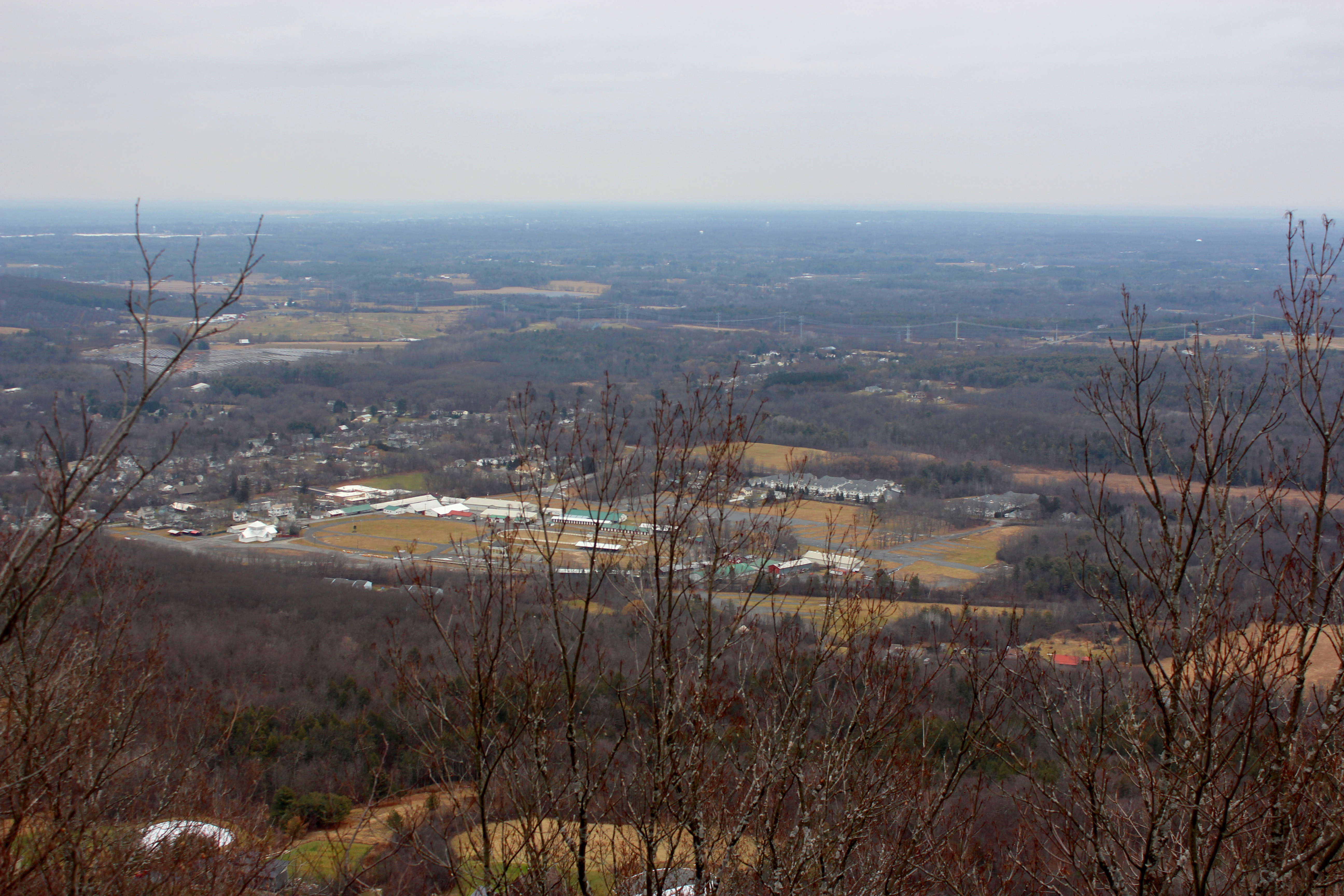
 |
| A view of central Voorheesville, one of two large villages in Guilderland. |
I started getting chilly after a few more minutes, so I began my hike back. It wasn't terribly cold, only in the lower 20s, but the cliff was exposed to open wind, and my hair (which had been wet when I began my trip) had frozen through. The hike back was somewhat monotonous, probably owing to the cold, and I was back at the car pretty soon.
No comments:
Post a Comment