Potic Mountain, elevation 853'. Coxsackie highpoint, Greene County town highpoints 13/14. Solo bushwhack ascent from NY-81. 2.02 mi, 449' gain, 36m RT.
I've been working through the town highpoints in Greene County NY for the past few months. In the northeast, there's no such thing as 'unincorporated land'; every acre is part of a town or a city (or a borough in NJ and PA). Therefore, every county is divided up into subdivisions that cover its entire area, much like states or countries.
Town highpointing isn't really a thing as far as I've found, except in Connecticut where governmental counties have been dissolved. Therefore, I will according to all research I've done be the first person to reach the highpoints of all 14 towns in Greene County, if I finish of course. After completing New Baltimore's Stahl Hill last Friday, Coxsackie was set to be my penultimate peak on the list.
Potic Mountain, the second-lowest highpoint in Greene County, actually is a hill of significant prominence, with a USGS benchmark at the summit. However, it's privately owned, split between local landowners and two large - and very active - quarries. Original plans to go Sunday when there was no work (following the only trip report for this peak I could find by Jean André Laverdure) were pushed back to today due to weather. I left work in the afternoon and headed to Coxsackie, parking at an abandoned house along Route 81 closest to the summit.
 |
| A view of Gary's Stone Quarry from my parking spot at the abandoned house. |
I planned to circumnavigate the quarry through a relatively thin strip of woods separating it from nearby houses, and had spent many hours scouting out this route on satellite maps. What the satellite maps didn't show is the recent addition the quarry has made, an access road cutting straight through the woods to the house's driveway. This made things significantly sketchier, more so than Stahl Hill had been, and I quietly followed a small stream that eventually met up with some ATV tracks. These took me closer to both houses and the quarry.
 |
| The route up, circumnavigating the quarry and climbing the steepest part of the mountain. Maps and overlay courtesy of AllTrails and CalTopo. |
Loud blasts and low rumbles echoed from the quarry every few minutes, masking my footsteps but also launching rocks into the air, hopefully too far away to be of any danger. I could see machinery and rock piles through the thin line of trees on the side of the trail. Soon, however, the trail deposited me out of sight of the quarry, at the base of an incredibly steep hill. Now the real climb began. Deer had made a network of switchback trails to ascend the slope, reaching a grade of 36°, and I followed these to the top of the mountain ridge. I found it interesting to discovery that switchbacks aren't a human invention, but made and used by animals as well.
 |
| Open maple-oak forest at the base of the steep slope. I always find this type of forest comforting, as it reminds me of woods where I grew up. |
 |
| A large widowmaker I had to avoid on the way up. Large branches or, in this case, whole trees held up by friction alone are a serious danger, especially on bushwhack peaks. |
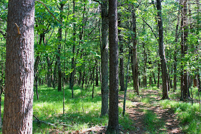
At the top of the ridge, I found a network of 4x4 and ATV trails that seemed to climb along the highest part of the ridge. There were several trails but the main one went exactly where I wanted to go, passing through several small clearings and a wide expanse of open, grassy young oak forest. Grassy forests are decently uncommon in the Catskills and this was by far the largest single chunk of this environment I've seen, making for beautiful walking and easy navigating.
 |
| Following the trail through the grassy afternoon forest. |
To my surprise, this trail led almost directly to the highpoint, passing within about ten yards of the obvious highest ground. Here I found the King Benchmark, placed atop the peak by the USGS in 1939, and not really much else. The ATV trails were the only other thing here, and I chuckled at the idea of a bunch of guys riding after work, trying to figure out what this marker was for out in the middle of the woods. I snapped a few summit pictures and enjoyed the top of Coxsackie only for a few moments before heading back down.
 |
| The King Benchmark, embedded in concrete and slowly being buried under pine needles. |
 |
| Potic Mountain, elevation 853'. Greene County town highpoint 13/14. You can't tell from this angle but I'm standing almost directly over the benchmark here. |
I was unsure of the legality of my parking spot (although there were no signs telling me not to), so I wanted to head back as quickly as possible. I stopped for a picture at the edge of the ridge above the steep part, where gaps in the leaves provided for limited views to the northeast (probably more expansive in the winter). The quarry was no longer blasting anything by the time I made it back down, so I had to move more consciously. Soon I was back at the car, another town conquered and a very questionable bushwhack safely complete.
 |
| Looking northeast towards the Berkshires from a gap in the trees at the edge of the ridge. |
 |
| Returning to the abandoned house where I parked. Note the newly-built access road to the quarry, not visible on any satellite maps. |

No comments:
Post a Comment