Length: 4.63 mi
Time: 1h44m
Elevation Gain: 1122'
Last winter I hiked Stoppel Point, a 3400' mountain in Cairo home to a plane crash and some excellent views. In the neighboring town of Jewett lies a sub-peak, West Stoppel Point, whose elevation places it among the 100 highest peaks in the Catskills. Unlike its more prominent father, West Stoppel is a bushwhack peak, with no trails or even herdpaths leading to its summit. However, as the closest of the hundred highest that was yet unclimbed (by me), it was my natural next target for a somewhat local hike.
From the limited information I could find online, it seems that West Stoppel is usually climbed via bushwhack from Stoppel Point proper. But given that I had already climbed Stoppel Point, I saw no reason to do so again, and instead concocted a different plan. I parked my car near Colgate Lake in Jewett, a popular walking and fishing spot to the north of the peak, and prepared to bushwhack my way to the top.
My initial goal was to cross the East Kill where it flows between Colgate Lake and Lake Capra to the east. However, after a mile of romping around through dense spruce forest, I discovered there was no way of crossing the East Kill without getting wet, which wasn't an option in 35 degree weather. Reluctantly, I returned to my car and parked closer to the lake, improvising a longer bushwhack plan from its western shore.
 |
| Hemlock trees line the unexpectedly wide East Kill. |
 |
| The limb of West Stoppel Point extends over Colgate Lake, seen from its easternmost point. |
 |
| A tributary of the East Kill flows in miniature cascades near the trailhead. |
While Colgate Lake is a popular spot, very few people take on the challenge of circumnavigating the lake. Its western shores very quickly fill with brambles and bushes, with countless herdpaths paralleling the shore and then fading into the brush. There was an old metal fence that followed the shoreline for awhile, but eventually it too disappeared. There was also a very old 4x4 trail farther in from the shoreline, but I worried it would deviate too much from my planned course, so I largely ignored it.
 |
| Pine trees line the opposite shore of the frozen lake. |
 |
| West Stoppel Point looms above Colgate Lake. Few hikes have given such a good view of the goal. |
As I approached the south side of the lake, I noticed a much clearer, grassier area right at the water's edge. I figured this would be better than fighting with brambles, so I made my way over to the wide shore. In the summer months, this area is evidently a marsh, and while it is filled with grass, there's no solid ground beneath it. It hasn't been cold enough recently for the lake to freeze deep, and I soon began breaking through the ice. I ran back to the true shore before my boots got wet and departed from the lake soon afterwards.
 |
| Blackhead Mountain rises to the north of the lake above the nearer pine forests. |
 |
| The wide, narrow summit ridge of Black Dome, Jewett's highest point, towers to the northwest. |
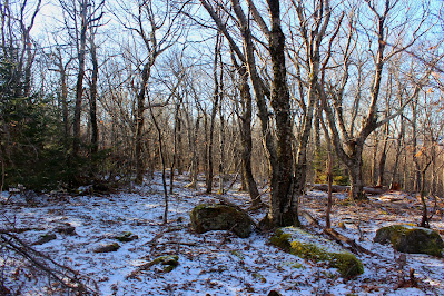
I can't say I've ever described a bushwhack as a grind before, but West Stoppel Point was pretty close to it. The forest is fairly monotonous the whole way up, mixed maple, oak, birch, and beech, typical of mid-altitude Catskill woods. There are a number of old logging roads, none of which have been used in decades, which are followable all the way up to the col, but I didn't follow these, not knowing where they would go. There are a lot of boulders and many sections of very dense young beech, but other than that there's no real obstacles to avoid.
 |
| Crossing a dry stream bed on the mountain's north slope. |
There are a few unnamed knobby peaks to the west of West Stoppel, and I considered ascending through the col of the nearest one, but I decided to just continue eastward to come out directly on top of the peak. Rather than a summit plateau, this peak has more of a gradually rounded top, which was covered in snow above 3000'. There are a few local maximums to the west of the summit, which is in an area with many evergreen trees. Surprisingly, I found there was a small cairn at the summit, leaving little doubt that I had reached the true highest point.
 |
| West Stoppel Point, elevation 3111'. Catskill Hundred Highest 47/100. Note the cairn at my feet. |
 |
| A view of the rocky, snowy terrain at the summit. |
I tracked farther to the east on descent, hiking more towards the nearest knob (called by some "West West Stoppel") and hoping to descend east of Lake Capra. Here I found an old logging trail at the col itself, and nearby was a rocky outcrop with another, smaller cairn. This looked like it had a decent view maybe a decade ago, but now in the winter all that was visible was the summit of Blackhead to the north.
 |
| Blackhead through the trees, across the valley and nearly a thousand feet above. |
On descent I went right down through the col between West Stoppel and the nearest knob, sighting some imposing-looking cliffs to the east. The terrain here was steeper and I followed a dried stream bed all the way back to my path on the way up. My attempts to avoid Lake Capra were unsuccessful, but I did find some decently straight logging trails to follow parallel to the lakes.
 |
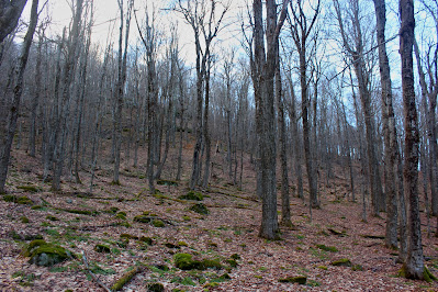
| Steeper, more open terrain in a maple forest below the col. |
I followed these trails around the south and east sides of the lake, leaving on occasion to walk to the shore and make sure I was still on the right track. There were quite a few people at the lake by the time I made it back to the trailhead, none of them geared up for quite as exciting an afternoon as mine.


No comments:
Post a Comment